A quiet morning begins a stormy weekend with Matthew
Saturday morning is overcast and hazy, with low clouds. The wind is 10 or 15 mph from the east. The barometer is 29.85 and falling, and the temperature is 78, though it’s very humid with a dewpoint of 75 degrees. The showers of the past few days are on hiatus until the rain begins in earnest later today from what remains of the once powerhouse Hurricane Matthew.
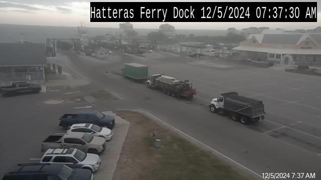
My street in Frisco is very quiet. Many visitors have already left — an older couple next door cleared out about three days ago. Most residents have moved their vehicles to higher ground. The construction crew building the new house came early to clean up the site across the street and move their work trailer.
It’s been a frustrating and stressful week for residents on Hatteras and Ocracoke. Matthew hasn’t even been around very long as a tropical cyclone — just since Sept. 28 when it suddenly burst on the scene as a 60 mph tropical storm.
All week long, the conversation in the villages has centered on whether to stay or to go. It’s almost all folks have talked about. Of course, by mid-Wednesday, almost all of us had decided to stay.
In just two days time, Matthew became a Category 5 hurricane briefly and has fluctuated mostly between a Category 3 and 4 ever since — presenting forecasters at the National Hurricane Center and local National Weather Service offices up and down the East Coast 10 days of having to deal with a new track scenario at almost every major model run.
“It’s been one of the most challenging storms to try to forecast,” Richard Bandy, meteorologist-in-charge of the National Weather Service Office in Newport/Morehead City, said earlier this week at one of the two weather briefings he has conducted by phone and webinar each day with emergency managers, first responders, and the media.
Almost every day, he began the briefing with some form of the statement that “Our confidence in the forecast track is very low at this point..”
At every turn, the quirky Matthew did almost the opposite of what forecasters predicted — or at least some variation on the opposite.
On Tuesday, the forecast made it sound as if Hatteras and Ocracoke were going to take the big hit — annihilating our infrastructure and sending raging floodwaters across the island. Many residents were clearly freaking out, though visitors seemed to go about their business of vacationing, heading to the beach whenever they could in between showers brought in by a lingering cold front.
By Wednesday morning, there was a complete turn-around, and the storm was going to make a sharp right turn into the ocean well away from the Outer Banks. That model held for a day or two — with Bandy emphasizing a “low confidence level.”
And, indeed, yesterday, Matthew’s forecast track started shifting slightly again with each new Hurricane Center update — bringing it slightly closer to eastern North Carolina.
As always, we won’t be really sure how the storm will treat us until it has come and gone. At this morning’s webinar, Bandy seemed more confident in the forecast.
At 6 a.m. this morning, Matthew was 360 miles southwest of Buxton, heading north-northeast at 12 mph with winds down to 105 mph.
By 11 a.m., the National Weather Service placed the center 270 miles southwest of Buxton. Matthew was moving toward the northeast near 12 mph, and this motion is expected to continue today. On the forecast track, the center of Matthew will continue to move near or over the coast of South Carolina today and just south of the North Carolina coast tonight through Sunday.
Maximum sustained winds had dropped to near 75 mph with higher gusts. Although weakening is forecast during the next 48 hours, Matthew is expected to remain near hurricane strength while the center is near the coasts of South Carolina and North Carolina.
At this morning’s briefing, Bandy didn’t have much new to add to what he had already told us yesterday.
He said a tornado watch has been issued for southeastern North Carolina, south of the Outer Banks.
On the radar at mid-morning, rain was heavy already over the southeastern areas of the state with several flash flood warnings and a tornado warning in place. Heavy rains from the hurricane are forecast to begin later this afternoon on Hatteras and Ocracoke, so residents have a few more hours to get ready for the storm.
Again Bandy stressed the heavy rains, potentially record river flooding, and storm surge that might be higher on southern Hatteras and Ocracoke than Hermine on Oct. 3.
“This is an extremely dangerous and life-threatening situation,” the Weather Service said this morning. “This could be the worst flooding event the area has faced since Hurricane Floyd (in 1999). There is a heightened threat from wind and surge as well.”
Here is a recap of the Hatteras-Ocracoke forecast.
Bandy adds that in Hermine, average ground level surge was measured by the National Weather Service at 2 to 3 feet above ground with 4 feet in the low spots.
“In this case,” he said, “I’d actually prepare for a foot higher than Hermine, with up to 4 feet above ground at average ground elevations and up to 5 feet in low spots.”
The storm surge is expected to be a mostly Sunday event. The surge will not rush in as it did with Hermine on Sept. 3, but the sound will rise and recede more gradually.
Storm surge on the oceanside of Hatteras will be slightly more than forecast. Instead of minor erosion and isolated wave run-up and overwash, we can expect moderate beach erosion and scattered areas of wave run-up and overwash, along with possible issues on Highway 12. The erosion and overwash could last into the high tides on Monday.
Wind direction. change. The wind will begin Saturday and Saturday night as east-southeast, shift to east-northeast, and perhaps some north wind at the end of the event.
The flooding on the mainland will contribute to water level rises in the Pamlico Sound, which is already at levels of 1 to 3 feet above normal from all the rainfall in the past few weeks.
Ocracoke and Hatteras are forecast to receive less rainfall – about 7 inches on northern Hatteras, 8 inches on southern Hatteras and perhaps up to 9 on Ocracoke.
The Weather Service has issued a flash flood watch from 8 a.m. on Saturday until 2 p.m. on Sunday and calls the potential rainfall “a dangerous and life-threatening flooding event.”
Heavy rain from the storm will start about mid-day on Saturday and continue into Sunday afternoon.
The Weather Service advises that residents and visitors should avoid travel, if at all possible this weekend. The NWS also advises residents and visitors to move property to a higher location — move your vehicles if you live in a flood-prone area. Pick up your yard, under the house, and secure loose objects on the deck.
All preparedness actions should be completed very soon.
A state of emergency, declared by Gov. Pat McCrory, is still in effect in coastal North Carolina. Also, both Dare and Hyde counties have declared states of emergency.
Ocracoke evacuated visitors Wednesday and cancelled Thursday’s mandatory evacuation for residents.
Dare officials say the state of emergency declaration for the county and its six towns will remain in place but have issued no evacuation orders.
However, in a news release this morning, county officials advised that road closures and travel restrictions are possible over the weekend.
“The National Weather Service is highly discouraging travel across northeastern North Carolina this weekend,” the county said in a news release. “As conditions deteriorate, road closures and travel restrictions are anticipated in Dare County, particularly for portions of Highway 12 on Hatteras Island.”
Dare County advises that travel to the area should be postponed until conditions improve.
Dare County emergency management director Drew Pearson aid in an email yesterday that Dare County will “partially activate” its emergency control group at 9 a.m. on Saturday ” to ensure the appropriate public safety agencies are in place to address issues that arise as we realize storm impacts.”
MORE INFORMATION
Click here for the latest Hurricane Matthew briefing from the local National Weather Service office.
To receive email updates directly from Dare County Emergency Management, register online at www.darecountyem.com and follow @DareCountyEM on Twitter.
Residents and visitors may contact Dare County Emergency Management by calling 252.475.5655 or visiting www.darenc.com for updated information.
For information regarding road conditions and closures, visit http://tims.ncdot.gov/tims/RegionSummary.aspx?co=28. For up to date information regarding the status of NC12, visit www.facebook.com/NCDOTNC12
For local weather information, go to http://www.weather.gov/mhx/. The page has links to the tropical forecast. You can find the beach forecast, including the rip current forecast on the Island Free Press home page — at the top right. Click on the icon with the beach umbrella.
CANCELLATIONS
Hatterasity, the bluegrass block party and festival planned for Oct. 6-8 in Hatteras village, has been postponed until a later date.
The Hatteras Island Cancer Foundation’s Fun Run, scheduled for Saturday in Avon has been cancelled.
The Carey LeSieur fundraising Bucket Party, scheduled for Saturday in Brigand’s Bay, will be on Saturday, Oct. 15, with a rain date of Oct. 16.
The Cape Hatteras Anglers Club regular meeting for Saturday, Oct. 8, is cancelled.
FERRY INFORMATION
The N.C. Department of Transportation’s Ferry Division suspended operations to and from Ocracoke Island on Pamlico Sound routes after the 4 p.m. departure from Ocracoke to Cedar Island on Friday, Oct. 7. The final run from Ocracoke to Swan Quarter departed at 1:30 p.m. Ferry officials suspended operations on the Ocracoke-Hatteras route after the 8 a.m. departure Saturday morning.
“The time has come to secure our boats and get our crews out of harm’s way,” said Ferry Division Deputy Director Jed Dixon. “Anyone still wishing to leave Ocracoke Island before Hurricane Matthew arrives should do so immediately.”
So far, the North Carolina Ferry System has evacuated more than 1,350 people from Ocracoke on the three routes.
Ferry Division managers will monitor weather conditions and resume service as soon as it is safe to do so.
For real-time updates, follow the Ferry Division on Twitter at @NCDOT_Ferry.
NATIONAL PARK SERVICE
Visitor Services. All visitor services and facilities at Cape Hatteras National Seashore, Fort Raleigh National Historic Site, and Wright Brothers National Memorial will be close at 5 p.m. today and remain closed until further notice.
All campgrounds closed at 10 a.m. today.
All Cape Hatteras National Seashore ORV ramps will be closed to vehicle traffic by 4 p.m. today.
Beaches, parking lots, and grounds remain open.
Visitor services and facilities will reopen after post-storm assessments are completed.
NATIONAL WILDLIFE REFUGES
Because of the anticipated arrival of Hurricane Matthew this weekend, National Wildlife Refuges in eastern North Carolina are making preparations to secure facilities and manage storm impacts.
The National Wildlife Refuges Visitor Center on Roanoke Island will be closed beginning Friday and remain closed until conditions can be assessed on or after Tuesday.
Alligator River National Wildlife Refuge – – The Tram Tour and Red Wolf Howling scheduled for Saturday are canceled. Currently, there are no plans to close the refuge to the public. However, visitors should be cautious, especially being aware of road conditions and on the lookout for fallen trees and debris. Assessment and clearing will likely not occur before Tuesday.
Mattamuskeet, Swan Quarter, and Cedar Island National Wildlife Refuges will be closed to the public beginning Saturday morning and will remain closed at least through Monday. The refuges will reopen to the public once conditions have been assessed and clearing accomplished.
Pea Island National Wildlife Refuge — The Pea Island Visitor Center will be closed beginning Thursday afternoon and will reopen when staff return on Tuesday, have assessed conditions, and have cleared any debris. All volunteer activities and public programs on Pea Island have also been cancelled during this time period. The Friday morning Bird Walk is cancelled.
For current updates on refuge conditions, follow us on Facebook @USFWS.NC or follow current releases at https://www.fws.gov/ncgatewayvc/news.html
RELATED STORIES
UPDATE: Get ready for high winds, heavy rain, storm surge on Hatteras and Ocracoke
MatthewsForecastTracShiftsNorthAndWestHeavyRainSurgeLikely.html
Latest Matthew forecast about the same, but focus now on rain
Matthew still forecast to re-curve south and east but confidence is low
Latest forecast moves Matthew farther away from Outer Banks
Hyde issues state of emergency, orders evacuations
State of Emergency declared in Dare, Matthew still aiming for Outer Banks
Matthew takes aim on southeast coast, Outer Banks
Powerful Matthew’s impacts on Outer Banks still in question
Outer Banks is keeping an eye on Matthew


