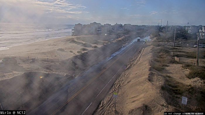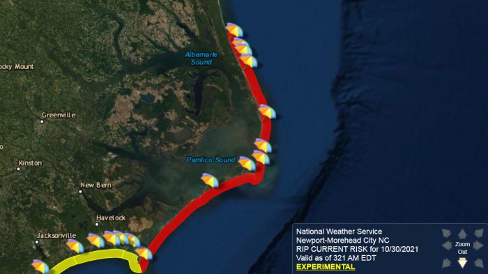
A high risk of rip currents is in effect for Saturday, October 30, while some standing water and sand remain on N.C. Highway 12 as of Saturday morning, due to overnight coastal flooding.
Per the Dare County Sheriff’s Office, flooding was reported Friday night on N.C. Highway 12 at multiple locations, including just south of the Richard Etheridge Bridge on Pea Island, in Salvo near the Otter Way area, and just north of Hatteras village. Though road conditions have much improved as of Saturday at 8:00 a.m., there are still slight amounts of ponding water and sand on the roadway.

N.C. Highway 12 is passable throughout, however, motorists are advised to use caution and to drive slowly through areas of standing water, as saltwater can damage vehicles.
The high risk of rip currents will continue throughout the day on Saturday for all Ocracoke and Hatteras Island beaches. A high risk of rip currents means that the surf zone is dangerous for all levels of swimmers, and beachgoers should stay out of the water.
The public should check surf and swimming conditions before heading to the beach, and the daily beach forecast at www.weather.gov/beach/mhx includes rip current risk levels, and information about other hazards along the beach. In addition, visitors are encouraged to sign up for text alerts from Dare County, ocean rescue agencies, and the National Weather Service by texting “OBXBeachConditions” to 77295.
For more information on the local forecast, visit www.weather.gov/mhx for general weather information, or the National Weather Service office in Newport / Morehead City’s Facebook page at https://www.facebook.com/NWSMoreheadCity/.


