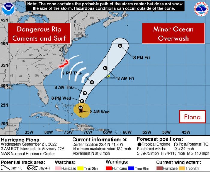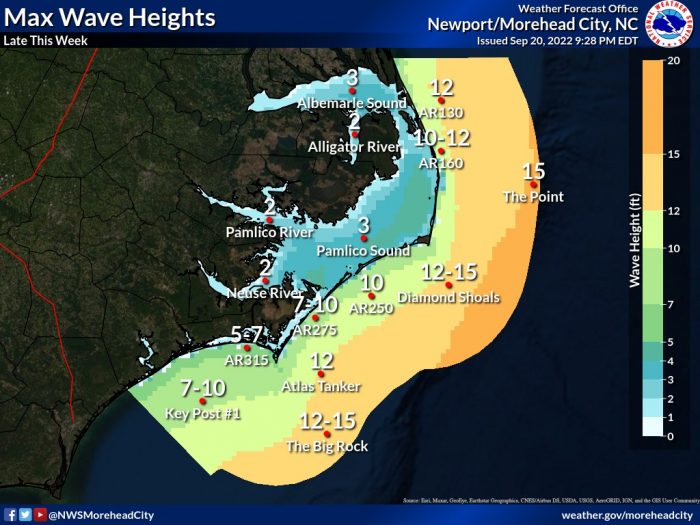
While Hurricane Fiona is expected to have no direct impacts to the Outer Banks, there will be an extended period of dangerous rip currents developing Thursday and continuing into the weekend, due to long-period large swells from the strengthening hurricane, per an update from the National Weather Service (NWS) Newport/Morehead City Office.
In addition, some minor ocean overwash and beach erosion could occur along the southern Outer Banks, mainly south of Oregon Inlet, and especially for beaches with compromised dune structures. The risk of minor overwash is also expected to linger into the weekend.
On Wednesday, September 21, there is a moderate risk of rip currents in effect for all Hatteras and Ocracoke Island beaches. A moderate risk means that only experienced swimmers that know how to escape a rip current should enter the surf.
Fiona is currently a major Category 3 hurricane as it continues to move north through the southwestern Atlantic Ocean. Fiona is forecast to continue moving north, then turn northeast and well away from Eastern N.C. mid to late week as a strong cold front moves off the U.S. East Coast.
For more information on the local forecast, visit www.weather.gov/mhx for general weather information, or the National Weather Service office in Newport / Morehead City’s Facebook page at https://www.facebook.com/NWSMoreheadCity/.


