

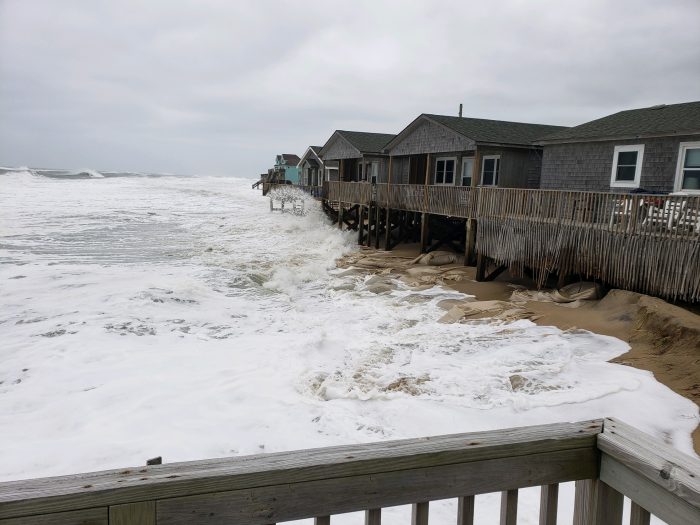
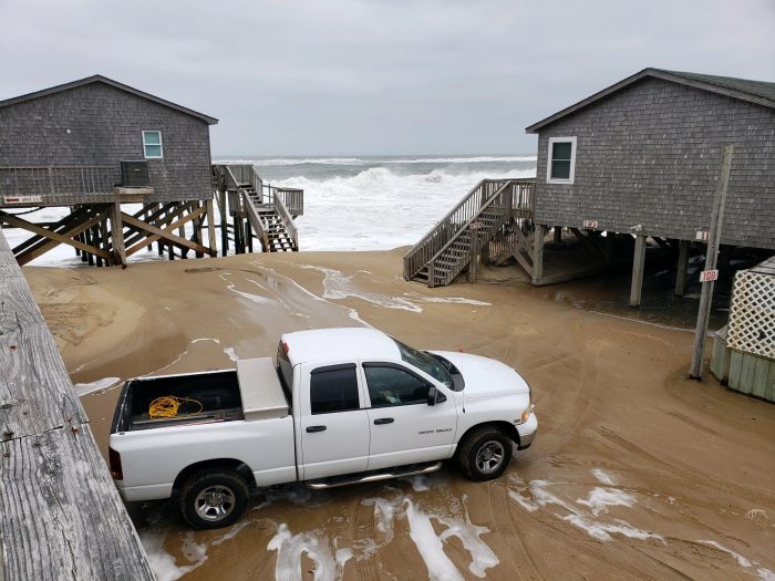
Minor to moderate ocean overwash was reported with Monday afternoon’s high tide, which occurred at roughly 2:30 p.m.
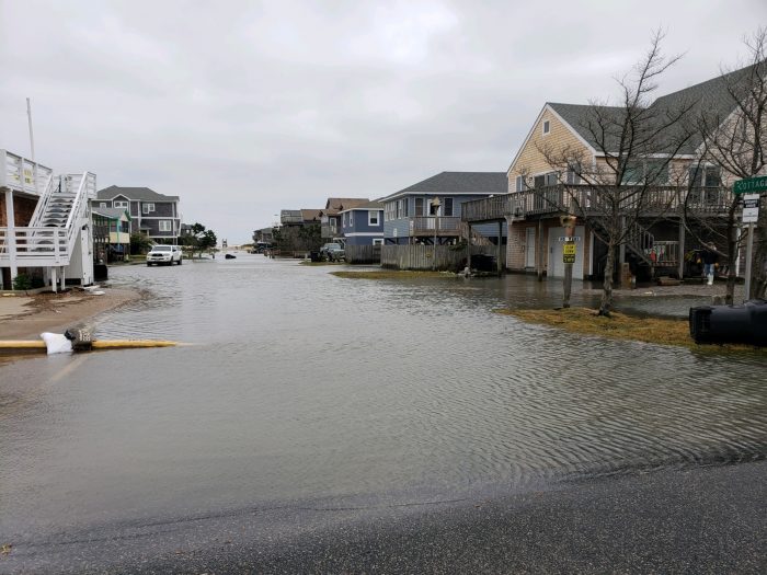
While N.C. Highway 12 remains open throughout, standing water and sand remain on the roadway, and flooding may continue through the afternoon. Travelers are advised to use caution, and to avoid driving if possible, as saltwater can severely damage vehicles.
Additional overwash is probable with the next high tide at roughly 3:00 a.m. on Tuesday morning.
Road conditions as of 2:30 p.m. on Monday per the North Carolina Department of Transportation (NCDOT) and additional sources are as follows:
- Oregon Inlet to Pea Island Visitor Center: Passable, but strong surf keeps taking away the dune near the Pea Island Visitor Center, which NCDOT crews continue to fortify as much as possible. Sand and water remain on stretches of the highway.
- Mirlo Beach/Rodanthe: Minor to moderate oceanside flooding was reported on N.C. Highway 12 in Rodanthe, and particularly in the S-Curves/Mirlo Beach area. Saltwater remains on the highway.
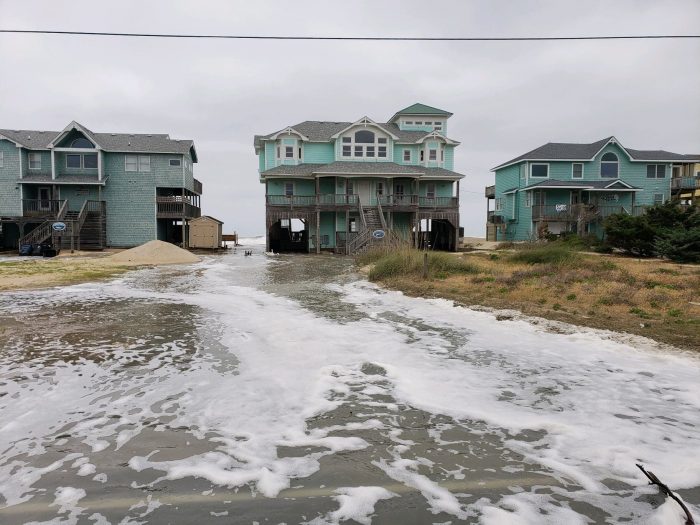
- Avon: Ocean overwash was reported along Ocean View Drive. Overwash has not yet impacted N.C. Highway 12, and the roadway is mostly dry.
- Buxton: Some overwash is continuing to impact the highway in northern Buxton. Traffic is moving, but slowly. Sand and water remain on the roadway.
- Hatteras: No issues currently.
- Ocracoke: No issues, but all ferry operations to and from Ocracoke Island remain suspended.
The low pressure system will continue to linger off the Outer Banks through Wednesday, and ocean overwash is expected to become more impactful with each successive high tide cycle. N.C. Highway 12 may become impassable for prolonged periods of time in the next several days.
Along the soundside, 1 to 3 feet of inundation for very low-lying areas will result in minor flooding of properties and some roadways, particularly for Ocracoke Island and southern Hatteras Island. Water levels will likely peak on Monday night.
Winds will continue to increase with maximum wind gusts of 45-50 mph currently forecast through Tuesday. Winds will peak late Monday night throughout the Outer Banks, then gradually diminish through the middle of the week.
Powerful surf with offshore wave heights up to 20 ft. and dangerous rip currents can also be expected for all Outer Banks beaches north of Cape Lookout.
For more information on the local forecast, visit www.weather.gov/mhx for weather information, or the National Weather Service office in Newport / Morehead City’s Facebook page at https://www.facebook.com/NWSMoreheadCity/.


