

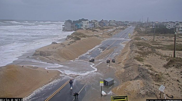
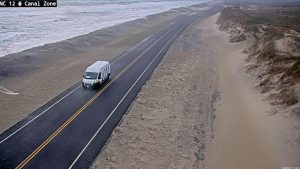
N.C. Highway 12 remained open and passable as of 7:30 a.m. on Wednesday morning, November 9, with some blowing sand and sea foam reported on northern Hatteras Island. The Mirlo Beach area north of Rodanthe, which is now bypassed by the Jug Handle Bridge, did experience some moderate flooding, and visitors are advised to avoid this area.
North Carolina Department of Transportation (NCDOT) crews will continue to be on the road today to conduct clean-up efforts as needed, and the public is advised to use caution if travel is necessary.
Ferry operations on Ocracoke and Hatteras Islands remained suspended as of Wednesday morning for all three routes: the Hatteras-Ocracoke ferry, the Ocracoke-Swan Quarter ferry, and the Ocracoke-Cedar Island ferry. The public can see updates on all Hatteras and Ocracoke ferry operations via the Ferry Division’s Twitter accounts at https://twitter.com/NCFerryHatteras/ and https://twitter.com/ncferrypamsound/, or by calling 252-996-6000 for more information.
Multiple weather events will continue to impact the Outer Banks this week, and a High Surf Advisory, Coastal Flood Advisory, and Wind Advisory remain in effect.
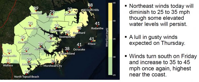
The strong northeast winds of 25-35 mph will diminish through today, however, large waves and wave runup may continue to produce areas of coastal flooding and ocean overwash/erosion through Thursday.
Portions of N.C. Highway 12 may be impacted by ocean overwash over multiple days, and through multiple high tide cycles. The last high tide was at approximately 7:45 a.m. on Wednesday, and the next high tide is approximately 8:00 p.m. on Wednesday night.
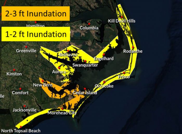
There is the potential for 1 to 2 feet of inundation above ground level along the oceanside from Duck to Ocracoke, and additional water level rises will be possible Friday into Saturday as the winds increase and shift to the south. When this occurs later in the week, the threat of flooding will likely shift towards the soundside Outer Banks.
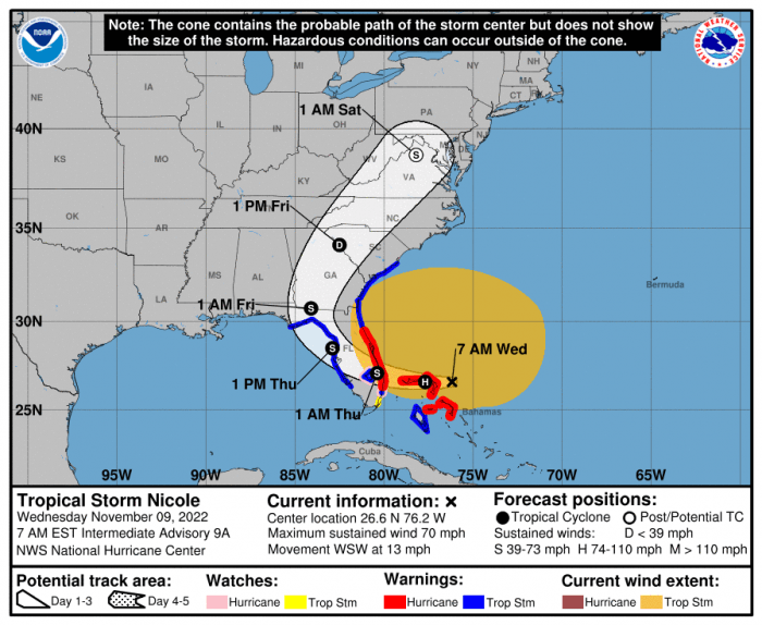
Meanwhile, now-Tropical Storm Nicole will continue to move westward and through Florida until Thursday. Nicole is forecast to lift through the Southeast U.S. and weaken as it moves up the East Coast. Rainfall, gusty winds, and isolated tornadoes are possible as Nicole passes by to the west of the Outer Banks area.
For more information on the local forecast, visit www.weather.gov/mhx for weather information, or the National Weather Service office in Newport / Morehead City’s Facebook page at https://www.facebook.com/NWSMoreheadCity/.


