

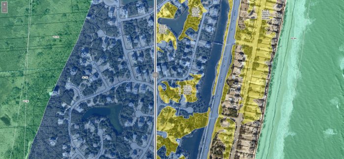
The Dare County Department of Information Technologies GIS (Geographical Information Systems) Division has released a new flood map tool for Dare County. The web application allows users to drag a layer across the map and visually switch between the previous flood maps from 2006 and the newly adopted flood maps.
The tool is available here https://gis.darecountync.gov/floodzones
The updated flood maps feature significant changes from the 2006 flood maps.
- Many properties were re-classified as Shaded X or X zone properties, which are considered low-risk zones.
- Other properties that remain in a flood zone, such as the AE flood zone, may have a lower base flood elevation. For example, a property designated AE8 on the 2006 maps may be designated as AE4 on the updated maps.
Flood maps only depict those areas subject to a 1% annual chance of flooding and do not reflect other flooding sources such as heavy rainfall or elevated groundwater levels. Floods can happen anywhere. Natural hazards and storms are a part of living on the Outer Banks and the sustainability of our community depends on managing flood hazards from all sources.
Hurricane season began June 1. Flood insurance is a valuable tool to protect your property. Remember flood insurance policies have a 30-day waiting period. Now is the time to contact your insurance agent and inquire what the new flood maps mean for your flood insurance premiums and policies. For more information on flood maps in Dare County, visit OBXFloodMaps.com


