
With the new moon this week that means higher and lower tides than normal, and an ongoing study of the phenomenon in North Carolina wants your photos.
The N.C. King Tides Project at the University of North Carolina Institute of Marine Sciences is asking for your help documenting the tides that are predicted from Oct. 6 through 12, especially on roadways and in low-lying areas.
You can submit photos and observations using the Coastal Observer app on your smartphone, available free at Google Play and the App Store.
Coastal Observer accepts photos from locations around the world, not just the Outer Banks. So if you are reading this, live in a coastal area and observe a king tide, hit them up with your shots.
King tides are regular and predictable events which are also expected to take place Nov. 3-9 and Dec. 2-7.
The submitted photos help visualize how “normal” high tides could look in the future due to sea level rise, according to the project. Using these images, a record can be created of how the shoreline looks now and track future changes.
“By visualizing these higher tide events we can start to understand how rising sea-levels will impact local resources and community investments,” organizers said.
While the King Tides Project focuses on water levels, citizen scientists can submit additional information that this app collects. All submitted photos can be viewed on the Coastal Observer website.


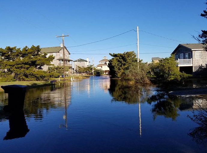
The photo needs a date and a description to give the reader a reference point. Is this of a King tide or is it just a random photo showing standing water in yards, which could have been the result of multiple days of heavy rainfall. It could be sound flooding on a non-King tide day.
This type of reporting is like the Weather Channel showing old footage during hurricane coverage, but not making it clear that it is old footage.
This is a picture of Pompano drive in N Avon the soundside of Hatteras Colony on looking onto South Albacore Lane. It was taken a least a year ago right after a hurricaine. This road is nice a clear and has been all week and for a long while now. It only floods in the event of a strong N west Wind when over 40MPH for at least 2 hours.