

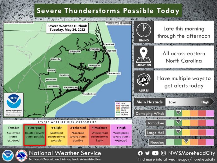
Another round of showers and thunderstorms are expected to begin late this morning and into the afternoon for eastern North Carolina, per a Tuesday morning update from the National Weather Service Newport/Morehead City office.
A few storms could become severe, with the main threats being heavy rainfall and gusty winds. Some small hail and a brief tornado are also possible, although unlikely, and localized flooding is possible as well.
There is a moderate rip current risk from Duck to Cape Hatteras, meaning that only experienced surf swimmers who know how to escape a rip current should enter the water. A minor rip current risk is in effect for the southern Outer Banks beaches from Cape Hatteras to Ocracoke.
For more information on the local forecast, visit www.weather.gov/mhx for weather information, or the National Weather Service office in Newport / Morehead City’s Facebook page at https://www.facebook.com/NWSMoreheadCity/.


