Thursday, April 24, 2025

Subtropical Storm Melissa in Pictures…WITH SLIDE SHOW

Share post:

[soliloquy id=”29147″]

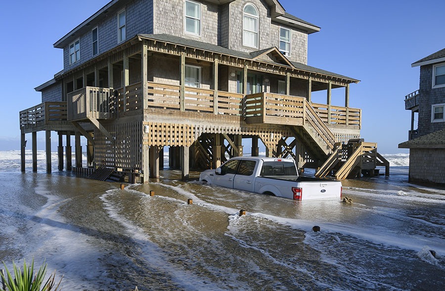
Island Free Press photographer Don Bowers captured these images of Avon and Buxton on Friday, which saw some of the highest water levels during the days-long storm that affected the Outer Banks this week. Suptropical Storm Melissa brought multiple periods of oceanside flooding and overwash to Hatteras and Ocracoke islands over the past several days, and flooding is expected to continue on Saturday, especially in the hours before and after high tide. The next high tide is at approximately 8:00 p.m. on Saturday night.

NCDOT reported that crews are continuing to work to reopen N.C. Highway 12 from Rodanthe to the Oregon Inlet Bridge. It is hoped that the roadway will temporarily reopen to traffic by Saturday afternoon. Flooding was reported throughout Hatteras Island with Saturday morning’s high tide, with overwash reported in north Hatteras, north Buxton, Avon, and Rodanthe.

The Island Free Press will continue to post updates as soon as they are available.

Trending

Subscribe

Help Support Local News! Subscribe for Free, Upgrade to Premium, or Make a Contribution.

Related articles

Ocracoke Express passenger ferry begins 2025 season on May 15

The Ocracoke Express passenger ferry between Hatteras and Ocracoke Islands will begin service for the 2025 season on May 15,...

Outer Banks Chamber head Karen Brown to retire in 2026

From SamWalkerOBXNews.com Outer Banks Chamber of Commerce President and Chief Executive Officer Karen Brown has announced she will be...

NWS to promote Rip Current Awareness Week April 27 through May 3

The National Weather Service offices that serve the coastal Carolinas (NWS Charleston SC, NWS Wilmington NC, NWS Newport/Morehead...

U.S. 158 repairs near Jockey’s Ridge will close northbound lanes starting Monday

From SamWalkerOBXNews.com Emergency repairs to the roadway will require the northbound lanes of West U.S. 158 near Jockey's Ridge...