
North Carolina emergency management officials have launched a new initiative for the state’s coastal counties as hurricane season gets underway — predetermined evacuation zones based on the most vulnerable areas.
North Carolina Public Safety Secretary Erik Hooks and Emergency Management Director Mike Sprayberry said the state worked with 20 coastal counties, including Dare, Hyde and Currituck, to create evacuation zones to help keep residents safe and allow for “simple and orderly evacuations.”
“The goal of Know Your Zone is to educate coastal residents and visitors about their evacuation zones so that everyone knows the zone they live in and knows to look and listen for that zone when evacuations are ordered,” Hooks said. “Knowing your zone and when to evacuate can save lives.”
Development of the zones by county officials began with storm surge modeling from North Carolina’s Hurricane Evacuation Study. County officials were able to use the study maps to determine potential for inundation, and combine that with population data, as well as previous local experience with coastal evacuations to draft the evacuation zones needed for their county.
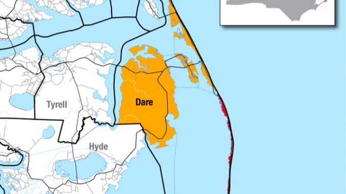
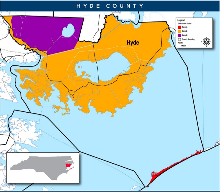
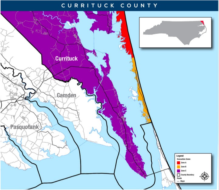
Some counties only need one zone where others have up to five zones in order to evacuate as efficiently as possible without over evacuating. Dare County has two zones — Hatteras Island is Zone A and the rest of the county is Zone B. Hyde and Currituck counties each have three zones.
Some inland counties that are not as susceptible to storm surge developed evacuation zones based on river flooding.
In the past, some evacuation orders have included descriptions based on local geography and elevations. Examples include:
- All unincorporated areas of a county
- Low lying areas in a town or county
- All areas within a certain distance of a particular river or streams
“Most visitors and some residents will not know if they are in a low-lying area, or how far they are from a river or stream,” Sprayberry said. “Having predetermined zones simplifies the evacuation process for local officials, residents and visitors.”
There is an online address lookup tool at KnowYourZone.nc.gov for residents in coastal counties to find their zone. The website also contains, county-by-county zone maps, educational materials, frequently asked questions and the North Carolina Hurricane Guide. The hurricane guide, which is available in both print and digital form, provides information for storm preparedness, response and recovery, and has been published in English and Spanish.
The Know Your Zone website is also available in Spanish at Conozca Su Zona.
The ReadyNC website continues to be the source for disaster preparedness information for North Carolina residents, with instructions on creating a family emergency plan and assembling an emergency kit. It also features live information on power outages and open shelters. ReadyNC.org is mobile friendly for phones, tablets and desktop computers and is available in English and Spanish. The ReadyNC app was retired after the 2019 hurricane season and is no longer available.