

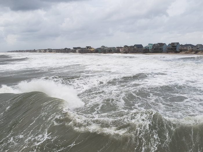
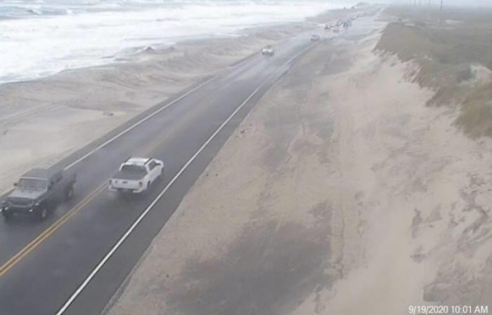
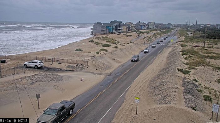
10:00 A.M. UPDATE: Ocean overwash was starting to impact N.C. Highway 12 and adjacent roadways throughout Hatteras Island as of 10:00 a.m. on Saturday, roughly an hour after the morning’s high tide. Overwash was reported in the Ocean View Drive area of Avon, northern Buxton, Mirlo Beach, and Pea Island just south of Oregon Inlet.
Travelers are advised to drive slow and use caution when driving through standing water, as saltwater can heavily damage vehicles. N.C. Highway 12 remained open as of 10:15 a.m.
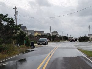
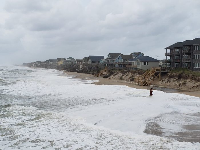
N.C. Highway 12 in Avon at approx. 10:00 a.m. on Saturday. Video by Rick Shaftan
A Coastal Flood Warning is still in effect for the Northern Outer Banks and Hatteras Island due to the expected impacts of Hurricane Teddy, per a recent update from the National Weather Service Newport / Morehead City office.
High astronomical tides will bring the threat for minor to moderate coastal flooding around the time of each high tide this weekend into early next week. Combined with strong, long period swell from distant Hurricane Teddy, there will be an increased potential for significant beach erosion and dune overwash through the weekend.
Stronger winds through the weekend could also bring more extensive coastal flooding impacts, especially for oceanside areas north of Cape Hatteras, and especially in hotspots that are prone to ocean overwash. This is expected to be a long duration event through multiple tide cycles, and at high tide, significant ocean overwash is expected, and beach erosion is also likely with 7 to 14-foot waves.
Travelers should note that N.C. Highway 12 could continue to be impacted over the next several days, and especially in the following areas that are prone to ocean overwash:
- South of the Basnight Bridge to the Pea Island Visitor Center
- Mirlo Beach area, on the northern edge of the tri-villages
- South of the Avon Pier along Ocean View Drive
- At the north end of Buxton
- Between Frisco and Hatteras Village
- Along Pole Rd., south of Ramp 55 in Hatteras village
- Along the north end of Ocracoke island
The next high tide is around 10:00 p.m. on Saturday.
Impacts will continue this weekend into early next week. The rip current risk is expected to remain elevated for all Hatteras and Ocracoke island beaches for the next several days as well.


This is just a few inches, wait until the swells arrive. Then the fun will begin.
Anyone on the road is going to regret it, same with those parked at oceanfront houses.