Monday, May 5, 2025

Severe Weather Possible on Thursday, December 30

Share post:

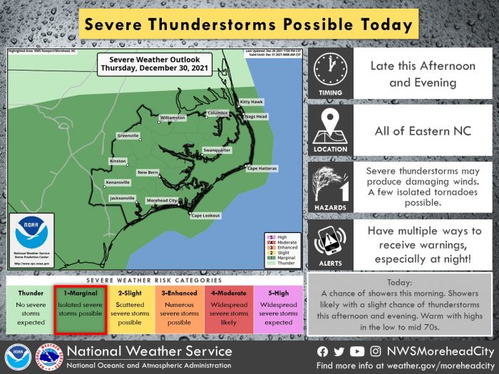
Severe thunderstorms could possibly develop on late Thursday afternoon and evening across the Outer Banks, per an update from the National Weather Service Newport / Morehead City Office.

A chance of rain begins on Thursday morning and continues into the early afternoon, and showers will become more likely with a slight chance of thunderstorms later this afternoon and evening as an area of low pressure tracks across the state. A few storms could become strong to marginally severe, with damaging wind gusts and the possible development of isolated tornadoes. Any severe weather threat should end by Thursday night.

For more information on the local forecast, visit www.weather.gov/mhx for weather information, or the National Weather Service office in Newport / Morehead City’s Facebook page at https://www.facebook.com/NWSMoreheadCity/.

Trending

Subscribe

Help Support Local News! Subscribe for Free, Upgrade to Premium, or Make a Contribution.

Related articles

New Slash Creek Bridge in Hatteras Village scheduled to open by Memorial Day Weekend

Despite wintertime delays due to cold and snowy weather, the new Slash Creek Bridge in Hatteras Village is...

Hurricane Preparedness Week: Know your risk – water and wind

Courtesy National Weather Service Newport/Morehead City National Hurricane Preparedness Week is May 4-10, 2025, and the National Weather Service and...

Commissioners in eight coastal counties considering resolutions opposing ferry tolls in state budget

From SamWalkerOBXNews.com Commissioners in eight coastal North Carolina counties plan to adopt a joint resolution on Monday that will...

Vehicle wreck causes Friday night power outage on Hatteras and Ocracoke Islands

A one-vehicle collision in northern Rodanthe was the cause of a power outage that affected Hatteras and Ocracoke...