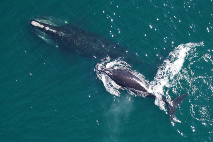
NOAA Fisheries has announced voluntary slow zones have been put in place in off the Outer Banks after endangered North Atlantic right whales were spotted offshore.
There are approximately 360 individual North Atlantic right whales remaining, including fewer than 70 reproductively active females.

Vessel strikes are considered the primary threat to the whales because they spend a lot of time at or close to the water surface, and they are difficult to spot from a boat due to their dark color and lack of a dorsal fin.
To reduce the risk of collisions, most vessels 65 feet or longer must travel at 10 knots or less in certain locations along the U.S. East Coast at certain times of the year.
That includes an area up to 20 nautical miles off the mouth of Chesapeake Bay, Cape Lookout and Beaufort Inlet, and from Wrightsville Beach southward, between November 1 and April 30 when right whales are migrating and calving.
NOAA Fisheries also institutes voluntary speed zones elsewhere in coastal waters when there are visual sightings of three or more right whales within a discrete area, or their presence is detected using acoustical devices.
The program notifies vessel operators to slow down to avoid right whales, provides maps and coordinates to vessel operators indicating areas where right whales have been detected.
For a period of 15 days after a whale is detected, mariners are encouraged to avoid these areas or reduce speeds to 10 knots or less while transiting.
On December 16, the Clearwater Marine Aquarium Research Institute Aerial Survey team reported a right whale entangled in fishing gear was spotted about 60 miles off Cape Hatteras.
The same team spotted a pod of right whales east of Cape Hatteras on Saturday and Monday, according to NOAA Fisheries.
A pair of voluntary slow zone are now in effect covering the offshore waters from Currituck Beach Light to near Drum Inlet on the Core Banks.
The zone for east of Cape Hatteras is in effect through January 12, with a northern boundary of 35°40′ N, a southern boundary of 34°56′ N, an eastern boundary of 74°59′ W and western boundary of 75°53′ W.
The zone north of Cape Hatteras is in effect through January 14, with a northern boundary of 36°21′ N, a southern boundary of 35°40′ N, an eastern boundary of 74°56′ W and a western boundary of 75°47′ W.
Boaters and other interested parties can sign up for email or text notifications about the latest Right Whale Slow Zones. You can also follow on Facebook @NOAAFisheriesNEMA and Twitter @NOAAFish_GARFO for announcements.


