
")
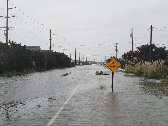
N.C. Highway 12 still had remaining ocean overwash at multiple locations just before low tide on late Sunday afternoon, and several more cycles of overwash are expected starting with Sunday night’s high tide, which is at approximately 11:00 p.m.

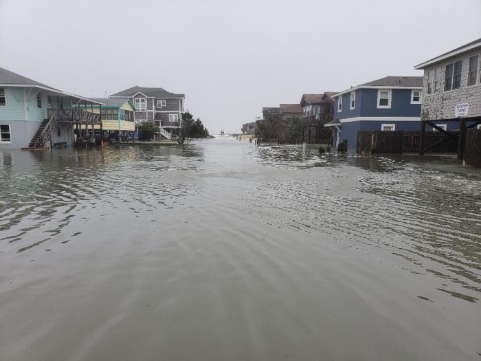
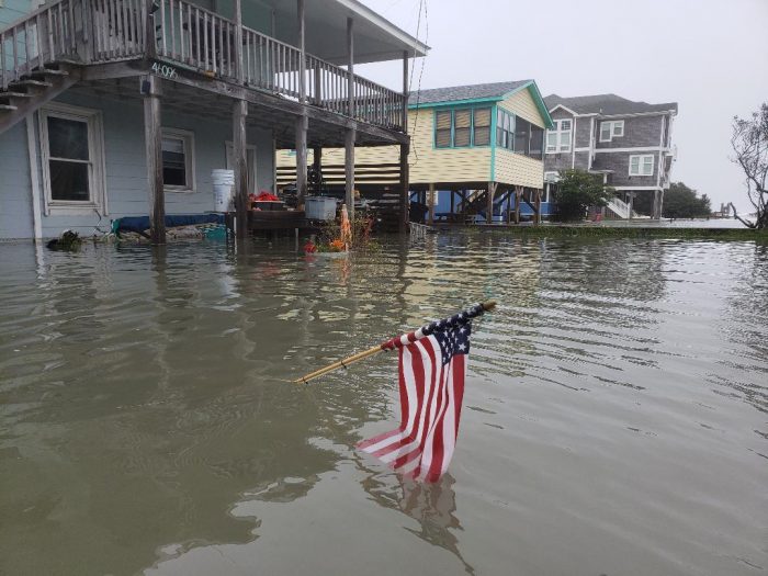
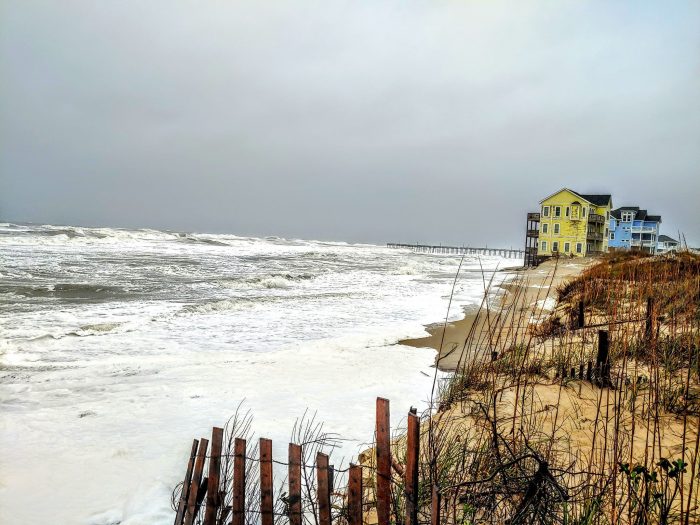
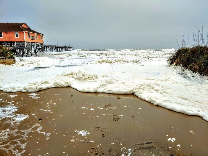
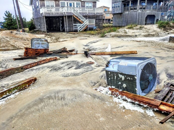
Flooding, sand, and standing water were reported along the main highway and side streets in Avon from the Avon Pier to the southern village borders, and was also reported in northern Buxton, and in northern Rodanthe and Pea Island.
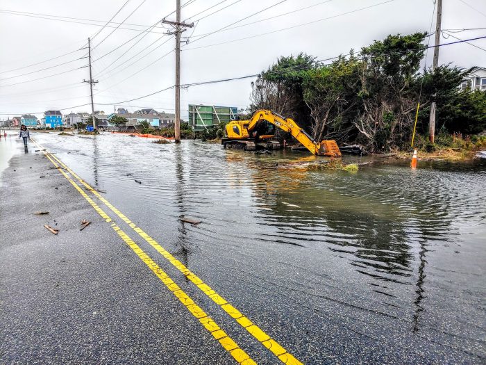
Dare County officials reported at 3:00 p.m. that due to the hazardous conditions affecting the clearing operations of N.C. Highway 12, and the expected overwash tonight, the highway will remain closed from Oregon Inlet to Rodanthe until weather conditions allow for safe and productive clearing efforts.
State transportation officials will reassess road conditions tomorrow and begin clearing and any possible repair work required to reopen the northern section of the highway. Per a Sunday afternoon update from drivenc.gov, N.C. Highway 12 is expected to reopen by 11:00 a.m. on Tuesday, November 19.
Per the National Weather Service (NWS) Newport / Morehead City office, the strong low pressure, which was located south of Cape Hatteras as of 3:30 p.m., will slowly drift eastward through the evening, then accelerate to the Northeast late tonight and Monday. Conditions are expected to slowly improve as the low moves away from the Outer Banks area.
“We are just coming off the highest tide cycle expected for this event and have seen many areas of ocean overwash along the OBX,” stated the NWS in an online public forecast discussion. “With very rough seas with descent wave energy and run up, [we] could continue to see [the] area experience overwash during the next two high tide cycles, though not as severe as this past high tide.”
A High Surf Advisory remains in effect until 7 p.m. on Monday, and a Coastal Flood Advisory remains in effect until 2 p.m. on Monday. A Wind Advisory is also in effect until 6:00 p.m. on Sunday evening.
For more information on the local forecast, visit www.weather.gov/mhx for weather information, or the National Weather Service office in Newport / Morehead City’s Facebook page at https://www.facebook.com/NWSMoreheadCity/.
The Island Free Press will continue to post updates as soon as they become available.


All is well in Rodanthe this Monday morning. Wind is lighter and school is out, going to be another great day!