

2:00 p.m UPDATE: Soundside flooding has been reported in Hatteras Village, specifically for neighborhoods along Eagle Pass Road. N.C. Highway 12 remains open and accessible throughout Ocracoke and Hatteras Islands.
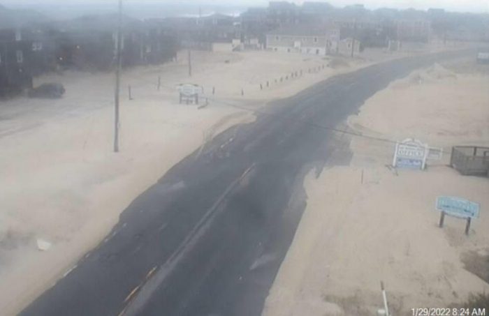
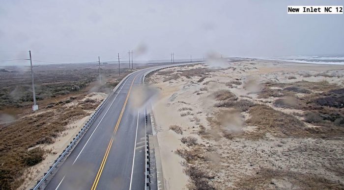
While no soundside flooding or ocean overwash was reported on N.C. Highway 12 with Saturday morning’s high tide, blowing sand and minor patches of standing water from recent rains were reported on the roadway in several locations, per a Saturday morning update from NCDOT.
“It’s another windy Saturday on the Outer Banks, and once again the stormy conditions have resulted in blown sand and water on NC12,” stated the NCDOT social media update. “The road is open, but PLEASE DRIVE WITH CAUTION. Overwash is possible, especially at high tide cycles this weekend.”
The next high tide is approximately 5:00 p.m. on Saturday.
All ferry operations on Ocracoke Island and Hatteras Island have been suspended as of Saturday morning due to the deteriorating weather conditions. Operations will resume once the storm subsides, and it is safe to do so.
Light snow flurries were reported on both Hatteras and Ocracoke Islands on Saturday morning, but with no accumulation. Higher snowfall amounts were affecting the northern Outer Banks, however, and folks traveling up the beach are advised to drive with caution.
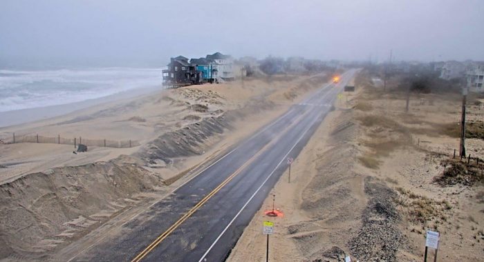
Strong north to northwest winds with up to 45 mph gusts could bring 1 to 2 feet of soundside flooding for very low-lying areas on Saturday from Rodanthe south, and large swell and elevated water levels could bring ocean overwash from Cape Point to Oregon Inlet on both Saturday and Sunday.
Freezing temperatures are a concern overnight, and temperatures will drop to the low-to-mid 20s on Saturday night. The public is advised to protect outdoor pets, exposed pipes, and sensitive vegetation as needed.
Low temperatures, with wind chill values as low as the single digits, will result in a hard freeze of any wet surfaces on Saturday night, and black ice is likely on Sunday, creating dangerous road conditions.
For more information on the local forecast, visit www.weather.gov/mhx for weather info, or the National Weather Service office in Newport / Morehead City’s Facebook page at https://www.facebook.com/NWSMoreheadCity/.


