

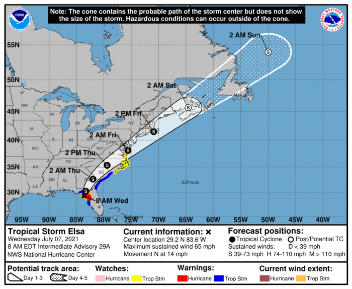
Tropical Storm Elsa is expected to bring impacts to Hatteras and Ocracoke islands on Thursday, including heavy rains, gusty winds, high surf and dangerous rip currents, and the potential for soundside flooding, per a recent update from the National Weather Service Newport / Morehead City office.
A Tropical Storm Watch is now in effect for the Outer Banks. A watch means that tropical storm conditions are possible within the next 48 hours.
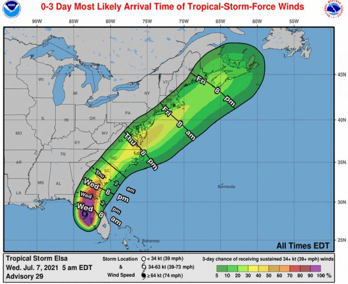
There is a 20-40% chance of Tropical Storm Force winds (39 mph or greater) occurring across Eastern N.C. The strong winds may lead to minor water level rises up to two feet above ground for soundside portions of the Outer Banks, and mainly north of Cape Hatteras. The most likely time of arrival for Tropical Storm Force winds along the Outer Banks will be Thursday morning to afternoon.
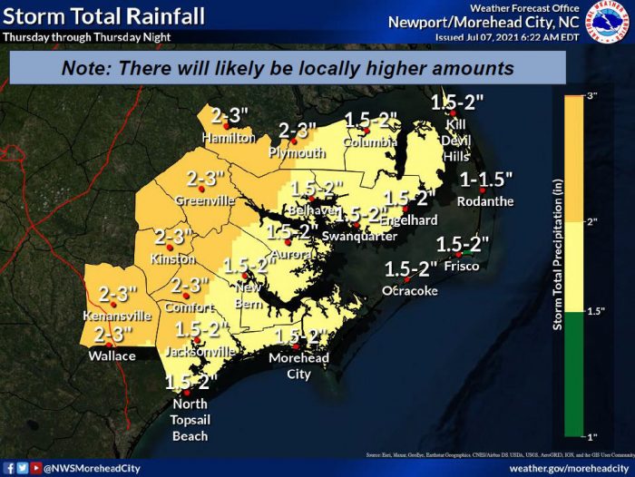
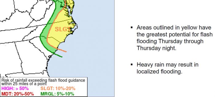
Rainfall amounts will range from 1 to 3 inches, with locally higher amounts possible. Localized flash flooding is possible, and especially in low-lying areas. Isolated tornadoes are also possible throughout the day on Thursday.
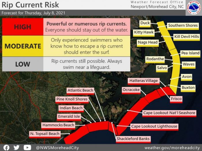
A high rip current risk due to strong winds combined with increasing swell energy is also forecast for Thursday, and the dangerous surf conditions could linger into Friday as well.
Residents and visitors are encouraged to stay abreast of changing weather conditions and to be ready to take action to protect themselves and their property. Protective actions may include avoiding travel during periods of heavy rain and high winds, and not driving through flood waters or parking vehicles in areas that could flood.
For up-to-date weather information, visit the National Weather Service at Newport/Morehead City at www.weather.gov/mhx. For updated information regarding road conditions on N.C. Highway 12, follow the North Carolina Department of Transportation on Facebook at www.facebook/ncdot, on Twitter @NCDOTNC12 or visit drivenc.gov.
In addition to ensuring mobile devices have government alerts enabled, Dare County Emergency Management encourages residents and visitors to sign up to receive emergency alerts—including severe weather watches and warnings, public safety and emergency-related warnings, and other time-critical notifications—by visiting www.OBXAlerts.com. Those that sign up can choose delivery methods to include email, phone call and text messages. For those that only want to receive alerts from Dare County Emergency Management as text messages, you can opt-in by texting DareEmergencyAlerts to 77295.


