Shellfish Area Closures: There’s An App For That!
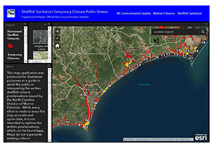
A new web application on the Division of Marine Fisheries website will help fishermen find what shellfishing waters are open or closed to harvest in real time.
One of the main missions of the division’s Shellfish Sanitation and Recreational Water Quality Section is to make sure that all shellfish harvested from North Carolina waters are safe to eat. To accomplish this, the section regularly tests shellfishing waters for the presence of fecal bacteria, surveys the shoreline area for the presence of potential pollution sources, and conducts studies on point source discharges of pollution, among many other things. All of the data collected is then used to determine the proper classifications for state shellfish growing areas.
Studies show that bacteria concentrations in some shellfish harvesting areas can become elevated following heavy rainfall, as fecal contaminants are washed from the ground surface, through stormwater ditches, and into the estuaries. As the shellfish feed, they can filter these fecal contaminants into their digestive system and concentrate them to a level that could cause severe illness if they are harvested and eaten raw. For these areas, management plans have been developed that require automatic temporary closures for shellfishing after certain rainfall thresholds are exceeded. These temporary closures remain in place until water quality sampling shows that bacteria concentrations have dropped to levels where shellfish harvesting is once again safe.
These temporary closures and reopenings are conveyed to the public through written proclamations that describe the boundaries of the temporarily closed shellfishing waters. While these written proclamations will remain the official, legal source for temporary closure descriptions, this new application is intended to help fishermen to visualize the closures in real time in a user-friendly way that is available on desktop computers, tablets, and cell phones.
The public can access the map through the division’s website at this link. It shows permanently closed shellfish harvest areas, as well as areas temporarily closed due to rainfall and stormwater runoff or other causes of short-term contamination like wastewater spills. Users can navigate throughout the coast to view different closure areas or use the location search tool in the top right-hand corner of the screen in order to navigate directly to an area of interest.


