UPDATE: Coastal Flood Advisory and High Surf Advisory Issued for Outer Banks
A Coastal Floor Advisory and High Surf Advisory has been issued for Dare and Hyde Counties per the Wednesday morning storm briefing from the National Weather Service Forecast Office in Newport / Morehead City.
Winds are projected to increase starting on Wednesday evening, and will peak just before daybreak on Thursday. Maximum sustained winds are forecast to be in the 40-47 mph range on Hatteras and Ocracoke islands, and blowing snow is likely during the storm.
Strong winds and rough seas should be expected over coastal waters, and water level rises are possible on the soundside of the Outer Banks.
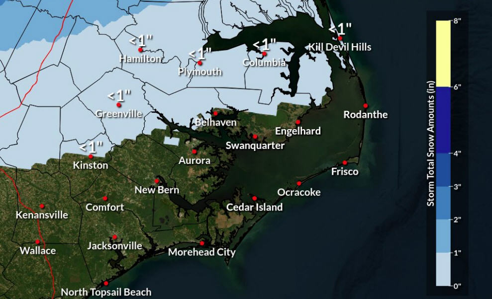
In addition, the amount of forecasted snow for Hatteras and Ocracoke islands has increased slightly, with 1-2 inches projected from Rodanthe to Ocracoke, and significantly higher amounts in the 2-8 inch range in inland Eastern North Carolina.
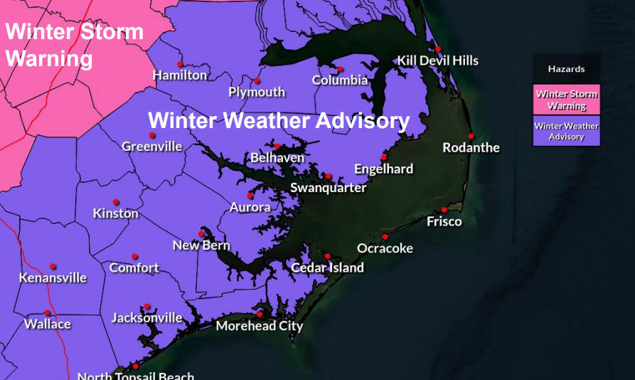
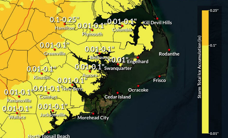
Eastern North Carolina residents should expect hazardous travel conditions starting this afternoon, due to icing at the start of the storm, followed by accumulating snowfall. Strong winds will create blowing snow, and impacts may linger due to colder weather moving into the area. Elevated surfaces such as bridges and overpasses are most likely to see icing.
Dare County was placed under a Winter Storm Warning on Tuesday afternoon, which is in effect from 3 p.m. on Wednesday until 1 p.m. on Thursday. A Winter Storm Warning means that severe winter weather conditions are expected in the immediate future.
It was also announced on Tuesday afternoon that Dare County Schools will be on an early release schedule (3 hours) on Wednesday, January 3. All afterschool activities are also canceled.
Hyde County offices will close today at 1 p.m. and will remain closed through tomorrow. Hyde County officials reported that they will evaluate conditions on Thursday regarding Friday’s operational status.
For more information, visit www.weather.gov/mhx for weather forecast information, or the National Weather Service office in Newport / Morehead City’s Facebook page, https://www.facebook.com/NWSMoreheadCity/.
The Island Free Press will continue to post updates on the potential storm and future snowfall as soon as they are available.


