Park Service’s DEIS for off-road vehicle management is now public
By IRENE NOLAN
By IRENE NOLAN
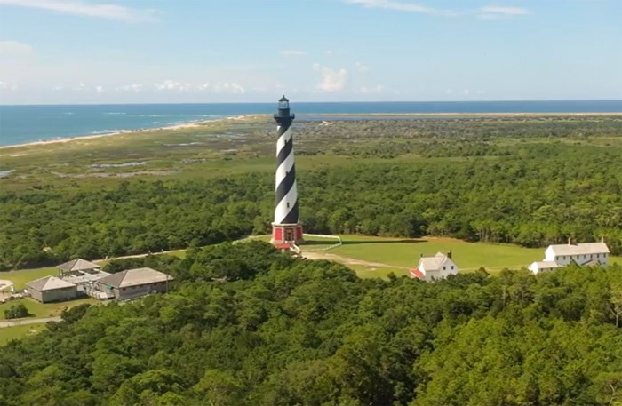
The National Park Service preferred alternative for managing off-road vehicle access to the Cape Hatteras National Seashore was released to the public today.
The preferred alternative is part of a Draft Environmental Impact Statement that the Park Service is required to prepare under the National Environmental Policy Act.
According to the Park Service, “The DEIS evaluates the impacts of several alternatives for regulations and procedures that would manage ORV use and access in the national seashore to protect and preserve natural and cultural resources and natural processes, to provide a variety of visitor use experiences while minimizing conflicts among various users, and to promote the safety of all visitors. “
Electronic copies of the DEIS are available for public review on the NPS Planning, Environment and Public Comment (PEPC) Web site for the project at: http://parkplanning.nps.gov/document.cfm?parkId=358&projectId=10641&documentID=32596
The document is 810 pages, including a 50-page executive summary, graphics, tables, maps, preparers, consultants, and references. Frank Folb of Frank and Fran’s in Avon said it weighs 8.3 pounds when printed out.
In the DEIS, the Park Service examines in detail six different options for managing ORVs in the seashore. Tables (available in the executive summary) compare and contrast Alternatives A through F.
The first five, A through E, were released by the Park Service last fall during the failed negotiated rulemaking process.
Alternatives A and B are known as “no-action” alternatives. In this case, the two are continuation of management under the interim protected species plan and continuation of management under the consent decree, under which beaches have been managed since 2008.
The other four are “action” alternatives.
New in the document released today is Alternative F, which is the Park Service’s preferred alternative.
The environmentally preferable option is Alternative D, which provides the least access of the six.
Elements that are common to all action alternatives include the following:
• ORV routes and areas would be officially designated in accordance with the executive orders.
• Year-round ORV routes and areas would be designated only in locations without sensitive resources or high pedestrian use.
• Year-round non-ORV areas would be designated.
• A new standard set of species management and monitoring measures would include “species management areas” (SMAs) and two levels of species management effort. SMAs include areas at the spits and points in addition to other sensitive resource areas.
• “Desired Future Conditions” would be established, as well as a system for periodic review and adaptive management initiatives.
• Night-driving restrictions would be in effect from May 1 through November 15, which
corresponds with turtle nesting season.
• ORV permits would be required and would involve a fee and education requirement.
• Overcrowding would be addressed using various methods for establishing carrying capacity.
• New vehicular access points and/or new or expanded parking areas would be identified.
• Commercial fishing vehicles would be exempted from some ORV restrictions, when not in conflict with resource protection.
Here is a brief description of Alternative D, described as “increased predictability and simplified management:”
Alternative D is the Environmentally Preferable Alternative. Under alternative D, visitors to the seashore would have the maximum amount of predictability regarding areas available for ORV use and vehicle-free areas for pedestrian use. Restrictions would be applied to larger areas over longer periods of time to minimize changes in designated ORV and non-ORV areas over the course of the year. To provide predictability under this alternative, only year-round ORV routes would be designated. Year-round non-ORV areas would include all of the SMAs and village beaches. SMAs would be closed to pedestrian use under Management Level 1 (ML1) measures during the breeding season. Seasonal night-driving restrictions would be established between the hours of 7 p.m. and 7 a.m. from May 1 to November 15. An ORV carrying capacity would be addressed solely by the use of vehicle stacking limits (one vehicle deep).
According to the Park Service, 40.8 miles of beach would be closed to ORVs year-round, no miles would be designated for seasonal ORV use, and 27.2 miles would be designated as ORV routes, year round.
Here are the details of Alternative F, described as “management based on Advisory Committee input.”
Alternative F is the National Park Service Preferred Alternative. The NPS used the Negotiated Rulemaking Advisory Committee’s input to create this action alternative, which is designed to provide visitors to the seashore with a wide variety of access opportunities for both ORV and pedestrian users. After shorebird breeding activity is
concluded, alternative F would re-open some SMAs to ORV use earlier and for a longer time than the other action alternatives. This alternative would involve the construction of two pedestrian access trails and improvements and additions to the interdunal road system. Under alternative F, Hatteras Inlet Spit and North Ocracoke Spit would be non-ORV areas year-round, with interdunal roads that allow access to the general area, but not the shoreline. SMAs would be closed to ORV use from March 15 through July 31, except South Point and Cape Point would have initial ORV access corridors and Bodie Island Spit would have an initial pedestrian access corridor at the start of the breeding season, with increased species monitoring in these areas. These access corridor(s) would close when breeding activity is observed. Village beach closures would vary under alternative F with the northern beaches closed to ORV use from May 15 through September 15 and southern beaches closed from March 1 through November 30. Seasonal night-driving restrictions would be established from one hour after sunset until after turtle patrol has checked the beaches in the morning, which is usually approximately one-half hour after sunrise.
Under Alternative F, according to the Park Service, 16 miles of beach would be closed to ORVs year-round, 23 miles would be designated for seasonal ORV use, and 29 miles would be designed as ORV routes year-round.
Other details of Alternative F:
The DEIS Service says it will provide visitors “with a degree of predictability regarding areas available for ORV use, as well as vehicle-free areas.”
Two popular areas will be closed year-round to ORVs—Hatteras Inlet and the North Point of Ocracoke with interdunal roads that would allow access to the “general area” but not the shoreline.
At Hatteras Inlet, 2.2 miles of village beach (from the east boundary to Ramp 55) would be open seasonally to ORVs. Another 1.8 miles of shoreline would be open year-round to ORVs. One mile of ocean shoreline would be closed to ORVs year-round, though a new interdunal road will provide access to False Point and the inlet.
North Point of Ocracoke will be closed year-round to ORVs with a new interdunal road from Ramp 59 for three-tenths of a mile with parking at the end of the road and access to the beach.
The shoreline between Ramp 27 and Ramp 30 will be closed to ORVs year-round.
At Bodie Island, 1.7 miles will be closed to ORVs year-round from Ramp 1 to one-half mile south of Coquina Beach. There will be 2.1 miles open to ORVs year-round, and 1.9 miles closed to ORVs March 15 through July 31.
At Cape Point, one mile from Ramp 44 to the point and for two-tenths of a mile west of the hook will be a year-round ORV route with expected limited access from March 15 to July 31.
The interdunal road will be extended behind south beach all the way to Ramp 49. Two news ramps, 47 and 48, will be added as “spurs” off the interdunal road.
The beaches in the northern villages of Rodanthe, Waves, Salvo and Avon will be closed to ORVs from May 15 until Sept. 15. The beaches in Frisco and Hatteras village will be closed from March 1 until Nov. 30.
No night driving from one hour after sunset until the turtle patrol has checked the beach in the early morning. Beach fires are prohibited from May 1 until Nov. 16 except in front of the villages, Coquina Beach, and the Ocracoke Day Use Area.
Permits will be required to drive on the beach. No cost has been established. Permits will be available for a week or a year from date purchased. There will be no limit on permits. A short education course will be part of getting the permit.
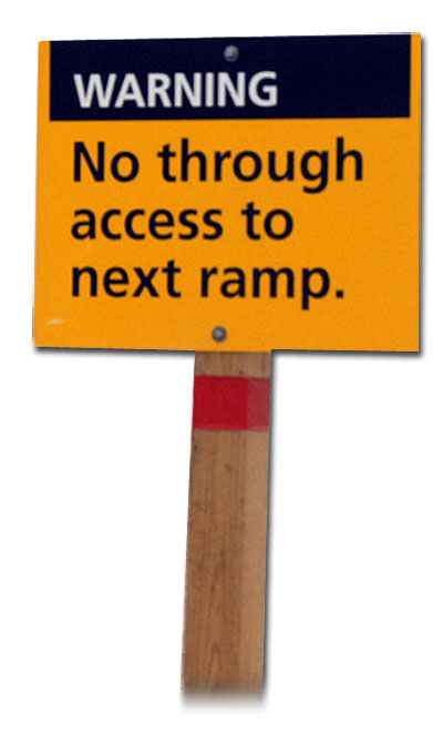
Eight new ramps will be created and one will be relocated. New pedestrian trails will be established. Current parking areas will be expanded and new ones will be built.
Buffers around nesting birds will remain unchanged from the consent decree.
Small business could see “negligible to moderate” economic impacts under Alternative F, as opposed to “long-term moderate to major adverse impacts” under the more environmentally friendly, Alternative D.
Reaction to the public release of the DEIS was muted today.
A few comments started coming out on fishing and community boards in the afternoon. Most of the beach access advocates we contacted today hadn’t had time to read even the executive summary today.
The two groups whose lawsuit against the National Park Service resulted in the consent decree of April 2008 – National Audubon Society and Defenders of Wildlife – along with Southern Environmental Law Center, which represents them, issued a media release on their Web sites this afternoon.
“The preferred alternative announced today falls short of the U.S. Department of Interior’s own scientists’ recommendations regarding the measures needed to protect wildlife within the national park,” the release said.
The public will have 60 days to comment which will begin when copies of the DEIS are mailed out and the Environmental Protection Agency files its Notice of Availability of the document in the Federal Register.
The Park Service also plans public meetings for comment and information on the Outer Banks and other locations in North Carolina and Virginia. The dates will be announced later.
FOR MORE INFORMATION
You can read the entire DEIS at http://parkplanning.nps.gov/document.cfm?parkId=358&projectId=10641&documentID=32596.
Details about making public comments are available on the same Web site under the Notice of Availability
You can click HERE to read the 50-page executive summary
You can read the entire media release from SELC, National Audubon, and Defenders of Wildlife at:
http://www.southernenvironment.org/newsroom/press_releases/grps_on_proposed_rules_for_off_road_vehicles_within_national_park_3_5_10/
To read a statement by OBPA, issued before the DEIS was released, go to: http://www.obpa.org/obpa_newsBlog.asp
Subject
Name
(required, will not be published)
(required, will not be published)
City :
State :
Your Comments:
May be posted on the Letters to the Editor page at the discretion of the editor.
May be posted on the Letters to the Editor page at the discretion of the editor.
May be posted on the Letters to the Editor page at the discretion of the editor.
May be posted on the Letters to the Editor page at the discretion of the editor.


