UPDATE: Awful Arthur takes aim at Cape Hatteras
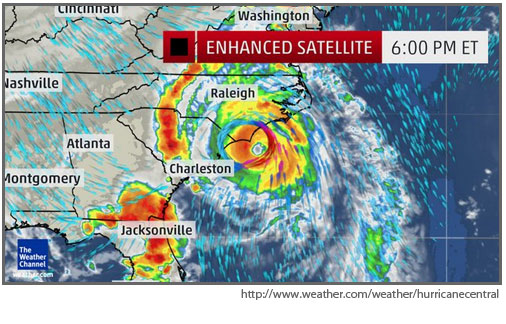
At 5 p.m., the center of Hurricane Arthur was about 185 miles southwest of Cape Hatteras, moving north/northeast at 13 mph.
The winds were still 90 mph, but an increase in wind speed is still expected.
The storm is forecast to come perilously close to Cape Hatteras overnight as a Category 2 hurricane with winds of about 100 mph.
Also at 5 p.m., the storm was south of Wilmington, N.C., and the National Hurricane Center’s cone of uncertainty — which shows the projected path of the storm — had narrowed considerably.
Earlier in the week, there was some hope that the hurricane would pass the Cape offshore, sparing Hatteras and Ocracoke from the worst of the storm. However, the Cape is now on the eastern edge of the cone, so it’s all but certain now that the storm will pass to the west of Hatteras and Ocracoke.
Some models are showing it making landfall southwest of the islands, perhaps around Bogue Banks, and moving north/northeast up the Pamlico Sound and exiting the Outer Banks at about Oregon Inlet.
The Weather Service in Newport, N.C., is forecasting sustained winds of about 83 mph with gusts over 100. The potential wind impact has been raised from moderate to high.
Forecasters say that there is the potential for heavy rains of 2-5 inches, locally 7 inches along the southern coastal areas, damaging winds, isolated tornadoes, and significant coastal flooding.
This afternoon, the Weather Service elevated its potential coastal flooding threat from moderate to high.
Water level rises of 3 to 5 feet above ground level can be expected for areas adjacent to the sounds and along oceanfront beaches — with higher amounts in some locations.
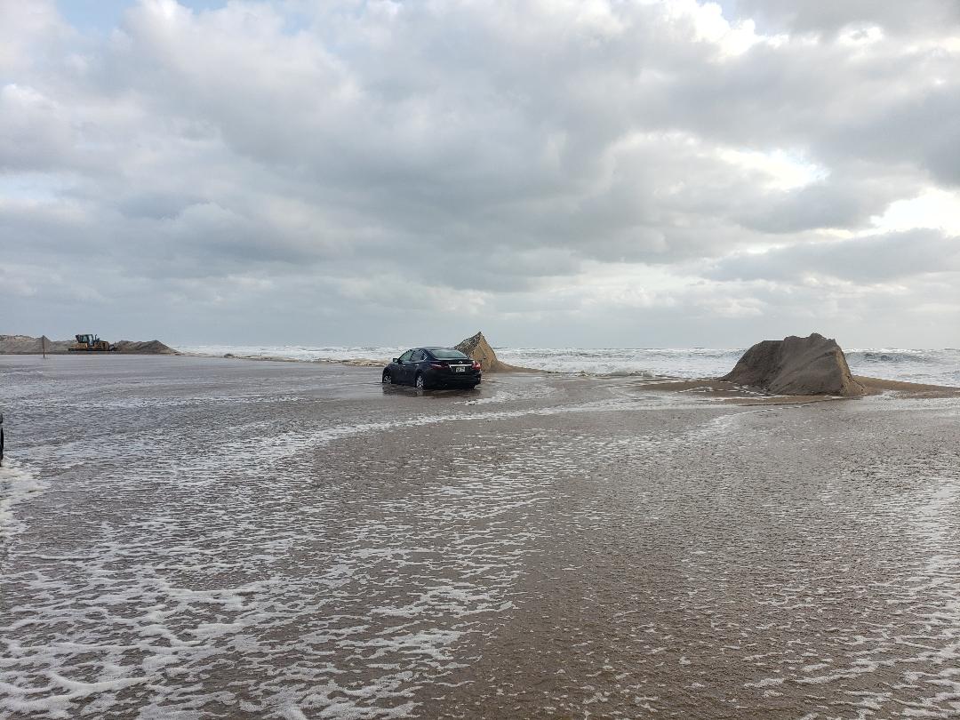
Significant ocean overwash is expected on the Outer Banks. Moderate to major beach erosion is forecast, along with very high surf and dangerous rip currents.
Soundside flooding when the winds shift to northwest will be moderate on the southern Outer Banks — from 3 to 5 feet.
Seas are expected to be 15 to 25 feet.
Dare County issued a mandatory evacuation order late yesterday for a residents of and visitors to Hatteras Island and sent out bulletins this afternoon, urging folks to leave the island because of the increasing storm intensity.
“Those who do not evacuate should be prepared to sustain themselves for at least 72 hours,” a Dare County news release said. “Be aware that emergency personnel may be unable to respond to calls for help during high winds. During and after the storm there is the risk of impassable roads due to soundside flooding and ocean overwash. And, access to essential goods and services may be disrupted. There are no Red Cross approved shelters in Dare County.”
Ocracoke had only a voluntary evacuation that began yesterday afternoon.
The storm is forecast to move northeast away from the Outer Banks quickly tomorrow morning with improving conditions and cooler and drier air.
MORE INFORMATION
The local NWS weather service office in Newport’s website is http://www.weather.gov/mhx/. The National Hurricane Center can be found at http://www.nhc.noaa.gov/.
To receive email alerts directly from Dare County Emergency Management, visit www.darecountyem.com, and follow @DareCoEM on Twitter. The Dare County Emergency Operations Center will be operating throughout the storm and may be reached at 252-475-5655 or visit www.darenc.com for updated information.
EVACUATIONS
Hatteras
The Dare County Control Group met late on Wednesday and issued a mandatory evacuation order for residents of and visitors to Hatteras Island beginning at 5 a.m. Thursday. After 5 a.m. Thursday, no access was allowed to Hatteras Island.
A State of Emergency has been issued for all of Dare County with the only restriction being the mandatory evacuation of Hatteras Island.
Ocracoke
Based on the most recent data from the National Hurricane Center, Hyde County officials declared a county-wide state of emergency as well as a voluntary evacuation for Ocracoke Island. Both were effective at 2 p.m. yesterday. There is a curfew on Ocracoke tonight from 8 p.m. until 8 a.m.
JULY 4 EVENTS
Avon
Because of the approaching tropical storm Arthur, the Avon Fireworks Committee, Avon Property Owners’ Association, Koru Village, Pyrotecnico, and Dare County have made a joint decision to reschedule the July 4 fireworks show on the Avon Fishing Pier, tentatively to Monday, July 7 at 9 p.m.
This storm is expected to pass close to Cape Hatteras on Friday, July 4 with winds and rain that would prohibit the fireworks show from taking place.
Because of the weekend turnover in rental houses with visitors coming to the island, a decision was made to postpone the fireworks show until Monday to ensure that all residents and guests have ample time to prepare a proper celebration of Independence Day, complete with fireworks display, as planned.
The Avon Fireworks Committee will reconvene on Friday, July 4 to confirm these plans after the storm has passed. Should adjustments be made to the tentative plans, there will be another news release on Friday afternoon.
The Fireworks Committee and Avon Property Owners’ Association would like to thank the National Park Service, Koru Village, Dare County, Pyrotecnico, and all of the event sponsors for their flexibility, cooperation and support.
Hatteras village
July 4 events in Hatteras village have been cancelled.
Ocracoke
Cancellations: Donald Davis storytelling, Ocracoke ponies, and classic car show.
Postponed until the July 5: Sand Sculpture Contest, Fig Cake Bake-Off, Parade (registration place may change), Pirates on Stage (one performance only at 1 p.m.), Evening celebration/Square Dance/Dance Party with the Rockers at Community Square.
Pending: Lighthouse opening for viewing, flag raising ceremony.
A revised schedule of times and venues will be posted when available.
NATIONAL PARK SERVICE
The Outer Banks Group National Parks, Cape Hatteras National Seashore, Fort Raleigh National Historic Site, and Wright Brothers National Memorial, closed down most of its facilities on the Cape Hatteras National Seashore on Wednesday.
- All NPS campgrounds — Ocracoke, Frisco, Cape Point and Oregon Inlet — closed at noon Wednesday and will remain closed until further notice. The Ocracoke campground reservation system has been temporarily suspended.
- Silver Lake Marina NPS docks closed at noon Wednesday, July 2.
- Ocracoke and Hatteras Island NPS Visitor Centers closed Wednesday and will remain closed until further notice. Bodie Island Visitor Center, Wright Brothers National Memorial and Fort Raleigh National Historic Site will be closed Thursday and Friday, July 3 and 4. Previously scheduled evening programs are cancelled as of today until further notice.
- Lifeguard beach operations at Ocracoke, Buxton, and Coquina are closed until further notice.
- The Cape Hatteras Lighthouse is closed until further notice. All park special programs scheduled have been cancelled until further notice.
- The Bodie Island Lighthouse is closed and the climbing reservation system will be temporarily suspended beginning Thursday.
- All NPS beaches closed to off-road vehicles at 9 p.m. Wednesday and will remain closed until further notice.
- The Buxton, Ocracoke, and Bodie Island permit offices are closed until further notice.
ROADS AND FERRIES
The N.C. Department of Transportation is keeping a close eye on Hurricane Arthur and making preparations to ensure it is ready to respond if needed. Crews in the coastal divisions are checking equipment to make sure it is working properly, topping off their fuel tanks and staging equipment as necessary prior to the storm’s arrival.
Along the Outer Banks, crews are staging front-end loaders, motor graders and bulldozers along Highway 12 in Ocracoke, Rodanthe and Pea Island, south of the Bonner Bridge, in Dare and Hyde counties. This is in addition to other equipment already at the maintenance yards in Manteo, Ocracoke and Buxton. NCDOT has more equipment ready to mobilize if needed, as well as employees prepared to patrol Highway 12 during and after the storm.
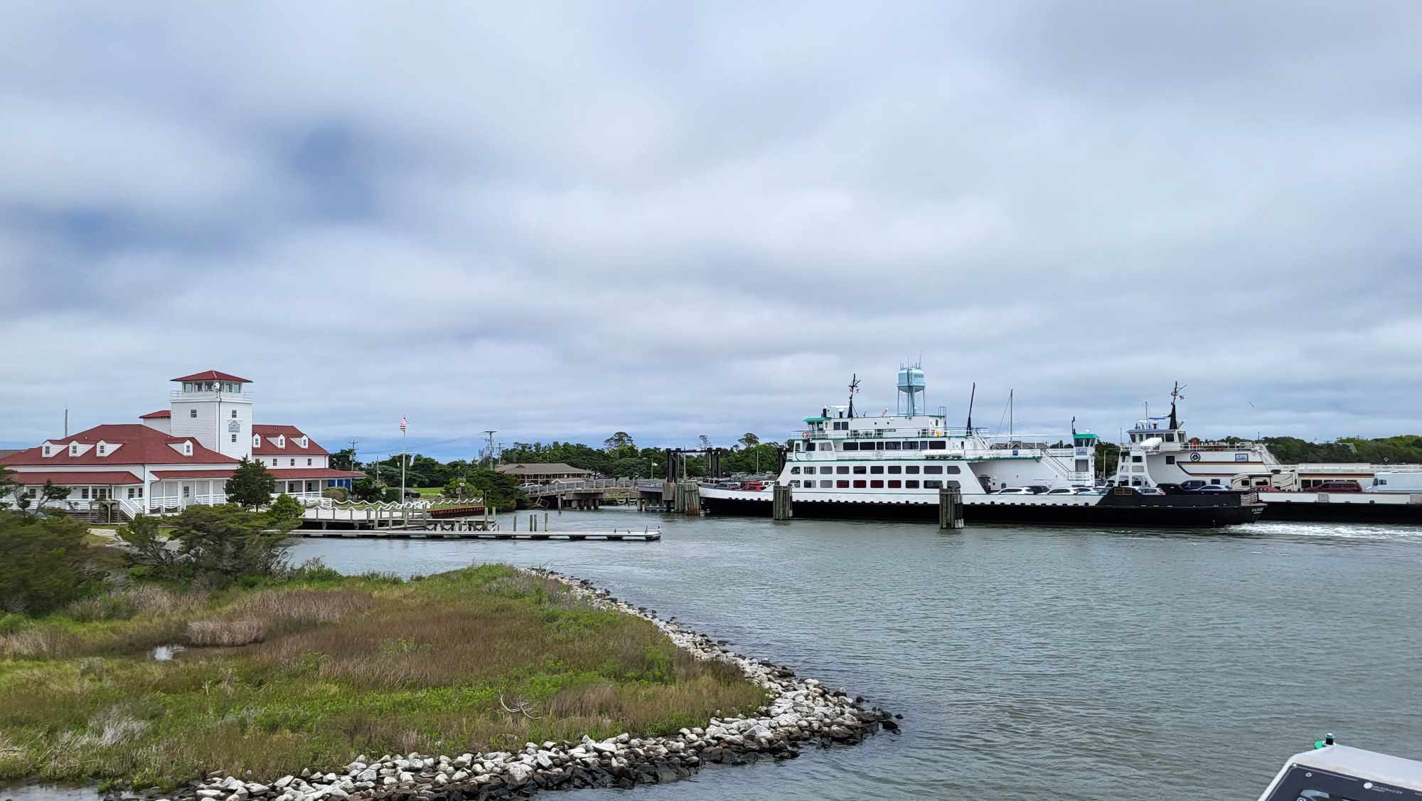
Crews inspected emergency ferry docks in Rodanthe and Stumpy Point to ensure the sites are ready if needed. The larger 180-foot ferries are already in use nearby at the Hatteras-Ocracoke route in case an emergency ferry route is needed once the storm passes.
The ferries cannot safely operate once winds reach about 30-35 miles per hour. The Ferry Division expects brief service interruptions as Hurricane Arthur proceeds up the North Carolina Coast.
NCDOT will provide real-time information about travel conditions through its Twitter feeds. As the storm approaches, the department will send out tweets about road closures, flooding, ferry cancellations and evacuation routes. Valuable travel information is also available through the department’s other social media tools – Facebook and YouTube. You can access social media feeds and other summer storm information on the NCDOT website.
The helpful resources on the website include:
- Traffic conditions/Advisories/Maps: http://tims.ncdot.gov/tims/default.aspx
- 511, the state’s toll-free traffic line: http://www.ncdot.gov/travel/511/default.html
- Safe driving tips: http://www.ncdot.gov/travel/safetytips/default.html
- Hurricane evacuation tips and maps: http://www.ncdot.gov/travel/evacuationmaps/default.html
- Ferry information: http://www.ncdot.gov/ferry/


