Remembering hurricanes Emily and Isabel
As we head into August and the period for the most intense hurricane activity in the eastern Atlantic, we pause to remember two catastrophic hurricanes that have significant anniversaries this year.
Hurricane Emily “brushed” the Outer Banks on Aug. 31, 1993 – 20 years ago. And Hurricane Isabel slammed Hatteras village on Sept. 18, 2003 – 10 years ago.
Theirs is the tale of two very different hurricanes, both of which had impacts that won’t be soon forgotten.
They were not particularly strong storms on the National Weather Service’s Saffir-Simpson Scale as they approached Hatteras, but they caused damage of historic proportions. And the damage was not caused only by wind in either case, but mostly by storm surge.
Emily caused terrific storm surge from the Pamlico Sound and Isabel brought a devastating surge from the Atlantic Ocean.
Hurricane Emily was not a really impressive storm as it moved through the Atlantic Ocean on a path that would take it very close to Hatteras Island.
According to the National Weather Service, “The tropical wave that spawned Emily moved off the West Coast of Africa on Aug. 17, 1993 and into the Cape Verde Islands. Five days later, a tropical depression formed about 700 miles east-northeast of Puerto Rico. The system moved northwest for two days before encountering weak steering currents and becoming stationary as it began to intensify.
“A ridge eventually built north of Emily on Aug. 26, causing the system to move toward the west while 900 miles east of Florida. After briefly becoming a hurricane on Aug. 26, the storm fluctuated in intensity between a hurricane and a tropical storm as it moved west-northwest. As Emily rotated around the ridge, it moved more to the north.”
Intensification continued and by the time Emily came within 13 miles of Cape Hatteras on Aug. 31, it had become a Category 3 storm.
Luckily for the Outer Banks, the hurricane veered north just offshore of Hatteras, but the southern part of the island was in Emily’s western eyewall for an hour and a half. This caused a terrific and destructive storm surge from the Pamlico Sound.
Wally DeMaurice, who was then director of the Weather Service office in Buxton, said the storm surge in Avon, Buxton, Frisco, and Hatteras was the highest in living memory. At more than 10 feet, the surge, he said, was higher than in the hurricanes of 1933 and 1944 – and probably the highest since an 1846 storm opened Oregon and Hatteras inlets.
Needless to say, the destruction to homes and businesses was devastating.
On the other hand, Isabel was a monster of a storm as it moved across the Atlantic toward its rendezvous with Hatteras village on Sept. 18, 2003.
It was only a Category 2 hurricane when it made landfall between Ocracoke Inlet and Cape Lookout. However, its history was very different from Emily.
Hurricane Isabel began as a strong tropical wave off the coast of Africa in early September. It became a tropical depression and then was christened Tropical Storm Isabel on Sept. 6. By the next day, it was a minimal hurricane, but it rapidly progressed up the Saffir-Simpson scale. A day later, on Sept. 8, Isabel was a Category 4 with winds of 135 mph. The winds kept going up and on Sept. 11, it became a Category 5 with winds measuring 160 mph. The 160-mph winds persisted for the better part of three days. After that the storm went briefly back to a Category 4, back up to a Category 5, and then back down to a 4 before becoming a Category 3 on Sept. 15.
Isabel was downgraded to a Category 2 on Sept. 16 and stayed there until it made landfall. However, the wave energy that built up as the storm churned over the ocean as a Category 4 and 5 sealed the fate of Hatteras village.
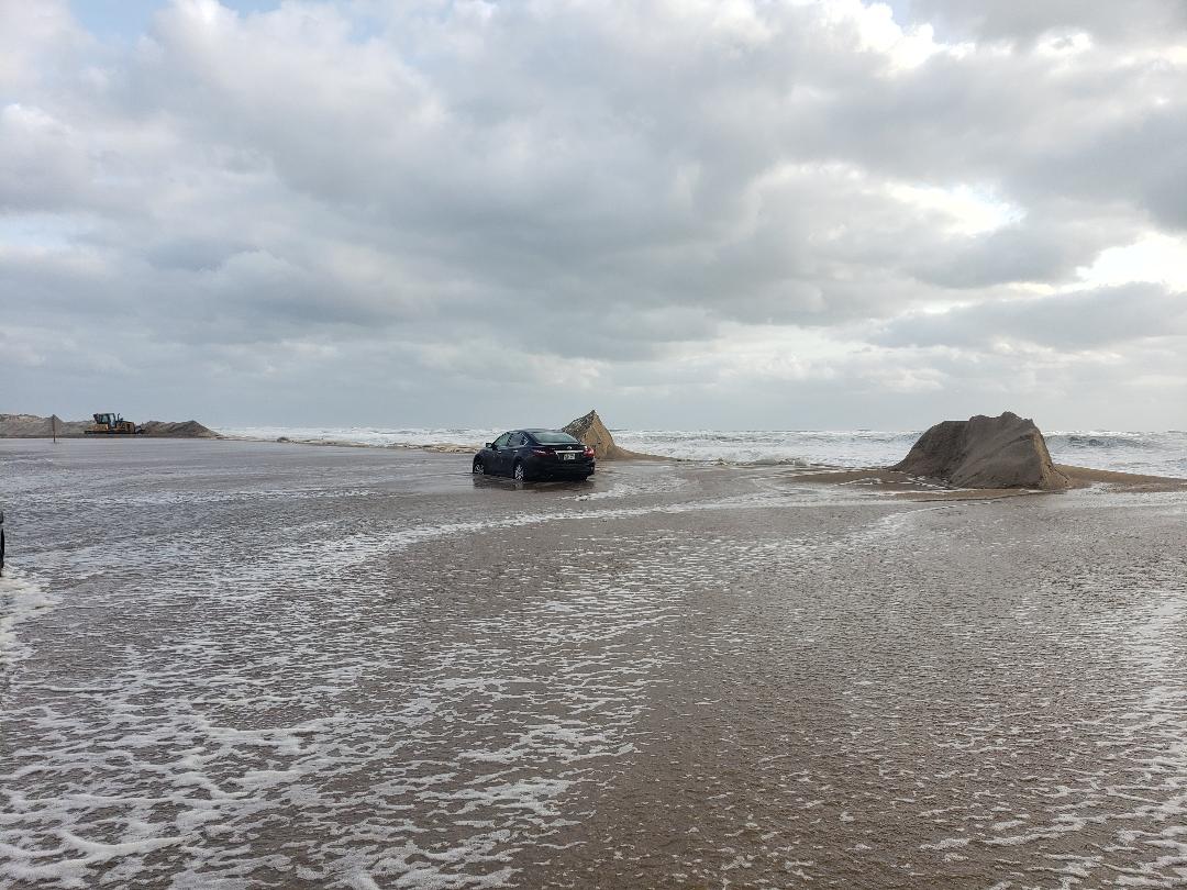
Hurricane Isabel storm surge came off the ocean – a surge of maybe 6 to 8 feet with huge waves on top of it that just about wiped out the eastern edge of the village and cut a new inlet between Frisco and Hatteras.
These are not storms that will be soon forgotten by any of us who lived through them.
And, although these anniversaries are not cause for celebration, they are certainly a good reason to pause and remember the resiliency of islanders and the triumph of the human spirit.
The articles on this “milestones” page include stories that I and others wrote after both of these storms.
It was before there was an Island Free Press when I worked for another publication that covered Hatteras and Ocracoke at the time, but these stories are still worth reading today, which is why we share them with you.
Reading them again brought back a lot of memories – some not good at all and others, bittersweet.
I especially liked what Anne Bowers wrote in a story about Hurricane Isabel, the destruction, the recovery effort, and the inlet that divided Hatteras Island.
“Disasters such as Hurricane Isabel break down more than property and buildings,” she wrote in a story that is posted on this page. “They also break down the barriers that sometimes divide people. Because of Isabel, all of us are on the same side, fighting the same fight: food, water, shelter. For now, we are divided only by water.”
ACKNOWLEDGEMENTS
I want to thank all of the writers who contributed to these stories, and the many islanders who sent photos for the Hurricane Isabel slide show. The photos were collected and posted by Hatteras Designs on the website, www.hatterasonmymind.com. Many folks sent in photos and we don’t know who all of them are, but the chief photographer for Hatteras Designs was Buddy Swain of Hatteras village. He and Jim Boyd designed the website, and although the photos have been taken down now, they provided many of them to Island Free Press.
Thanks also to the National Weather Service and the very good information provided by the meteorologists there.
We welcome more photos and more stories of survival and recovery on Hatteras and Ocracoke islands. Send them to editor@islandfreepress.org.


