It’s now official: Alternate Hatterasferry channel is permanent
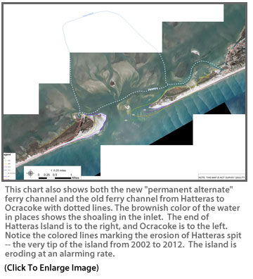
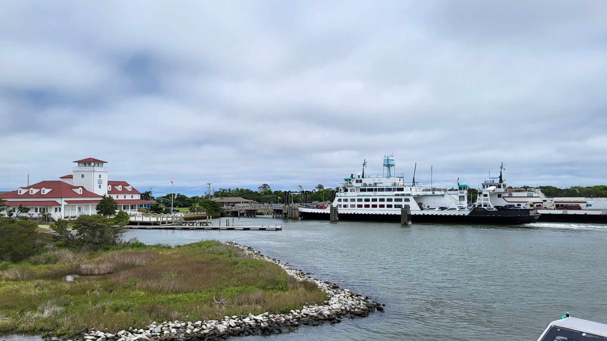
The U.S. Coast Guard hosted a “symbolic” ribbon-cutting yesterday afternoon to establish Barney Slough as the permanent alternate channel to carry ferries and other boat traffic between Hatteras and Ocracoke.
The event at the Graveyard of the Atlantic Museum was billed as a “media availability,” and about six reporters attended, along with a large contingent of Coast Guardsmen, several officials from the North Carolina Department of Transportation and the U.S. Army Corps of Engineers, three Dare County commissioners, assistants from the offices of North Carolina U.S. Sens. Richard Burr and Kay Hagan, and 30 or so members of the public from Ocracoke and Hatteras.
Most of the meeting was a discussion of the issues in maintaining deep enough water to carry fishing boats out of the inlet to the ocean and ferry boats that move residents, visitors, and vendors of goods and services between the islands.
The Coast Guard is charged with marking and maintaining aides to navigation in waterways, and the U.S. Army Corps of Engineers oversees such waterways issues as mapping and dredging.
Capt. Sean Murtagh, Coast Guard Sector North Carolina, opened the meeting with remarks about the continual shifting sands and shoaling in the state’s waterways.
The old ferry channel between Hatteras village and north Ocracoke has been a headache, especially since hurricanes Irene in 2011 and Sandy in 2012. It has been dredged off and on and continues to fill up with sand.
Murtagh noted that the channel has been remarked five times since Hurricane Arthur on July 4.
After several intense years of trying to keep the old ferry channel open, the Coast Guard established Barney Slough as a temporary route in February 2013. The ferries continued to use the old channel when they could but gave up completely last December.
The future of the old channel was the topic of most of the questions from the media and the public at the meeting.
Murtagh reiterated that the Coast Guard is committed to maintaining and marking the old channel from Hatteras village to Hatteras Inlet, a route that is vital to the island’s commercial and recreational fishing industries.
Two different figures were given for the value of the Hatteras waterway to the economy of the area — $150 million and $168 million. But both illustrate the importance of the channel for transporting fishing boats, ferry boats, visitors, and goods and services.
Ed Goodwin, Ferry Division director, said the recognition of the Barney Slough as the new permanent alternate ferry route “means a whole lot” to the division.
The new route will be marked and maintained by the Coast Guard and the buoys will be lit at night — something the captains haven’t had until now.
The new route, he said, adds to the time for a ferry trip from 35 or 40 minutes to 60 to 75 minutes in some cases, but that the division is running six larger ferries on the route instead of four smaller ones, so is able to move about the same number of vehicles each day.
However, the extra fuel is costing the Ferry Division about $1.2 to $1.5 million more a year at a time when the General Assembly is cutting the division budget.
Ocracokers are concerned that the added time and long waits are cutting into the number of visitors making the trip to the island, whose economy relies heavily on these “day trippers.”
While officials noted that the old route is not being abandoned, Goodwin talked about the difficulty of keeping ferries running in a channel with a depth of 2 1/2 or 3 feet as opposed to the 5 1/2 feet required by the ferries. The old channel is also too narrow in places to allow two boats to pass each other.
Goodwin also talked briefly about a feasibility study that is underway to look at using passenger ferries between Hatteras village and Silver Lake Harbor in Ocracoke village.
It’s not a new idea, although some previous discussions about passengers-only focused on moving them from Hatteras village to the ferry docks on the north end of Ocracoke — about 13 miles from the village. From there, shuttles would take visitors to the village.
That idea never went anywhere, and the current study has the advantage of bringing people directly into the village where they can get around on foot or rent bikes or golf carts.
Bob Keistler, navigation program manager in the Wilmington office, repeated that the Army Corps will not abandon the old channel “as long as we have money.” However, paying for the continual dredging is a problem for governments without money. He said, the Corps can expect about $750,000 in a good year for mapping channels and dredging.
Hatteras marina owners and watermen expressed their concerns at the meeting about two issues — correctly marking the old channel and keeping a deep-water route through Hatteras Inlet open.
Some of the commercial and recreational fishermen at the meeting brought photos taken over the weekend of a part of the old channel that they must use to get to the ocean. The photos showed a man standing in waist deep water in what is supposed to be the marked channel.
“We’re concerned about marking places in there that haven’t been taken care of the way we think it could be,” said Allen Burrus from Hatteras village, vice-chairman of the Dare County Board of Commissioners.
The local watermen have marked the channel in their own way — with floating Clorox bottles.
“Even your guys are following the Clorox bottles,” he said to the Coast Guard.
The local watermen, who are now managing to find their way around the shoals and continue using the old channel, are also concerned about dredging in the new channel if they need to use it in the future to get to the ocean.
The Army Corps is now authorized by Congress to maintain the old channel, but not Barney Slough. Getting that authorization would require an act of Congress.
There were no easy answers from any of the officials at the end of the meeting, but small groups of folks hung around for at least another half hour. Ocracokers had more conversations with the Ferry Division officials, and watermen were huddled with Corps and Coast Guard officials poring over maps of the channels.
When he left Rom Whitaker, who runs a charter boat out of Hatteras, was unsure what he thought.
“It all takes money, and we don’t have any,” he said.
“It’s a mess,” said Dan Oden, an owner of Oden’s Dock marina in Hatteras.
“We’ll keep an alternate route open for ferries, but how are our guys going to get out the inlet?” he asked.
FOR MORE INFORMATION
Click here to read an Aug. 22 blog about problems with shoaling at Hatteras Inlet.


