By IRENE NOLAN
By IRENE NOLAN
Forecasters predicted a busy hurricane season this year, and that’s exactly what we have now.
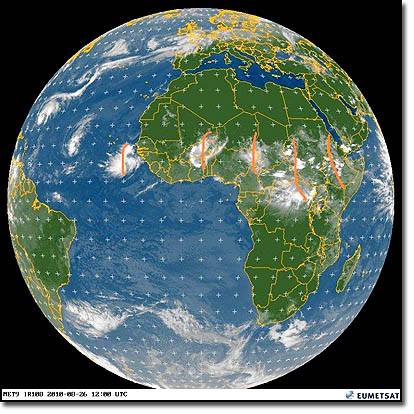
There are two named storms – Danielle and Earl – and a third just waiting for a name. And other strong tropical waves are poised to keep rolling off Africa as we approach the peak of the hurricane season about mid-September.
Though neither Danielle nor Earl is expected to directly threaten the East Coast, we will see impacts from the storms on Hatteras and Ocracoke islands.
That impact will be rough seas and a high threat of rip currents beginning tomorrow, easing the first of the week, and then picking up again later in the week.
It will not be a good week for swimmers in the ocean. However, it could be a good week for surfers.
This evening, Danielle was a strong Category 4 storm that is forecast to past east of Bermuda toward the end of the weekend. And even with a passage east of Bermuda, those 135 mph winds will send large waves toward the coast.
The National Weather Service at Newport, N.C., says that the long-period swell energy and an afternoon low tide will bring a high risk of rip currents for all beaches north of Cape Lookout, including Hatteras and Ocracoke, through Saturday evening. The most likely time for rip currents is a couple of hours either side of low tide, which will be about 4:30 p.m. on Saturday.
NWS meteorologist Hal Austin says that the high threat is expected to continue through Sunday and ease the first of next week.
However, Danielle is being closely followed by Earl, which was still a tropical storm this evening, but Austin said it is predicted to be a hurricane by Sunday.
Earl is now forecast to stay off the East Coast also. However, it is forecast to move north between North Carolina and Bermuda, bringing it closer to our beaches.
Austin said the rip current threat will pick up again as Earl approaches later next week and into the Labor Day weekend.
And finally a tropical low right behind Earl is expected to become Tropical Storm Fiona. That storm is forecast to be farther south than Danielle and Earl and perhaps move farther west before curving northwest, and it could affect the East Coast by the week after next.
You can keep up with the local forecast at http://www.erh.noaa.gov/er/mhx/ and you can check the daily rip current forecast at http://www.erh.noaa.gov/mhx/RipHazard.html.
The National Park Service has lifeguarded beaches at Coquina Beach on Bodie Island at at the Day Use Area on Ocracoke. There are no lifeguarded beaches on Hatteras this year.
Click here to see video of a satellite view of Hurricane Danielle
Click here to see video of a satellite view of Tropical Storm Earl
FOR MORE INFORMATION
Rough surf conditions routinely produce life-threatening rip currents capable of overtaking even the strongest swimmers and surfers. The National Park Service offers the following information and tips to help Outer Banks visitors avoid this potentially deadly ocean hazard.
Rip currents are channels of water that develop in an opening in a sand bar. Though relatively narrow near the beach, rip currents can increase to over 50 yards in width as they extend up to 1000 feet offshore. The velocity of the water can be as high as 5 mph.
Rip currents can be identified before entering the water. Look for an area of murky water due to sediment mixing as the channel opened in the sandbar. If the rip current has lasted a long time, the color of the water will appear darker than the surrounding water because of the channel carved by the flowing water. Rip currents will also move objects and/or foam steadily seaward and will cause a break in the incoming wave pattern.
The most common mistake of those caught in a rip current is to panic and attempt to swim directly back toward the shore. Even the best Olympic swimmers can not successfully swim towards the shore in the strongest rip currents. Rip currents can pull a swimmer away from the shore but not under the water.
Safety Tips
Stay out of the water during dangerous surf conditions.
Know how to swim. Non-swimmers should not rely on floats, such as boogie boards, while in deep water.
Always swim near a lifeguard.
Locate rip currents before entering the water.
Tune in to NOAA weather radio and monitor websites (National Weather Service, Eastern Dare County, NC) and local media for updated surf conditions during your stay on the Outer Banks.
Check with the lifeguards about rip currents and other hazardous conditions.
Do not attempt to rescue someone caught in a rip current. Notify a lifeguard or, if there is no lifeguard, yell directions on how to escape, throw the victim something that floats, and call 911.
What to do if caught in a rip current:
Remain calm. Remember, it will not pull you under.
Swim parallel to the shore until you break free, then swim diagonally toward the shore.
If you cannot swim out of the current, float until it weakens, then swim diagonally toward the shore.
Summon help by waving your hands.
For more information on rip currents, ask a lifeguard or check the website at http://www.ripcurrents.noaa.gov.
Subject
Name
(required, will not be published)
(required, will not be published)
City :
State :
Your Comments:
May be posted on the Letters to the Editor page at the discretion of the editor.
May be posted on the Letters to the Editor page at the discretion of the editor.
May be posted on the Letters to the Editor page at the discretion of the editor.
May be posted on the Letters to the Editor page at the discretion of the editor.


