SELC, Defenders take another shot at DOT plan to replace Bonner Bridge
The Southern Environmental Law Center and Defenders of Wildlife today issued a news release again attacking the North Carolina Department of Transportation for its current plan to replace the Bonner Bridge and address Highway 12 “hotspots” in a phased approach.
Defenders of Wildlife and the National Parks Conservation Association, represented by SELC, have already sued in federal court to stop the DOT plan and have also challenged a major CAMA permit issued by the state in state court.
Neither of those cases has been decided.
Here is the complete, unedited news release:
Conservation groups today call on Governor-elect Pat McCrory and state legislators to provide a less-exposed, more reliable and permanent solution for Outer Banks residents and tourists that is not dependent on the repeatedly washed-out and closed-down Pea Island section of Highway 12. The groups say that the Governor-elect and legislature need to step in because NCDOT is mired in defending previous short-sighted, short-term plans instead of pursuing a long-term solution.
“The only thing reliable about the Pea Island section of Highway 12 is that it will wash out and cut off access again in another storm or high tide,” said Julie Youngman, senior attorney, Southern Environmental Law Center. “Trying to maintain the status quo using Band-Aids that wash away with each storm makes no sense for residents or taxpayers when NCDOT could invest funds on permanent solutions to provide reliable, less vulnerable access through a longer bridge or high-speed ferries.”
While NCDOT cites cost as an obstacle to such solutions, earlier this year it revised its cost estimates for a longer bridge through the Pamlico Sound, concluding that its construction costs would range from only $569 million to $629 million. The groups point out that between funding already set aside for NCDOT’s current patchwork approach and for unnecessary transportation projects elsewhere in the region, nearly $1 billion in funding exists for investment in a longer bridge or high-speed ferry system.
NCDOT already plans to spend $476 million on its current plans. NCDOT already has $244 million programmed in the State Transportation Improvement Program (STIP) to rebuild Bonner Bridge at its current location, and it recently allotted an additional $232 million in the STIP for so-called “Phase II” bridging over two sections of Highway 12 damaged in recent hurricanes. The groups have sent NCDOT a request to account for what it already spent on previous temporary bridges, sand removal, and pavement repairs after Hurricane Irene last year and other storms in the last three years.
NCDOT could abandon or defer the Mid-Currituck Bridge project (currently slated for $28 million per year for 40 years) and divert several years of that funding to a longer bridge or ferries for Hatteras. Likewise, NCDOT could defer or abandon the unpopular expansion of U.S. 64 through Dare County and a wildlife refuge, for which $370 million has been designated in the STIP, and spend only what is necessary to refurbish or replace the existing Alligator River bridge, leaving the rest for the Bonner Bridge replacement project. Widening U.S. 64 is not justified by traffic projections, is opposed by the East Lake community, and is destructive to wetlands.
Drawing on these sources, NCDOT would have ample funds to invest in a long bridge or ferries for Hatteras access. If state decision-makers choose to reallocate less, tolls collected from Hatteras Island visitors could make up any difference, with special dispensation for residents.
“Einstein defined insanity as doing the same thing over and over again and expecting different results. Replacing this bridge just isn’t the answer when even modest storms and tides now routinely swamp Highway 12,” says Jason Rylander of Defenders of Wildlife. “This is the North Carolina coast. Big storms happen. Let’s build a bridge in the right place or create a ferry system and stop the madness.”
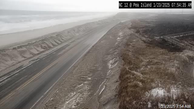
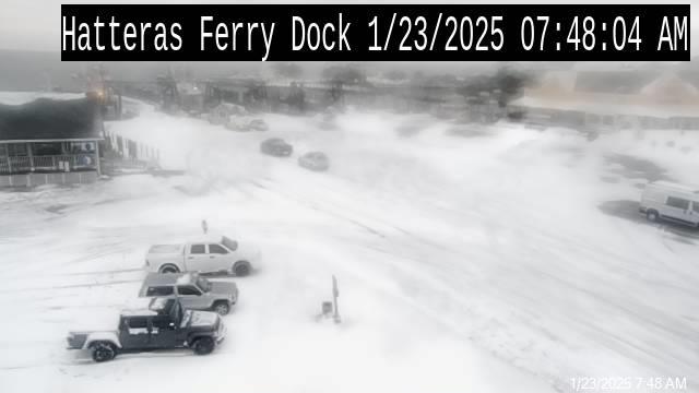
The current plans to replace Bonner Bridge contain no solution or budget to address the re-occurring access problem south of the bridge other than on an emergency basis when Highway 12 washes out and predictably cuts off access for residents and tourists again. Today’s current damage due to Hurricane Sandy is reminiscent of previous washouts in the same section of highway, including storm damage in years 2006, 2009, and 2011 and foreshadows future washouts at other high-erosion “hot spots” between Rodanthe and Bonner Bridge.
Scientific models show this exposed section of Highway 12 and two other areas of the road on the refuge are extremely vulnerable to erosion, overwash, and the creation of new inlets. The beaches south of the existing bridge are among the fastest eroding beaches in North Carolina with average rates in some areas over 12 feet a year. According to NCDOT’s own studies, its proposed “Phase II” bridges could be in the ocean within a few years as the island erodes.
In 2003, all state and federal agencies involved in the bridge replacement project agreed that building a long bridge to bypass the eroding beaches of the wildlife refuge was the preferred option for Hatteras Island. Letters from state Sen. Marc Basnight and Dare County politicians, however, forced the agencies to reconsider and pursue rebuilding the status quo. If the project had gone forward at that time, the bridge over Pamlico Sound would be completed and open to traffic today.


