Coastal Flood Advisory continues, as flooding remains a concern for the rest of the week
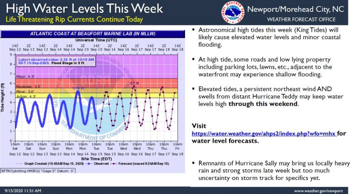
Swell from distant hurricane Paulette will gradually diminish today, but at the same time, the Outer Banks will transition to a period of higher astronomical tides (king tides) for the remainder of the week, per a Tuesday afternoon update from the National Weather Service (NWS) Newport / Morehead City office.
The transition will cause higher water levels and at high tide, Hatteras and Ocracoke islands may have some minor flooding issues. These higher water levels may continue through the weekend due to a combination of factors, which include elevated tides, a persistent northeast wind, and swells from distant Hurricane Teddy.
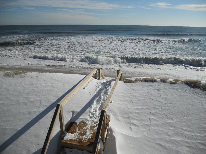
At high tide, some roads and low lying property, including parking lots, lawns, etc., which are adjacent to the waterfront may experience shallow flooding. Minor flooding was reported in oceanfront neighborhoods of Hatteras Island on Monday evening, however N.C. Highway 12 remains clear and passable throughout as of Tuesday afternoon.
In addition, a high risk of life-threatening rip currents remains in effect, and is expected to continue over the next several days.
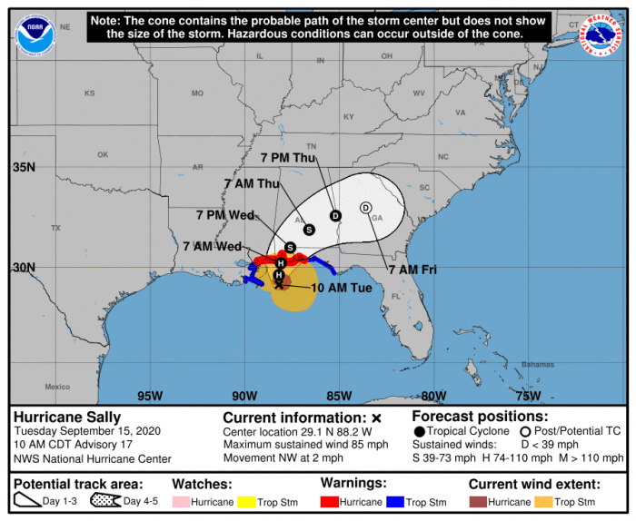
The Outer Banks may also see some impacts from the remnants of Hurricane Sally this week, including localized heavy rain and the possibility of stronger storms later in the week. This is all dependent on the track and timing, and both factors are currently too uncertain right now to give specifics for the Outer Banks area.
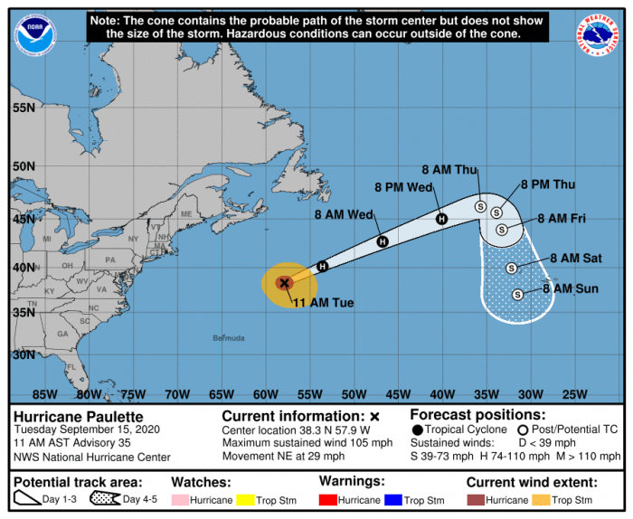
As of 11 a.m. on Tuesday, the center of Hurricane Paulette was located near latitude 38.3 North, longitude 57.9 West. Paulette is moving toward the northeast near 29 mph (46 km/h). A faster motion toward the east-northeast is expected through Thursday. Paulette is forecast to slow down and turn toward the east-southeast and south-southeast late Thursday and Friday.
Maximum sustained winds are near 105 mph (165 km/h) with higher gusts. Some strengthening is possible through tonight, but rapid weakening is forecast to begin on Wednesday as the cyclone undergoes extratropical transition. Paulette should complete its transition to an extratropical cyclone on Thursday.
For more information on the local forecast, visit www.weather.gov/mhx for weather information, or the National Weather Service office in Newport / Morehead City’s Facebook page at https://www.facebook.com/NWSMoreheadCity/.


