“Focus on the Impacts” is a key message from Hurricane Preparedness Forum
“Focus on the impacts, impacts, impacts. Water is what kills. Do not focus on just the category of the storm.”
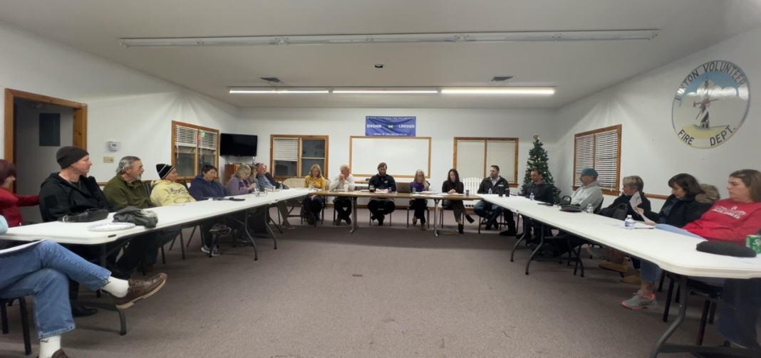
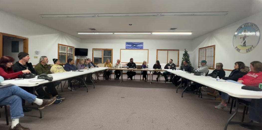
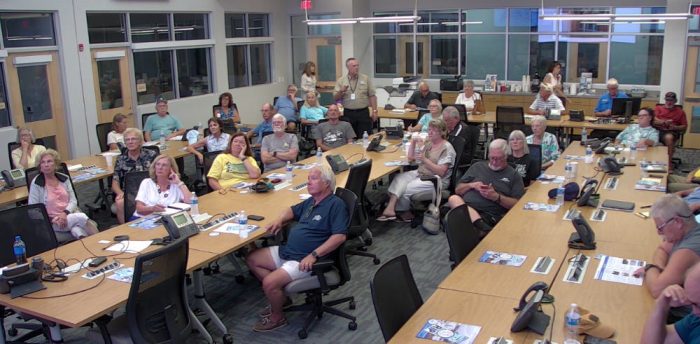
This was one of the main messages shared by Erik Heden, the National Weather Service’s (NWS) local Warning Coordination Meteorologist, at a well-attended Hurricane Preparedness Forum held in Manteo on Wednesday, August 23.
The forum, which featured both Heden and Lead Meteorologist Carl Barnes from the NWS Newport/Morehead City office, and Dare County Emergency Management Director Drew Pearson, featured a wealth of information on hurricane preparation, possible risks, and the best resources for accurate forecasts.
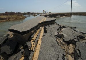
But it was the importance of paying attention to all possible impacts of a hurricane – not just the category which measures wind speed as outlined by the Saffir-Simpson Hurricane Wind Scale – that was a prevalent theme throughout the presentation.
“Raise your hand if you’ve heard the phrase ‘I’m not going to leave unless it’s a [category] three, or a two, or a four, or any number,” said Heden, which resulted in a round of raised hands and nods from the crowd of roughly 30 in-person attendees. “One of our biggest messaging challenges we have is too much focus on the category and the actual intensity of the storm. And I’m not saying not to pay attention if it’s a category three… Just know it’s only part of the puzzle.”
There were multiple, recent examples to back up this message, too.
Hurricane Dorian, which made landfall on Ocracoke Island on September 6, 2019, as a Category 1 storm, brought seven feet of storm surge throughout the village.
Hurricane Isabel, which cut a new inlet in northern Hatteras Village in 2003, approached the Outer Banks as a Category 1 before strengthening to a Category 2 in the hours before landfall. And Hurricane Irene – which shut down the island for weeks due to multiple new inlets north of Rodanthe – was just a category 1 when it hit the Outer Banks.
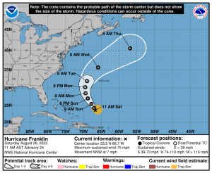
“The [hurricane cone] is probably the most used graphic by the news, by us, by the Weather Channel, by everyone,” said NWS Meteorologist Carl Barnes, referring to the commonly recognized hurricane graphic on the NHC website. “How much rain is on this graphic? Does it tell you about rain? How about storm surge?
“The key to this graphic is that this [shows] the center point of the storm,” said Barnes. “The only thing that you should be getting out of this [graphic] is the general direction of motion of the storm, and the general expected intensity… That’s it.
“There is a lot of misinformation that can be derived from this…. For example, the biggest one is that the cone represents the areas that are going to receive the impacts. Not the case,” said Barnes. “Be very careful in how you use this graphic, and understand all of the impacts.”
The roughly hour-long presentation, which will be available on the local NWS YouTube channel as well as Dare County’s Current TV, was stuffed with information for visitors, new residents, and even longtime locals.
Highlights of the information shared at Wednesday’s Forum include the following.
Hurricane Preparation
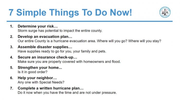
Pearson outlined how important it was to have a full and comprehensive hurricane preparation plan, from checking a home and ensuring everything is in proper order, (especially for outdoor items), to having an evacuation plan that deviates from just staying at a makeshift shelter.
“The shelter is the place where you’ll be saved, but it’s not a place where you’ll be comfortable,” said Pearson. “So, if you have visitors that come all summer long, then go visit your visitors. If they’re coming to see you, then go see them when you need to.”
For residents who stayed, both Pearson and the NWS representatives also outlined how important it was to have ample supplies. “A three-day supply is the national standard, and we don’t like that number,” said Barnes. “Seven days is better, and if you live on Hatteras Island or somewhere that’s even more vulnerable, you’re probably going to want more.”
“If you live in an area that could get cut off, you need to make sure that you have plenty of supplies, because help might be a little bit delayed.”
The essentials of an emergency kit were also outlined, which included the basics like non-perishable food and water, as well as a radio, batteries, chargers, and cash, as credit cards may not be functional once the internet is down for days. Outer Banks residents were also advised to keep their gas tanks full.
“For anyone who remembers recent storms over the last couple of years, gas really becomes a commodity after the storm,” said Barnes. “You have to be thinking about these things now while you have time to really sit down and think about it.”
Pearson and the NWS representatives also touched on how important it was to consider pets and medication supplies, as well as making sure that neighbors without a solid support system were safe.
“I encourage you to check on your neighbors,” said Pearson. “We are in an amazing community where we help each other, but we do have a program in place to help [people evacuate], and it’s run by our social services department.”
Risks to watch out for when it comes to hurricanes
While the category of a storm and its corresponding wind speeds were touched upon, Heden and Barnes both emphasized that storm surge was the biggest factor when it came to damage and deaths, with 80-90% of storm-related deaths attributed to flooding alone.
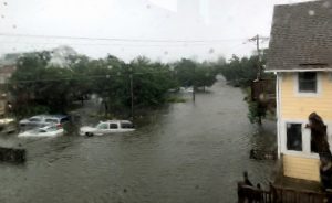
Roughly half of these deaths were related to vehicular incidents, which reinforced the NWS representatives’ message of “Turn around, don’t drown.”
“Water is extremely powerful, and it scours out the road,” said Heden. “If there is flooding, and all you see is water, you don’t know if the road is even there… and more than 50% of deaths in flooding are vehicle-related.”
Rip currents were another big impact that tends to be overlooked when it comes to storms, per Heden and Barnes, and one of the prime examples was 2019’s Hurricane Lorenzo, which occurred just a couple of weeks after Dorian made landfall on Ocracoke.
“Does anybody remember Lorenzo in 2019?” asked Heden. “[Lorenzo] was 2,000 miles out to sea as a category five storm during a beautiful stretch of weather. But we lost four people in the Carolinas because of Lorenzo, and we didn’t lose anybody because of Dorian.”
Rainfall and tornadoes were the last two impacts that Outer Banks residents and visitors were advised to be on the lookout for, as rainfall can add to flooding risks, and tornadoes can occur with the outer bands of a storm.
“Any tropical system can produce tornadoes,” said Heden. “So, if you make the decision to leave, then leave. If you make the decision to stay, then stay and hunker down. You shouldn’t be traveling around when these first outer rain bands come through, because we can get tornadoes as soon as [the edge of a storm] reaches the coast, not just when the center of the storm arrives.”
Where to get information
Another prevalent theme throughout Wednesday’s presentation was where to get the best information when it comes to storms, and the answer centered on both the National Hurricane Center (NHC) and Dare County.
One in-person attendee asked about which hurricane models were best, as there are multiple models to consult around the world when it comes to hurricane direction and intensity, and Barnes attested that for the United States, the National Hurricane Center was the best resource.
“Those people do it for a living. They spend all year, even outside of hurricane season, studying models and studying the storms. They live, eat, breathe, sleep hurricanes all the time. Forecasts coming from the National Hurricane Center will always be the best forecasts,” said Barnes. “Again, getting information from reputable sources, especially on social media, is essential. You might see people posting that ‘This is the new European model… [and the] European model did great during the last storm.’ But that doesn’t mean it’s going to get the next storm.
“Be very hesitant about any information that you see going around from just one model. The National Hurricane Center forecast is the best forecast. It always will be. It’s not always going to be perfect, but it will always be the best forecast.”
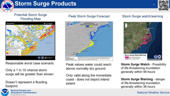
Heden and Barnes also stressed the importance of following forecasts regularly, and paying attention to the small deviations that can make a huge difference.
“They talk about sports being a game of inches. Meteorology is a game of miles,” said Heden, referencing Hurricane Florence which devastated the Down East area in 2018, but which left Hatteras and Ocracoke Islands unscathed. “If Florence had shifted 60 miles to the north, with a bullseye over Hatteras Village, do you think there’d be an issue in Buxton if we had 20 to 30 inches of rain? Yes. You got extremely lucky that you did not have [the direct impacts of] Florence.”
 As for where to get information, Barnes and Heden shared a QR code with forum attendees, (pictured right), which will direct folks to the NWS website where loads of information is available, outside of the NHC’s popular cone of uncertainty.
“There’s a ton of information on our website,” said Heden. “It can be information overload, so I tell people to zoom into your town, bookmark it, and then mess around with it. Look at the data.
“The big advantage of this is anything you see on the National Hurricane Center website, which is also a good website, will be [represented], and it will cover the forecast, the outlook, storm surge – it’s all on our website as well.”
Heden, Barnes, and Pearson also touched on the point that the Outer Banks was about to get into the most active period of the hurricane season, and now was the time to both prepare and bookmark online resources that will come in handy in the future.
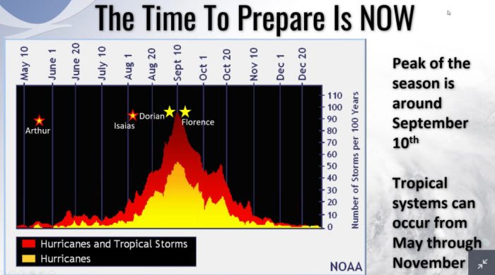
“We call this our campfire map, and I’m sure you can figure out why,” said Heden, referring to the graphic shared at the presentation. “We’re getting into a time of year where we typically see, across the Atlantic, more storms. Our water temperatures are very, very warm right now… So, it is worth noting that right now is getting into the peak of hurricane season, especially over the next six weeks.
“We don’t have anything directly expected to impact us in the immediate future. So now is the perfect time to make sure that you’re making all these preparations that we’re talking about.”
The overall message of the presentation was that risks were prevalent and multi-faceted, but a little planning and attention to the right resources for information would go a long way.
“We are extremely vulnerable to storms,” said Heden. “We are actually the most vulnerable stretch of coastline in the entire United States.”
“We’re blessed to live in an area that is fantastic, but with that comes responsibility,” said Heden. “You have zero control over what Franklin’s going to do over the next seven days, but you do have control over working on your hurricane kit… You do have control over paying attention, and not focusing on the category, and focusing on all the impacts instead.”
Links and resources for hurricane information
In addition to the QR code above, the following resources can be helpful during the height of hurricane season:
- Sign up for text alerts from Dare County, ocean rescue agencies, and the National Weather Service by texting “OBXBeachConditions” to 77295.
- For more information on the local forecast, visit weather.gov/mhx for general weather information, or the National Weather Service office in Newport / Morehead City’s Facebook page at https://www.facebook.com/NWSMoreheadCity/.
- For continued up-to-date information on tropical conditions, follow the NWS at gov/mhx/tropical.
- To sign up for the Special Needs Registry for hurricane assistance through Dare County, visit https://www.darenc.gov/departments/health-human-services/special-medical-needs-registry or call 252-475-5599.
- For Dare County hurricane information, including reentry procedures, visit https://www.darenc.gov/departments/emergency-management/hurricanes.
- For up-to-the-minute local information on hurricanes, as they happen, listen to Radio Hatteras at 101.5 (Avon through Hatteras) and 99.9 (Tri-villages), or visit them online at https://www.radiohatteras.org/.
- For up-to-the-minute online news coverage on active hurricanes, continue to check the Island Free Press.


