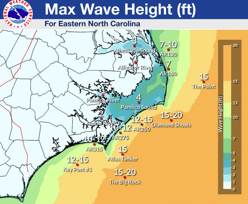
There is high confidence in a dangerous rip current/surf conditions and beach erosion event that will begin on Monday and continue through the coming week as Hurricane Franklin passes offshore.
Localized ocean overwash along the Outer Banks is possible during this time, and heavy rain is forecast over the next few days, well before any impacts from Idalia arrive later in the week.

A high risk of rip currents is in effect on Monday for Hatteras and Ocracoke Islands.

Idalia became a named storm on Sunday, and impacts to eastern N.C. from Tropical Storm Idalia could occur mid-to-late week, but the extent of any impacts is uncertain at this point and largely track and intensity dependent.
Tropical Storm Idalia is forecast to become a hurricane by Tuesday with a track into the northeast Gulf before a turn towards the East Coast. On the current track, impacts may be felt in the Outer Banks area as early as Wednesday night.
The public should check surf and swimming conditions before heading to the beach, and the daily beach forecast at www.weather.gov/beach/mhx includes rip current risk levels, and information about other hazards along the shoreline. Visitors can also sign up for text alerts from Dare County, ocean rescue agencies, and the National Weather Service by texting “OBXBeachConditions” to 77295.
Remember that the forecast will continue to be refined, and the public can check for updates on the NWS Newport/Morehead office’s website at weather.gov/mhx/tropical.


