High risk of rip currents will likely continue on Tuesday as Tropical Storm Danny forms off of South Carolina.
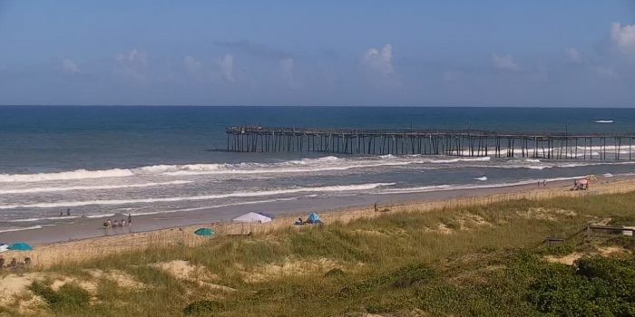
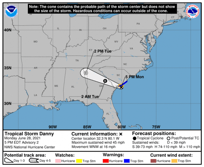
Tropical Storm Danny formed off of the coast of South Carolina on Monday afternoon, and although impacts to the Outer Banks will be minimal as Danny quickly moves inland, a moderate-to-high threat of rip currents is expected to continue on Tuesday, per an update from the National Weather Service.
“We’re expecting that the biggest threat [of rip currents] will be in the morning, but conditions are likely going to improve throughout the day,” said Meteorologist Casey Dail of the National Weather Service Newport / Morehead City office.
As of Monday evening, a high threat of rip currents is expected on Tuesday for all beaches on Hatteras and Ocracoke Island, while a moderate threat of rip currents is forecasted for N.C. beaches north of Oregon Inlet. A “high risk” means that life-threatening rip currents are likely, and that the surf zone is dangerous for all levels of swimmers.
At 5:00 p.m. on Monday, Tropical Storm Danny was located approximately 35 miles south-southwest of Charleston, S.C. Danny is moving toward the west-northwest near 16 mph (26 km/h) and this general motion is expected to continue into Tuesday. On the forecast track, Danny will make landfall along the southern coast of South Carolina early this evening, and move west into Georgia late tonight and early Tuesday morning.
The public is advised to check surf and swimming conditions before heading to the beach, and to stay out of the water when a high risk of rip currents is present. The beach forecast at www.weather.gov/beach/mhx includes daily rip current risk levels and information about other hazards along the beach, and visitors are also encouraged to sign up for text alerts from Outer Banks lifeguards, ocean rescue agencies, and the National Weather Service by texting “OBXBeachConditions” to 77295.
For more information on the local forecast, visit www.weather.gov/mhx for general weather information, or the National Weather Service office in Newport / Morehead City’s Facebook page at https://www.facebook.com/NWSMoreheadCity/.
