High threat of rip currents expected on Friday; Distant Franklin may cause elevated rip current risks into early next week
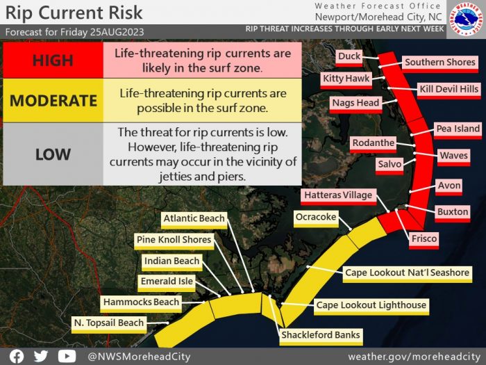
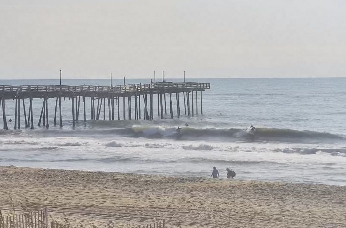
A high risk of rip currents continues on Friday, August 25, for all Hatteras Island beaches, per a recent update from the National Weather Service (NWS). A moderate risk of rip currents is also in effect for Ocracoke Island.
A high risk of rip currents means that the surf zone is dangerous for all levels of swimmers, and beachgoers should stay out of the water. The elevated rip current risk is due to residual swell from northerly winds that occurred along the Outer Banks earlier this week.
The public should check surf and swimming conditions before heading to the beach, and the daily beach forecast at www.weather.gov/beach/mhx includes rip current risk levels, and information about other hazards along the shoreline. Visitors can also sign up for text alerts from Dare County, ocean rescue agencies, and the National Weather Service by texting “OBXBeachConditions” to 77295.
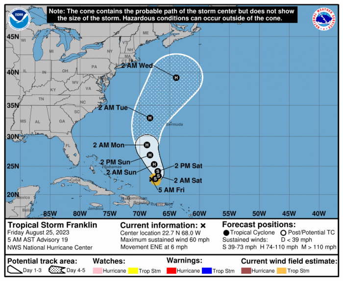
Current Tropical Storm Franklin is also forecast to strengthen to a hurricane by Sunday, and then pass between the Outer Banks and Bermuda around the middle of next week, per an update from Wobx.com.
Increased surf from the distant storm will keep the rip current risk elevated, and coupled with the full moon King Tide that will last through September 4, the storm could cause some minor overwash and erosion along the most vulnerable stretches of shoreline.
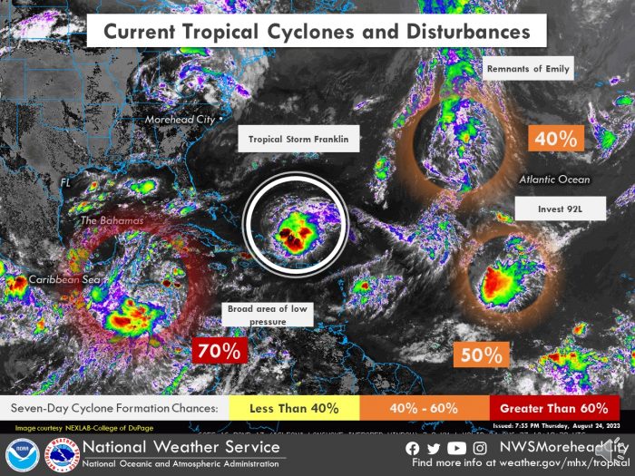
There is also the potential for additional tropical cyclone development in the eastern Gulf of Mexico, which may near the Southeast U.S. coast around mid-week next week. For continued up-to-date information, follow the NWS at weather.gov/mhx/tropical.
For more information on the local forecast, visit www.weather.gov/mhx for general weather information, or the National Weather Service office in Newport / Morehead City’s Facebook page at https://www.facebook.com/NWSMoreheadCity/.
