Remnants of Laura could bring damaging winds, 1-2 ft. water level rise north of Cape Hatteras
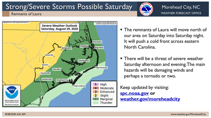
The remnants of Tropical Depression Laura are expected to move eastward and pass near or north of Eastern N.C. on Saturday evening, which will link up with a cold front and bring a severe weather threat starting on Saturday afternoon, per a Friday update from the National Weather Service Newport / Morehead City office.
Damaging winds and an isolated tornado or two will be possible, and gusty southwest winds will produce minor water level rises of 1 to 2 feet above ground level on Saturday evening, and north of Cape Hatteras.
As of Friday afternoon at 2 p.m., Tropical Depression Laura was located about 85 miles northwest of Memphis, Tennessee, with maximum sustained winds of 30 mph. Laura was moving ENE at 20 mph, and this trajectory is expected to continue over the next 24 hours. Laura will move away from the Eastern Seaboard and out to sea sometime on Saturday night.For more information on the local forecast, visit www.weather.gov/mhx for weather information, or the National Weather Service office in Newport / Morehead City’s Facebook page at https://www.facebook.com/NWSMoreheadCity/