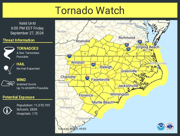
Tornado Watch until 6 p.m. for all of eastern N.C.
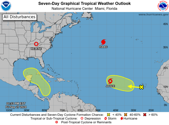
The remnants of what was Major Hurricane Helene are forecast to move across eastern North Carolina on Friday, prompting a Tornado Watch until 6 p.m. for the entire region.
There is also the potential for minor coastal flooding on the beaches of Hatteras and Ocracoke, as well as along the shorelines and waterways along and above the Albemarle Sound.
Helene made landfall last night along the Florida Big Bend as a category four storm, and was downgraded to a tropical storm as it moved through Georgia this morning.
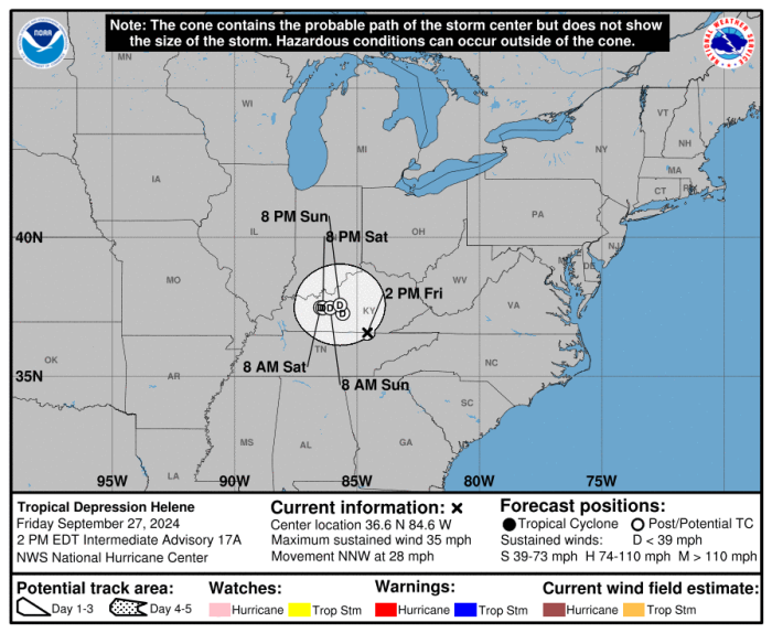
Rain and wind continues to spread into North Carolina today, with the worst conditions occurring in the mountains and central parts of the state where a frontal boundary has combined with Helene to create life threatening flash flooding.
There have been reports of flooding not seen in more than a century in the Asheville area, along with landslides in Haywood County.
One person has died already in the storm, after a tree fell on a woman’s home in the Charlotte area.
The National Weather Service says showers and thunderstorms, some that could produce a brief tornado with little to no warning, are expected to move into the northeastern corner of the state later this afternoon and into the evening.
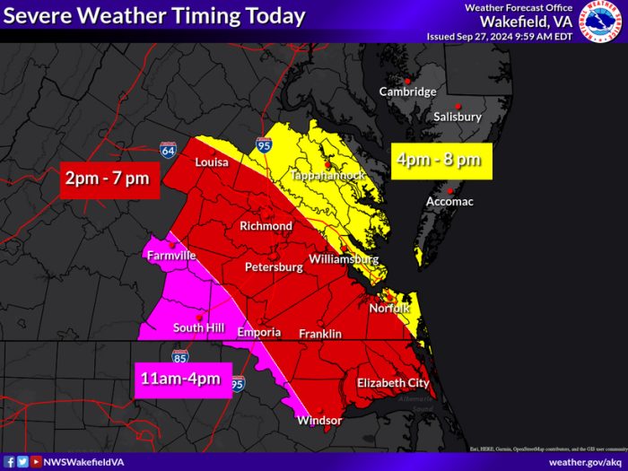
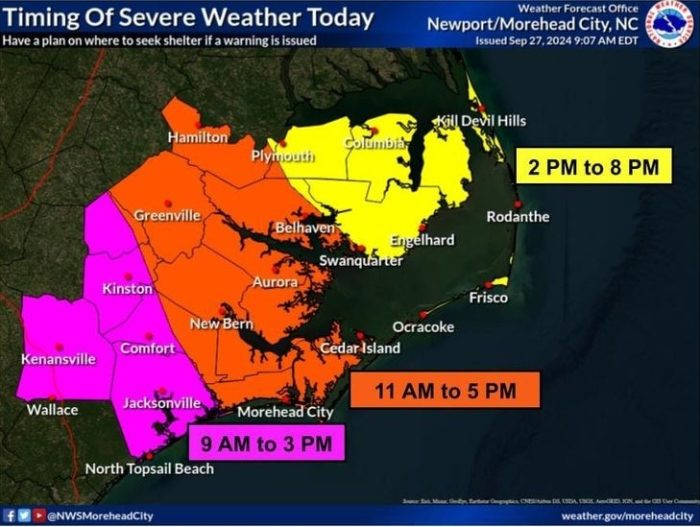
We could see some gusty southeasterly winds, as well, and a Coastal Flood Advisory continues today for water level rises of one feet above ground on Hatteras and Ocracoke islands.
Minor overwash is possible at the usual troublespots in Rodanthe, Buxton and the north end of Ocracoke between 2 and 6 p.m. with this afternoon’s high tide.
Southeasterly winds of 20 to 30 mph, with locally higher gusts, are likely, especially over the coastal waters.
That will lead to surf of 4 to 8 feet, and a High Surf Advisory will is in effect for areas south of Oregon Inlet through 4 a.m. Saturday.
A High Risk of rip currents, with powerful shore break, is posted again Friday for all of the beaches. Red flags are flying indicating it is too dangerous to be in the ocean.
Winds from the southeast have already started pushing up water levels in the Currituck and Albemarle sounds and their tributaries.
That is combining with run off from last week’s heavy rains to cause minor flooding in many areas that usually see water from a southerly breeze.
Elevated water levels also continue along the soundside of the Outer Banks, but the winds are expected to push the water towards the shorelines along the mainland.
Those sound waters should not be returning with any speed, or rising to flood levels, as winds are forecast to slowly ease as Helene becomes a giant rainmaker while losing its tropical characteristics over the Appalachians and Ohio and Mississippi valleys.
Saturday’s forecast looks to be dry and seasonably warm, with highs in the mid 80s.
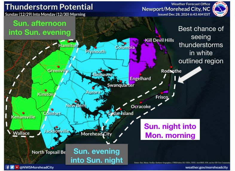
A chance of showers and storms returns late Sunday and into Monday as Helene’s remnants move across the area, with highs around 80.
National Weather Service seven-day forecasts for:
Latest radar images from NWS Newport:
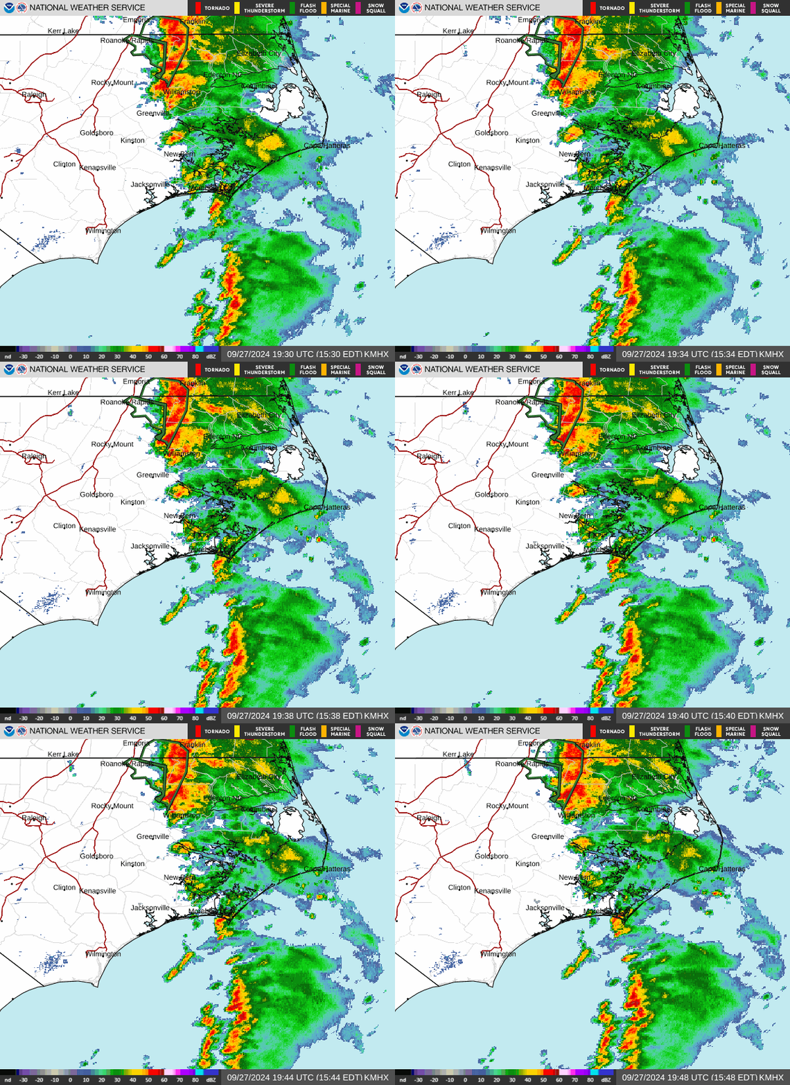
For LIVE data from flood gauges at key locations throughout North Carolina, including automated email and text alerts, visit https://fiman.nc.gov/
Sign up for emergency alerts from Dare County and its municipalities. Beach safety and rip current information can be found at LoveTheBeachRespectTheOcean.com.
Currituck County provides beach safety and emergency updates for Corolla and the mainland via Currituck Alert.
The NCDOT Ferry Division provides real-time text or email alerts from their routes via the Ferry Information Notification System (FINS) at www.ncdot.gov/fins. System-wide route status updates will also be posted on the Ferry Division’s Twitter and Facebook pages.
Click to watch LIVE video from downtown Manteo, Queen Elizabeth Street
Click to watch LIVE video from Corolla, courtesy Currituck County/WebCOOS
Click to watch LIVE video from SurfChex cameras along the Outer Banks


