Waterspouts spotted off Rodanthe, Ocracoke on Wednesday afternoon
Video from Chicamacomico Banks Fire & Rescue
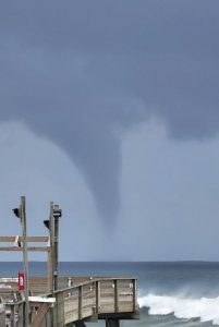
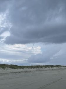
Offshore waterspouts were reported near Rodanthe and Ocracoke Island on Wednesday afternoon per multiple reports, including an update from the National Weather Service (NWS) Newport/Morehead City office.
“We have received several reports of waterspouts associated with thunderstorms impacting the area today,” stated the NWS Newport/Morehead City office in an online update. “For those near the water, please be mindful of nearby thunderstorms and be ready to take shelter should a thunderstorm threaten.”
All reports occurred around 1:00 p.m. on Wednesday, and the waterspouts had dissipated by roughly 3:00 p.m.
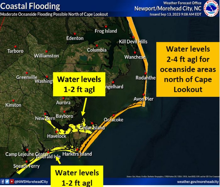
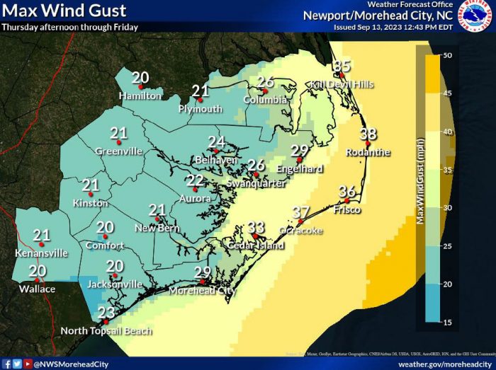
Distant Hurricane Lee is expected to continue to impact the Outer Banks, however, and Hatteras and Ocracoke Islands are now under a Coastal Flood Warning beginning on Thursday, September 14, at 4:00 p.m.
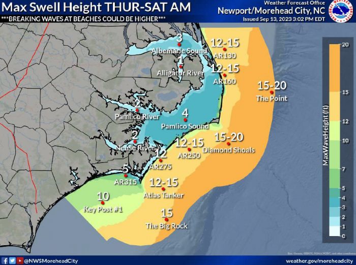
This is in addition to a High Surf Advisory for large breaking waves of 10-15 feet in the surf zone, and a Beach Hazards Statement for dangerous rip currents.
2 to 4 feet of flooding above ground level is possible in low-lying areas near shorelines and tidal waterways, especially around high tide. The Coastal Flood Warning is in effect through Saturday morning.
Oceanside flooding could lead to travel impacts along vulnerable sections of N.C. Highway 12, particularly during high tide. Oceanfront locations where there is no protective dune – like the northern end of Rodanthe and parts of Buxton and northern Hatteras village – could become inundated with ocean water.
Residents and visitors in vulnerable areas should take action to protect property and relocate before structures become impacted by ocean water. At this time, soundside impacts are not anticipated.
Ocean conditions will continue to worsen on Wednesday and into the weekend, keeping the ocean unsafe for swimming into the weekend. A high risk of rip currents is expected to remain in place for the rest of the week.
The public should check surf and swimming conditions before heading to the beach, and the daily beach forecast at www.weather.gov/beach/mhx includes rip current risk levels, and information about other hazards along the shoreline. In addition, the public can visit Dare County’s Love The Beach, Respect The Ocean website for current rip current risks and additional info.
Visitors are also encouraged to sign up for text alerts from Dare County, ocean rescue agencies, and the National Weather Service by texting “OBXBeachConditions” to 77295.
Visit the National Weather Service’s local website at weather.gov/mhx/tropical for continued updates on Hurricane Lee.
