Pea Island: An Inlet on the Move
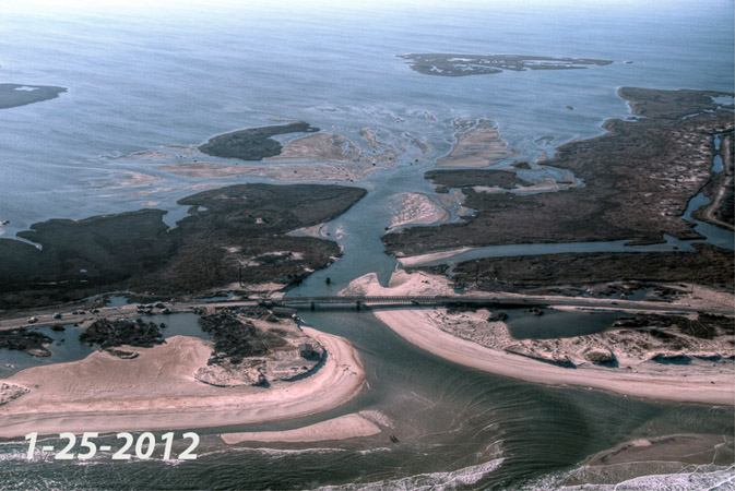
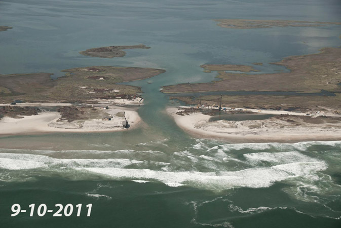
The inlet created at mid-Pea Island by Hurricane Irene has been on the move since the storm hit Hatteras Island on Aug. 27, almost six months ago.
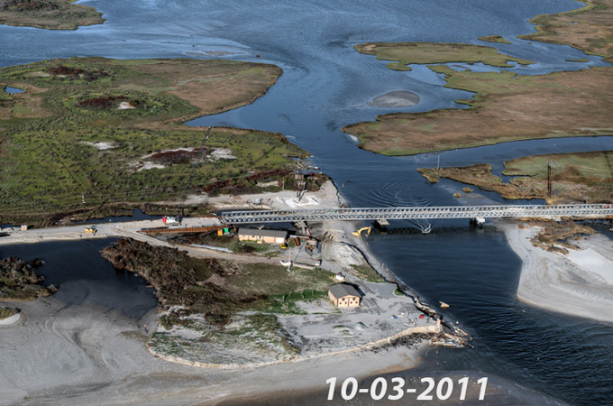
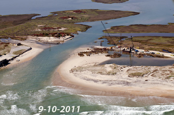
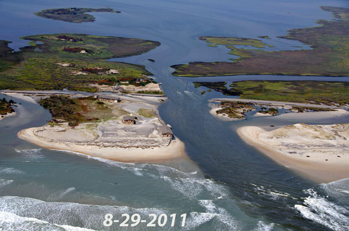
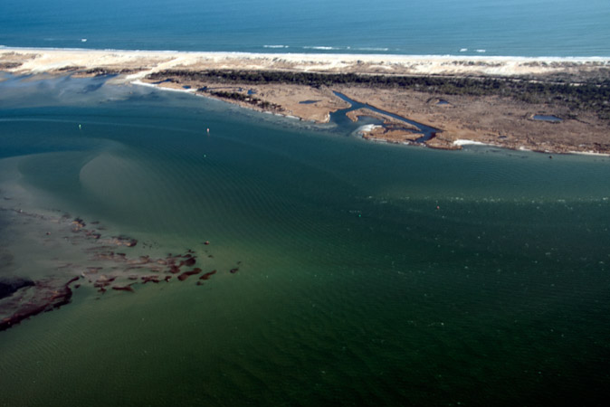
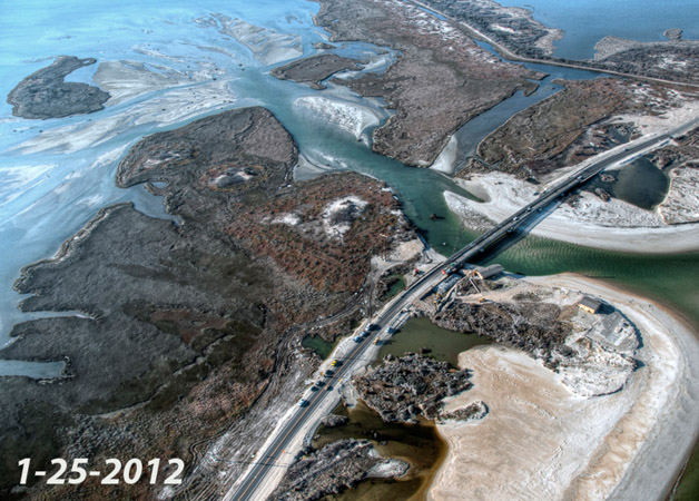
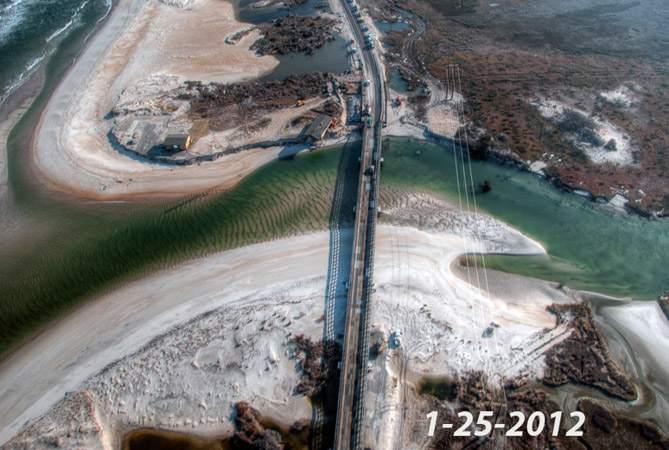
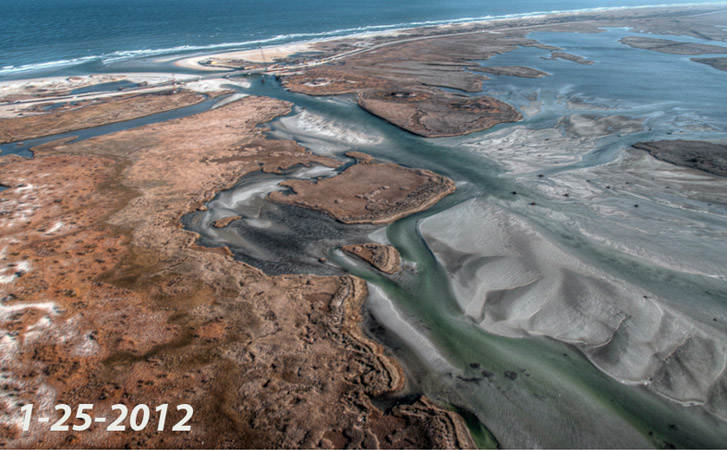
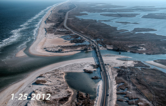
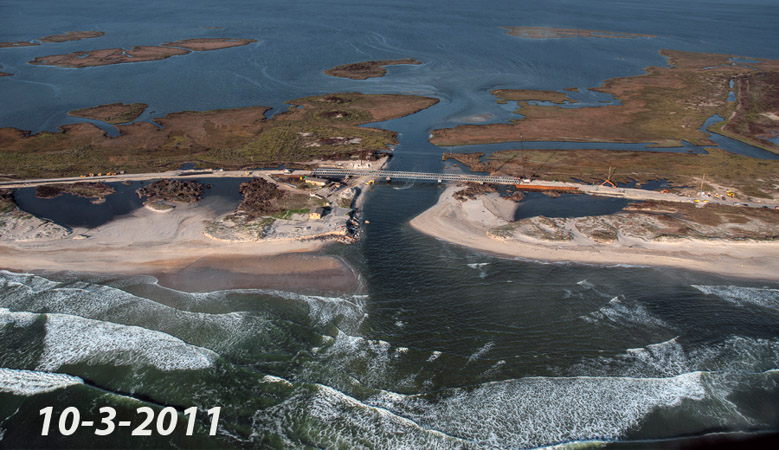
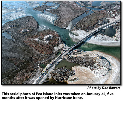
The changes at the inlet have been documented by Island Free Press photographer Don Bowers in a series of aerial photos that he has taken since two days after the hurricane.
Pea Island Inlet is moving south at a rate that has concerned both the North Carolina Department of Transportation and the Cape Hatteras Electric Cooperative.
At several times since the storm, the inlet has come perilously close to the CHEC power poles that carry the transmission lines that bring power to Hatteras and Ocracoke. The power poles have been sandbagged, then moved and sunk in cement deeper in the sand. Currently, they are not threatened.
Also, late last month, DOT crews began reinforcing the inlet’s south shore with rock and metal sheet piling to stem erosion that could undermine the temporary bridge. A total of 200 truck loads of stone and 100 feet of sheeting are expected to be used to secure the shoreline.
Other changes are apparent in the aerial photos over the past six months.
Earlier this week, Dr. Stan Riggs, distinguished research professor and Harriot College distinguished professor in the geological science department at East Carolina University, made some observations about the island’s newest inlet during a community forum in Buxton.
Riggs, who has probably studied barrier island geology longer than any other scientist, and his colleagues at ECU — Dorothea V. Ames, research instructor; Stephen J. Culver, Harriot College distinguished professor and chair, and David J. Mallinson, associate professor – made several presentations this week, based on their newly released book, “The Battle for North Carolina’s Coast.”
Many of us have seen Riggs’ presentation before since he’s been researching coastal areas for more than four decades and written several other books. And we’ve heard his message – that we live in one of the most dynamic places on earth.
That’s no surprise to anyone who lives on Hatteras and Ocracoke or who visits here regularly. Northeasters and tropical systems are constantly shaping and reshaping the barrier islands.
“All of Pea Island has been an inlet in the past – not once, not twice, but numerous times,” Riggs said.
In fact, the new Pea Island Inlet is located just a quarter mile from where New Inlet breached the island in the 1930s. That inlet eventually closed on its own, but the remnants of the bridge that was built over it are still visible on the soundside of Highway 12.
“This is a very small inlet,” Riggs said about our newest breach.
And a colleague added that in his research he had come across early surveys of Oregon Inlet, which was cut by a hurricane in 1846. At that time, he said it also was a small inlet, which has grown over the decades to a large, dynamic inlet that is critical to the commercial and recreational fishing economy of coastal North Carolina.
Riggs noted that Bowers’ aerial photos show that the inlet is full of sand and that a flood-tide delta has developed on its backside.
The months since the hurricane, Riggs said, have been warm and not stormy and the inlet’s future depends on storm dynamics.
“If we go for a good period of time (without a storm),” he said, “the inlet has good potential to close down by itself.”
However, if we are plagued by northeasters and tropical systems in the near future, they will continue to clear out the inlet and keep it open.
Such are the dynamics of a barrier island, which is always on the move.
Currently, NCDOT is studying long-term solutions to bridging Pea Island Inlet and an inlet that also opened during Hurricane Irene at another problematic area of the island, at the S-curves north of Rodanthe.
Hurricane Irene also cleared out Oregon Inlet and Hatteras Inlet, which have both been plagued with shoaling in the recent past.
However, the calm period since the storm has contributed to more shoaling problems at both inlets.
Currently, the passage through Oregon Inlet is so shallow that it is problematic for big trawlers going to and from Wanchese.
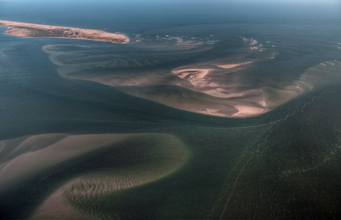
And Rollinson Channel in Hatteras Inlet, used by the state ferries and local commercial and charter fishing boats, has gotten shallow enough to interfere with both ferry operations and the passage of the fishing boats.
The last two photos in the accompanying slide show show quite clearly the shoaling in Hatteras Inlet, especially the last shot of Rollinson Channel with a narrow ribbon of dark, deeper water being encroached on by the shoals, which are lighter in color.
Bowers will continue to document the changes at Pea Island Inlet when he takes to the skies with local pilot Dwight Burrus of Burrus Flightseeing.









[…] Read Article […]