Potential Tropical Cyclone One expected to bring strong rip currents next week
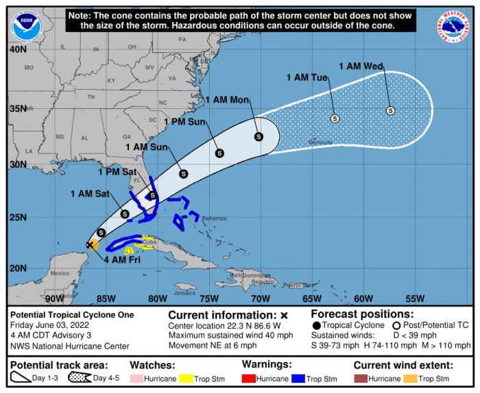
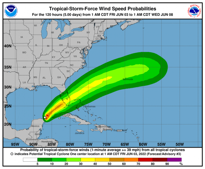
National Hurricane Center advisories have started on Potential Tropical Cyclone (PTC) One, which is expected to become Tropical Storm Alex later today. This system is expected to pass through southern Florida and then emerge into the Atlantic before passing several hundred miles south of North Carolina on Sunday
Though direct impacts to the Outer Banks are not anticipated with this system, strong rip currents are expected, as well as dangerous shorebreak.
Swell from this system will reach the N.C. coast sometime on Sunday, and the high rip current risk will likely continue through the middle of next week.
As of 7:00 a.m. on Friday, PTC One was located approximately 420 miles southwest of Ft. Myers Florida with maximum sustained winds of 40 mph. The system is moving toward the northeast near 6 mph, and this general motion with an increase in forward speed is expected to begin later today and continue through Sunday.
The system is expected to develop a well-defined center and become a tropical storm later on Friday, and some slight strengthening is possible while it approaches Florida today and tonight. Alex will be the first named storm of the 2022 Hurricane Season, which started on June 1.
The public is advised to check surf and swimming conditions before heading to the beach, and the daily beach forecast at www.weather.gov/beach/mhx includes rip current risk levels, and information about other hazards along the beach. In addition, visitors are encouraged to sign up for text alerts from Dare County, ocean rescue agencies, and the National Weather Service by texting “OBXBeachConditions” to 77295.
For more information on the local forecast, visit www.weather.gov/mhx for general weather information, or the National Weather Service office in Newport / Morehead City’s Facebook page at https://www.facebook.com/NWSMoreheadCity/.
