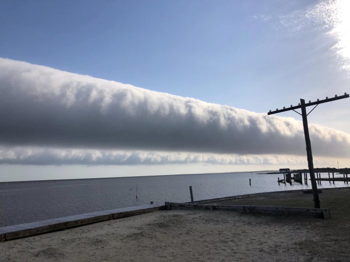
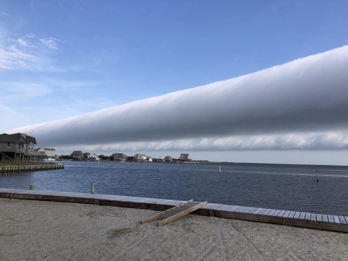
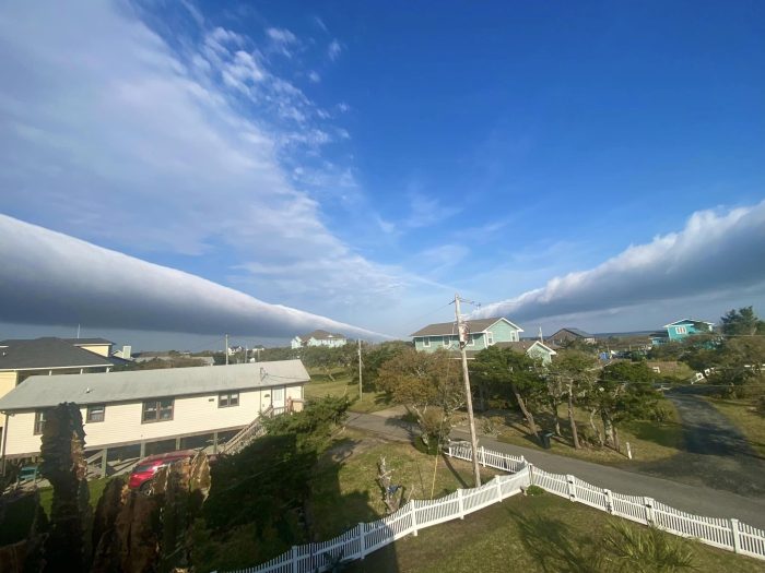
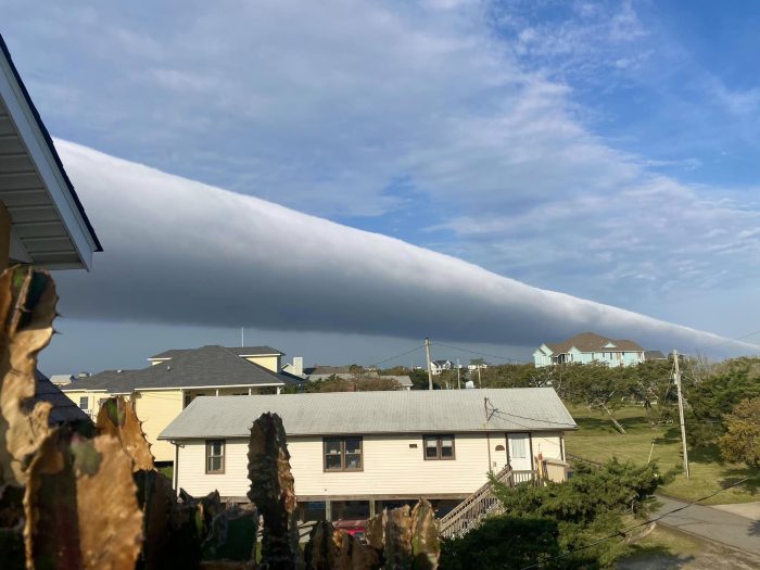
A wave of clouds create a show on the Outer Banks
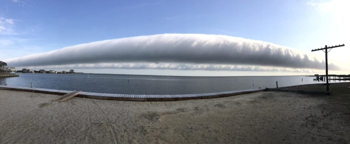
A line of clouds created an impressive show on the Outer Banks on Tuesday morning, April 16, which was caught on camera by a number of Hatteras Island residents and visitors.
“Cool wave clouds called an undular bore moved across the Outer Banks this morning,” stated Brad Panovich, Chief Meteorologist for WCNC-TV, in a trending social media post. “When a low-level boundary such as a cold front or outflow boundary approaches a layer of cold, stable air, it creates a disturbance in the atmosphere, producing a wave-like motion known as a gravity wave. In this case, a strong outflow boundary from storms last night in Virgina.”
Tuesday will be a slightly cooler day after a warm start to the workweek, with temperatures hovering in the mid-to-high 60s and partly to mostly cloudy skies.
For more information on the local weather forecast, visit www.weather.gov/mhx for weather information, or the National Weather Service office in Newport/Morehead City’s Facebook page at https://www.facebook.com/NWSMoreheadCity/.