Tropical Storm Alex will bring strong rip currents this week

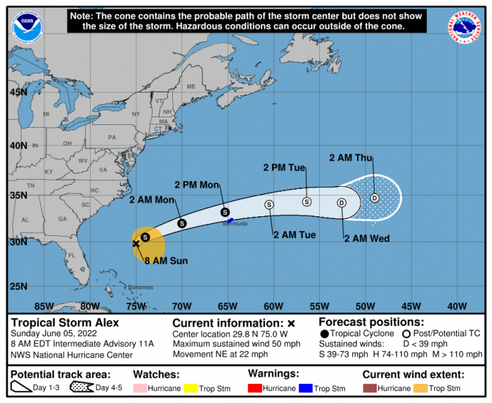
Tropical Storm Alex, (the first named storm of the 2022 Atlantic Hurricane Season), formed on early Sunday morning, but the storm will continue to move away from the Southeast U.S. coast this week, and no direct impacts to the Outer Banks are expected.
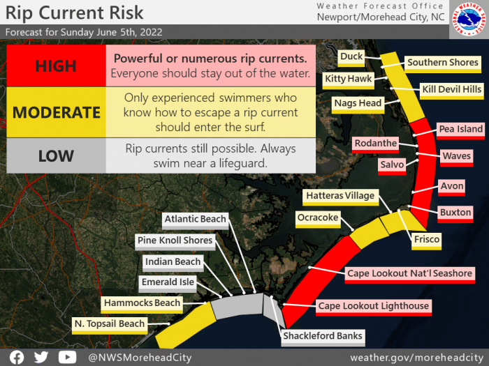
However, prolonged swell from this system will reach the North Carolina coast later today, and an increased threat of dangerous rip currents is expected through at least mid-week.
As of 8:00 a.m. on Sunday, Alex was located about 635 miles WSW of Bermuda with maximum sustained winds of 50 mph. Further acceleration to the northeast is expected over the next 12-24 hours, and a gradual turn to the east-northeast and east is expected on Monday or Tuesday. On the forecast track, the tropical storm is expected to pass near or just north of Bermuda on Monday.
The public is advised to check surf and swimming conditions before heading to the beach, and the daily beach forecast at www.weather.gov/beach/mhx includes rip current risk levels, and information about other hazards along the beach. In addition, visitors are encouraged to sign up for text alerts from Dare County, ocean rescue agencies, and the National Weather Service by texting “OBXBeachConditions” to 77295.
For more information on the local forecast, visit www.weather.gov/mhx for general weather information, or the National Weather Service office in Newport / Morehead City’s Facebook page at https://www.facebook.com/NWSMoreheadCity/.


