Florence’s Southern Track Remains the Same, but Storm Surge and Heavy Rains Still a Concern
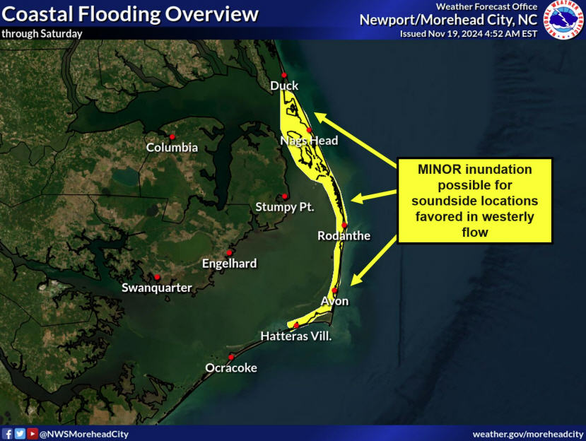
The projected southern track of Florence remained the same in the Wednesday evening update from the National Weather Service (NWS) Newport / Morehead City update, but heavy rains and storm surge are still a large threat for Hatteras and Ocracoke Islands.
As of 5:30 p.m., Florence had maximum winds of 120 mph and was on track for a late Friday landfall, possibly as a major hurricane, somewhere in southern North Carolina or South Carolina.
Tropical storm force winds could arrive as early as Thursday morning for Hatteras and Ocracoke islands, although there is a reduced chance of hurricane-force winds impacting the Outer Banks. Per Wednesday evening’s update, Hatteras and Ocracoke islands will see maximum sustained winds of 45-53 mph, and wind gusts in the 56-63 mph range, with higher winds occurring in southern Hatteras Island and Ocracoke.
Rainfall and storm surge are still major concerns for the islands, and rainfall totals up to 15 inches are possible in southern Hatteras Island and Ocracoke. 4 to 6 feet of storm surge is forecast from Ocracoke to the tri-villages region, and 2-4 feet of storm surge is forecast from the tri-villages to the Virginia / North Carolina border.
Residents are advised to have all preparations completed by Wednesday evening. As of 8:30 a.m. on Thursday morning, access to the Outer Banks will be restricted to emergency personnel only.
The Dare County Emergency Operations Center is activated and can be reached at 252.475.5655. The call center will reopen at 8:30 a.m. on Thursday.
To receive notifications directly from Dare County Emergency Management, visit www.darenc.com/emergencyalerts and follow @DareCountyEM on Twitter.
For more information on Florence’s local impacts, visit www.weather.gov/mhx for weather forecast info, or the National Weather Service office in Newport / Morehead City’s Facebook page, https://www.facebook.com/NWSMoreheadCity/ .


