Florence Slowly Approaches Southern Carolina Coastline as Ocean Overwash Becomes an Issue Throughout the Islands
Florence began a slow move towards the southern Carolina coastline as NCDOT crews worked to remove excess ocean water and sand from portions of Highway 12 on Thursday afternoon.
Per the 5 p.m. update from the National Hurricane Center, Florence was located about 100 miles east-southeast of Wilmington, N.C., and was moving west-northwest at 5 mph.
A slow westward to west-southwestward motion is expected to continue into Friday, and the center of Florence will approach the coasts of North and South Carolina later tonight, then move near or over the coast of southern North Carolina and northeastern South Carolina on Friday.
Hurricane-force winds extend outward up to 80 miles from the center and tropical-storm-force winds extend outward up to 195 miles. A NOAA reporting station at Cape Lookout, North Carolina, recently reported a sustained wind of 68 mph and a gust to 85 mph.
Doppler radar data indicates that maximum sustained winds have decreased to near 100 mph with higher gusts. Little change in strength is expected before the eye of Florence reaches the coast, however, with slow weakening expected after the center moves inland or meanders near the coast.
Locally, wind gusts up to 78 mph are forecast for Hatteras Island, and wind gusts up to 85 mph are forecast for Ocracoke Island starting tonight through Saturday night. Maximum sustained winds up to 62-67 mph are also forecast for the islands through Saturday night.
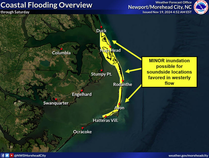
Rainfall and storm surge are still major concerns for the islands, and rainfall totals up to 8 inches are possible in southern Hatteras Island and Ocracoke. 4 to 6 feet of storm surge is forecast from Ocracoke to the tri-villages region, and 2-4 feet of storm surge is forecast from the tri-villages to the Virginia / North Carolina border.
NCDOT crews were removing sand and water from N.C. Highway 12 during the afternoon, particularly in northern Hatteras village which was battered with waves at Thursday morning’s high tide.
N.C. Highway 12 remains intact, however, additional oceanside flooding is probable at multiple locations on Hatteras and Ocracoke islands during the next high tide, which is around 11 p.m. on Thursday night. All residents are advised to stay off the roads, and N.C. Highway 12 remains closed from Bonner Bridge south.
No power outages were reported on Hatteras and Ocracoke islands as of Thursday evening at 5:00 p.m.
The Dare County Emergency Operations Center is activated and can be reached at 252.475.5655.
To receive notifications directly from Dare County Emergency Management, visit www.darenc.com/emergencyalerts and follow @DareCountyEM on Twitter.
For more information on Florence’s local impacts, visit www.weather.gov/mhx for weather forecast info, or the National Weather Service office in Newport / Morehead City’s Facebook page, https://www.facebook.com/NWSMoreheadCity/.


