Severe weather forecast for Wednesday, April 3
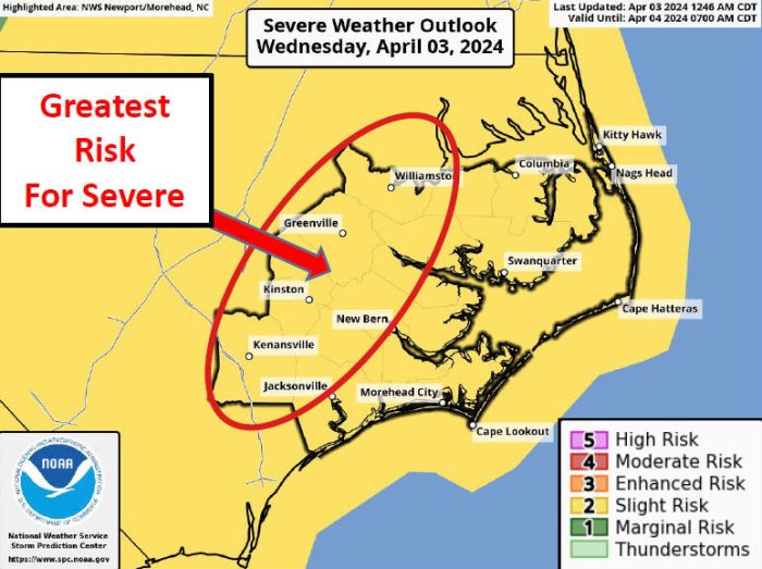
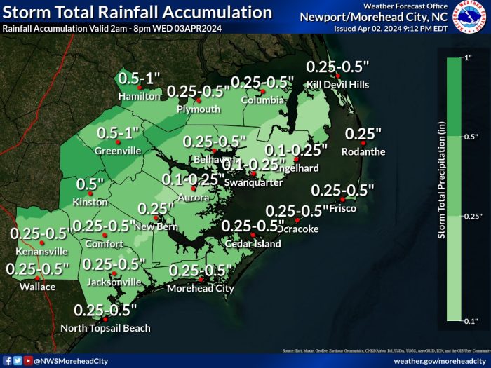
Showers and scattered thunderstorms will develop ahead of an approaching cold front on Wednesday, and several of these storms could become severe, per an update from the National Weather Service Newport/Morehead City office.
The highest risk of thunderstorms will occur late Wednesday morning through the afternoon, and the threat of severe weather will diminish after 6:00 p.m. Severe thunderstorms are most likely inland, from Jacksonville to Columbia, N.C.
The strongest storms will bring the threat of 50-60 mph wind gusts, although isolated large hail is also possible.
Hazardous marine conditions are forecast to last through Friday, with strong westerly winds behind the front. Strong winds could produce some minor soundside water level rises along the Outer Banks on Thursday and Friday.
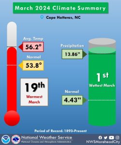
The National Weather Service also notes that Cape Hatteras recorded 13.86 inches of rain last month, the wettest March ever at the station since records began in 1893, per an update from SamWalkerOBXNews.com.
The station has been previously located at the historic U.S. Weather Bureau Office in Hatteras village, the former National Weather Service office in Buxton where the Cape Hatteras Schools soccer fields are located. It is now an automated station at Billy Mitchell Field in Frisco.
The previous record for March was set in 1989, which saw 11.20 inches of precipitation.
For more information on the local forecast, visit www.weather.gov/mhx for weather information, or the National Weather Service office in Newport / Morehead City’s Facebook page at https://www.facebook.com/NWSMoreheadCity/.
