Waterspout spotted off of Rodanthe on Monday morning; Severe thunderstorms possible again on Monday
Video by Ryan White of Hatteras Jack in Rodanthe
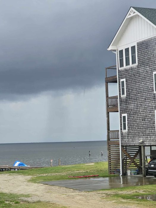
A small waterspout was spotted off of northern Rodanthe at around 7:30 a.m. on Monday, July 22, in the open waters of the Pamlico Sound, and ahead of an approaching front. The waterspout dissipated after approximately five minutes, and made no contact with land, according to reports from residents in the area.
A waterspout is a whirling column of air and water mist, and waterspouts fall into two categories: fair weather waterspouts and tornadic waterspouts, per the National Weather Service (NWS). Tornadic waterspouts have the same characteristics as a land tornado and are associated with severe thunderstorms. Fair weather waterspouts usually form along the dark flat base of a line of developing cumulus clouds in light wind conditions, and normally move very little.
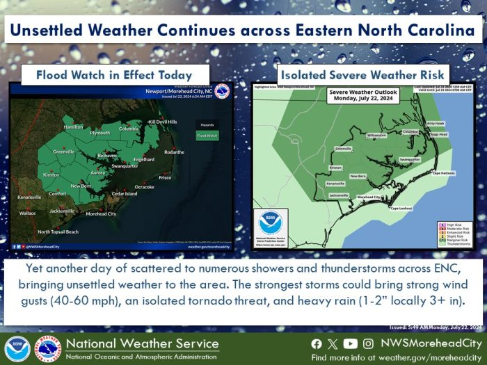
According to the NWS Newport/Morehead City Office, Monday will bring another round of unsettled weather across Eastern North Carolina, with a slight threat of severe thunderstorms throughout the day. The strongest storms will be capable of producing rainfall rates of 1-2” per hour, and damaging wind gusts of 40-60+ mph.
A Flash Flood Watch is in effect for mainland areas of Eastern N.C. that have experienced heavy rains over the past few days. “Even outside of the watch area, some flooding concerns will be possible, but the risk looks lower than areas covered by the watch,” said Roger Martin at the NWS Newport/Morehead City office.
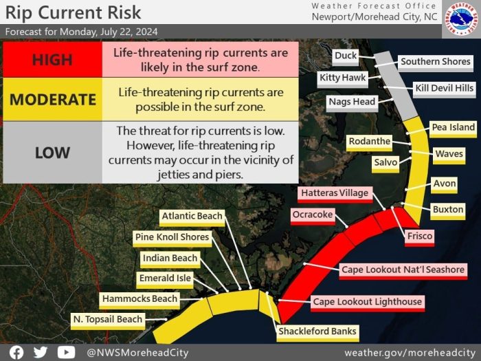
A high risk of rip currents is also in effect for all Hatteras and Ocracoke Island beaches south of Cape Hatteras.
For more information on the local forecast, visit www.weather.gov/mhx for weather information, or the National Weather Service office in Newport/Morehead City’s Facebook page at https://www.facebook.com/NWSMoreheadCity/.
