‘Don’t just focus on the category of the storm – Water is what kills people.’ Key takeaways from Avon’s Hurricane Preparedness Forum
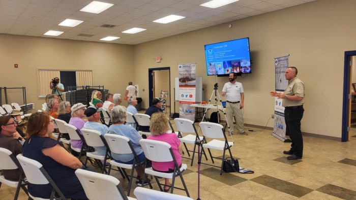
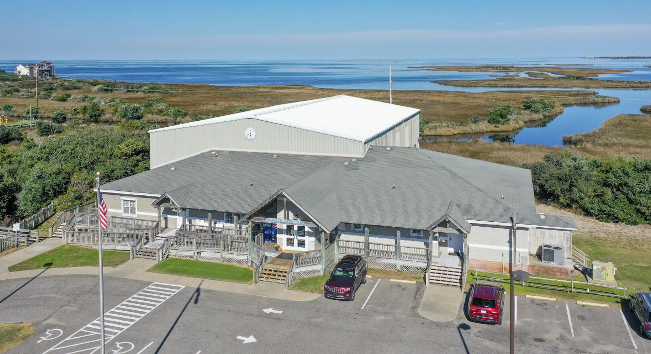
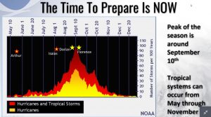
As the 2024 Hurricane Season approaches its August and September peak, National Weather Service’s (NWS) local Warning Coordination Meteorologist Erik Heden and Dare County Emergency Management Director Drew Pearson hosted a timely community forum in Avon on July 30.
These NWS and Dare County-hosted hurricane forums are held every year to inform at-risk communities like Hatteras Island about preparation steps to take now, where to get solid information, and the impacts to watch out for.
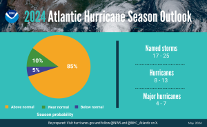
But this year’s Avon forum, which attracted a substantial local crowd, seemed especially imperative given the 2024 Hurricane Season forecast.
“We don’t know how many storms we’re going to get in Dare County, or if we’re going to have any at all,” said Heden. “However, there’s an 85% chance that we’re going to have an above-normal year. We don’t usually go that high of a number.”
“Usually, I say ‘it takes just one storm to make an impact on our community,’” added Heden. “But we’re waving our hands today and saying, ‘it looks like it’s going to be an active year.’ So, you really should be taking this seriously, especially this year.”
There were several key messages that were repeated at the Avon forum, and repeated often. The first was about how to gauge the impacts of a storm, and plan accordingly.
“Don’t just focus on the category of the storm. Water is what kills people,” said Heden. “If you just remember that, then we’ve done our duty here today.”
One of the other key messages was to prepare now and secure an optimal week’s worth of supplies before a storm is on the horizon.
“Do it now, when the stores are fully stocked, you’re not stressed, and you’re going to make good decisions,” said Heden.
The full video of Tuesday’s forum – as well as videos from previous forums – will be available on the NWS Newport/Morehead City office’s website at https://www.weather.gov/mhx/hurricanecommunityforums, as well as on its YouTube page.
In the meantime, highlights from the Avon forum are outlined below.
How to gauge the risks and impacts of an approaching hurricane
When a hurricane is on the horizon, many residents and visitors obsessively watch the subtle shifts of the National Hurricane Center’s cone maps that show the category and the forecasted track of the center of the storm.
But as Heden pointed out, this lone forecasting graphic does not tell the story of what to expect.
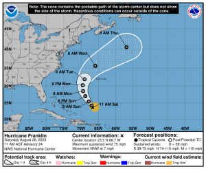
“A lot of people focus on the category of the storm,” said Heden. “We’ve all said ‘I’m not going to leave unless it’s a two’ or ‘I’m not going anywhere unless it’s a four.’”
“Categories are important but it’s not a whole puzzle.”
There are multiple – and recent – examples to back up this message, too.
Hurricane Dorian, which made landfall on Ocracoke Island in September 2019 as a Category 1 storm, brought seven feet of storm surge throughout the village.
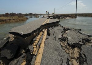
Hurricane Isabel, which cut a new inlet in northern Hatteras Village in 2003, approached the Outer Banks as a Category 1 before strengthening to a Category 2 in the hours before landfall. And Hurricane Irene – which shut down the island for weeks due to multiple new inlets north of Rodanthe – was just a category 1 when it hit the Outer Banks.
Instead of category and wind speeds – which account for less than 10% of hurricane fatalities – it’s the storm surge that causes the most significant damage, as evident by every recent impactful storm on the Outer Banks.
“85% of people that die in hurricanes are water-related deaths, and that’s not reflected in the category at all,” said Heden. “And most of those deaths occur in vehicles. I know [2018’s] Hurricane Florence wasn’t a big deal up here, but we lost 15 people in our state, and 11 of the 15 occurred in vehicles.”
Heden also noted that post-storm activities played a big role in storm-related fatalities, like driving around in flooded roads, trying to conduct repairs while flooding is still an issue, and other activities that occur after a storm is gone, but the remnants of the storm’s impacts remain.
“When we get [flood] water, the water is nasty,” said Heden. “You don’t want to be out traipsing through the water -we’ve lost people due to infections in Eastern North Carolina because they were out in the water.
“If you decide to stay, stay put. Don’t be out in the yard,” he added. “We lose people to heart attacks, falling off ladders, electrocution, carbon monoxide… These are not things that I made up out of some crazy movie. This is what has happened in our community across Eastern North Carolina. So be safe afterward. Don’t be in a rush to get back, and don’t be in a rush to clean up.”
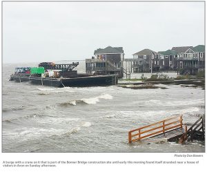
When it came to the infamous cone map, Heden also pointed out that just because an area is out of the cone’s direct path, it doesn’t mean that it’s immune to impacts. 2016’s Matthew didn’t make landfall anywhere near the Outer Banks, but it nevertheless brought substantial storm surge from Hatteras to Manteo and Kill Devil Hills.
“Pay attention to all aspects of the storm, and do not just focus on where the landfall will be,” said Heden. “[The hurricane] is many hundreds of miles across… If it’s anywhere in our general vicinity, we should be paying attention.”
Rip currents were another big impact that tends to be overlooked when it comes to storms, and one of the prime examples was 2019’s Hurricane Lorenzo, which occurred just a couple of weeks after Dorian made landfall on Ocracoke.
“Does anybody remember Lorenzo in 2019?” said Heden. “[Lorenzo] was 2,000 miles out to sea as a category five storm during a beautiful stretch of weather. But we lost four people in the Carolinas because of Lorenzo.”
“Anytime you have a powerful storm out there, whether it hits you or not, is going to produce strong swell at the beach,” said Heden. “So when we put out messages for rip currents, please share that with the community.”
Rainfall and tornadoes were the last two impacts that Outer Banks residents and visitors were advised to be on the lookout for, as rainfall can add to flooding risks, and tornadoes can occur with the outer bands of a storm.
“It’s spinning. So, it’s not hard to surmise that you potentially could get tornadoes with any tropical storm or hurricane,” said Heden. “You need to have a way to seek shelter in the lowest part of your building immediately… Usually, you only have minutes to respond because they’re very quick. So, if you are going to stay, have a battery power radio, and make sure your phones are charged and [can accept alerts.]”
How to prepare (and why you should start now)
If a worst-case scenario occurs, the state of North Carolina does have emergency shelters for residents who have to head off the island in a hurry. But as Pearson stated multiple times during the July 30 forum, these shelters are not places where anyone wants to land.
“It’s the last place you want to be,” he said. “There are no amenities. You might not even have a hot meal. You might not even get a cot – you might just get a blanket.”
“You don’t want to be in a shelter. Have a plan to go somewhere else, where you can be safe with people you love, and have your supplies with you.”
Most islanders are reluctant to ask for favors, let alone a place to stay for possible days on end with kids and pets in tow. But as Pearson and Heden pointed out, evacuating and staying with loved ones isn’t asking for hand-outs – it’s reciprocity.
“[You have] relatives that like to come down and visit you because we live in paradise,” said Heden. “So, go visit them, and have a northern and southern route, depending on which way the storm goes.”
For residents who stayed, both Pearson and Heden outlined how important it was to have ample supplies. A three-day supply of essentials, like water, food, pet food, and medicines, is a good start. But having a week of supplies – and maybe more – is a much more comfortable landing space when it comes to preparation.
Dare County also has a Special Needs Registry for hurricane assistance throughout Dare County. Residents who have already signed up are covered, but folks who may need special assistance during a storm can learn more by visiting https://www.darenc.gov/departments/health-human-services/special-medical-needs-registry or by calling 252-475-5599.
But above all else, having an evacuation plan – even if you’re firmly rooted on the island – is one of the main cornerstones of preparation.
“Everybody in this room should have a plan to evacuate,” said Heden. “I know we don’t leave because it’s hard to get back. I know some people’s livelihoods are dependent on recovering as quickly as possible. I understand all that. But I also understand that I want you to be here next year to hear the [next forum].”
“If we get a really bad storm, your life is more important than anything that you leave behind.”
Where to get timely and accurate information
Another prevalent theme throughout Tuesday’s presentation was where to get the best information when it comes to storms, and the answer centered on both the National Weather Service and Dare County.
“There’s not a lack of information out in the community. You’ve got plenty of information – social media, local meteorologists – it’s information overload,” said Heden. “[But] ‘if it’s the weather you love, it’s weather.gov.’ That’s all you have to remember… you’ve paid for that, it’s your tax money at work.”
While weather.gov – and specifically the National Weather Service’s office in Newport/Morehead City’s website and the National Hurricane Center’s website – are the frontlines for accurate data, there are other resources that are designed to keep islanders accurately informed on storm impacts, Dare County updates, and other necessary information.
A list of local Outer Banks resources for information is below.
- For alerts and notifications from Dare County on a customizable list of events or emergencies, (including hurricane evacuations and updates), visit https://www.darenc.gov/departments/emergency-management/emergency-alerts.
- For rip current information and other beach hazards, sign up for text alerts from Dare County, ocean rescue agencies, and the National Weather Service by texting “OBXBeachConditions” to 77295.
- For real-time flood maps that show water level rises throughout Hatteras and Ocracoke Islands, (as well as optional alerts), visit the NC Flood Inundation Mapping and Alert Network.
- For information on the local forecast, visit weather.gov/mhx for general weather information, or the National Weather Service office in Newport/Morehead City’s Facebook page at https://www.facebook.com/NWSMoreheadCity/.
- For up-to-date information on tropical conditions, follow the NWS at gov/mhx/tropical or visit the National Hurricane Center’s website. Just pay attention to all info, and not just the cone graphics.
- To sign up for the Special Needs Registry for hurricane assistance through Dare County, visit https://www.darenc.gov/departments/health-human-services/special-medical-needs-registry or call 252-475-5599.
- For Dare County hurricane information, including reentry procedures, visit https://www.darenc.gov/departments/emergency-management/hurricanes.
- For updates regarding road conditions, visit DriveNC.gov and follow the North Carolina Department of Transportation and NCDOT NC 12 on Facebook. The Dare County Sheriff’s Office also shares local road condition updates on its Facebook page.
- To get notified of ferry delays or cancellations, sign up for text and/or email alerts via the N.C. Ferry System’s FINS system: www.ncdot.gov/fins.
- For up-to-the-minute local information on hurricanes, as they happen, listen to Radio Hatteras at 101.5 (Avon through Hatteras) and 99.9 (Tri-villages), or visit them online at https://www.radiohatteras.org/.
- For online news coverage on active hurricanes, continue to check the Island Free Press.


