High Surf, Coastal Flood, Rip Current advisories along Outer Banks through weekend from Ernesto
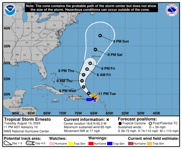
While Hurricane Ernesto is forecast stay more than 700 miles off the North Carolina coast, the Outer Banks will see large surf and dangerous rip currents through the weekend.
“Like we have experienced before, this does not mean we will escape impacts from the storm,” said forecasters at the National Weather Service office in Newport/Morehead City.
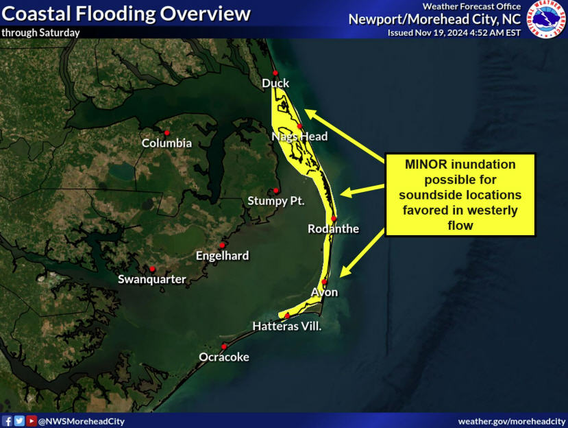
 Coupled with higher lunar tides, there is the possibility of ocean overwash with high tide along vulnerable stretches of the beach.
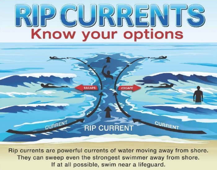
“We are very concerned for a high risk of rip currents coinciding with high populations at the beach this weekend due to the nice weather,” the weather office said.
A Coastal Flood Advisory and High Surf Advisory have been issued for Hatteras and Ocracoke islands starting Friday afternoon through early Monday.
And there is a High Risk of rip currents on Friday for the beaches from Duck southward, and a Moderate Risk for Carova and Corolla.
“There’s still a ton of fun activities you and your loved ones can do at the beach this weekend that don’t involve getting in the ocean,” said Currituck County Emergency Management in a Facebook post.
The National Hurricane Center is calling for Ernesto to possibly strengthen to major status on Friday, and cross Bermuda on Saturday as a large hurricane.
Swells from the storm will start arriving early Friday along North Carolina’s coastal waters, where Small Craft Advisories have been posted.
Those waves will increase and peak at around 8 to 9 feet late Friday night, and then will be slow to subside through the weekend.
Along with the bigger waves, this weekend there is a full moon and Earth’s lone natural satellite is at the closest point of its orbit known as perigee.
That creates a King Tide, a non-scientific term used to describe exceptionally high and low tides over multiple consecutive days.
That could mean overwash issues along the vulnerable oceanfront areas on Pea Island, in Rodanthe, Buxton, between Frisco and Hatteras, and the north end of Ocracoke.
High tide on Friday is around 6 p.m., Saturday around 6 a.m. and 7 p.m., and on Sunday around 7 a.m. and 8 p.m.
While the weather forecast is for near-perfect conditions to be on the beach, it will not be a good weekend to enter the ocean.
With the high-energy, long period swells, there will be large waves breaking in the surf zone and numerous rip currents.
And the King Tide will also enhance the rip currents with lower than normal tides around 12 p.m. on Friday, midnight and 1 p.m. on Saturday, and 1 a.m. and 2 p.m. on Sunday.
A similar situation happened in 2019, when Hurricane Lorenzo passed more than 2,000 miles off the North Carolina coast and lead to more deaths than were experienced with Hurricane Dorian which crossed directly over the Outer Banks with record-breaking flooding that same year.
