Additional ocean overwash reported Monday evening
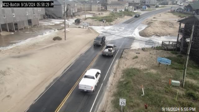
8:45 P.M. UPDATE: The North Carolina Department of Transportation (NCDOT) has closed N.C. Highway 12 on northern Ocracoke Island between the ferry terminal and the pony pens until further notice due to darkness, ocean overwash, and water on the roadway. Ferry service between Hatteras and Ocracoke is also suspended.
Another round of ocean overwash was reported ahead of Monday evening’s 6:45 p.m. high tide on northern Ocracoke Island, northern Hatteras Village, northern Buxton, Pea Island, and on side streets in Rodanthe.
Per a press release from the Cape Hatteras National Seashore, travelers are advised to avoid northern Ocracoke Island on Monday evening and to use caution around high tides for the rest of the week due to higher-than-average tides and an ongoing high surf advisory.
On Hatteras Island, visitors should use caution on the beach at the north end of Rodanthe, due to the presence of debris-related hazards from threatened oceanfront structures, such as building materials and parts of septic systems.
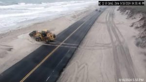
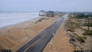
N.C. Highway 12 is open and passable as of 6:00 p.m., but saltwater and sand remain on the highway, and drivers are advised to slow down as saltwater can damage vehicles. North Carolina Department of Transportation (NCDOT) crews will continue to work to clear the roads of standing water and sand this evening, and tomorrow morning as needed.
Potential Tropical Cyclone Eight, (which was located about 45 miles west of Cape Fear as of 5:00 p.m. Monday), will continue to bring impacts to the Outer Banks, such as flooding rain, coastal flooding, a few tornadoes, and high winds.
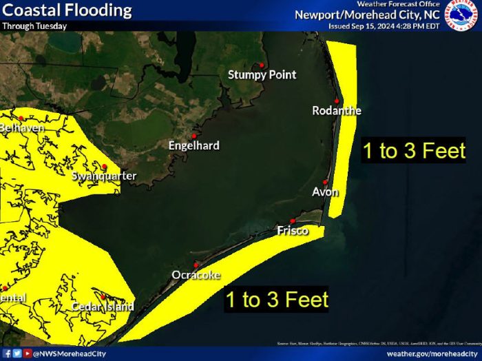
Additional ocean overwash of 1-3 feet above ground level is possible, particularly around the next several high tide cycles. The next high tide is approximately 7:10 a.m. on Tuesday.
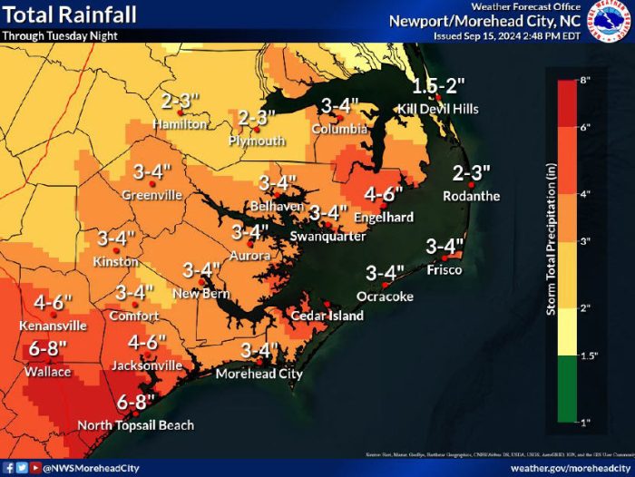
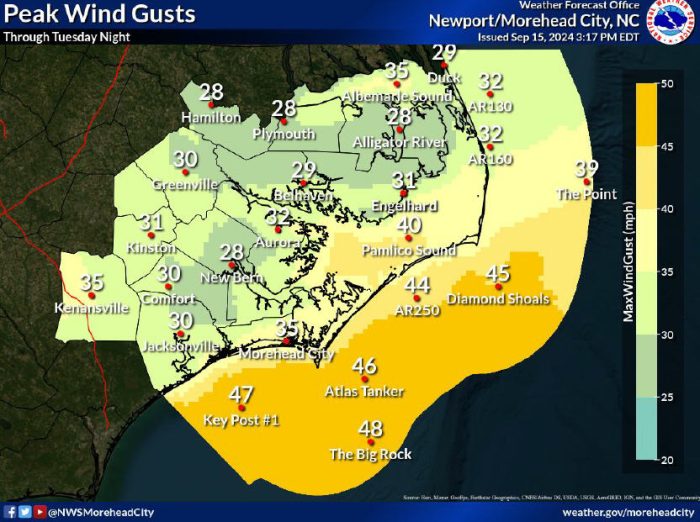
Peak wind gusts of 35-40 mph are forecast through Tuesday night, and an additional 3-4 inches of rain is possible through Tuesday night as well.
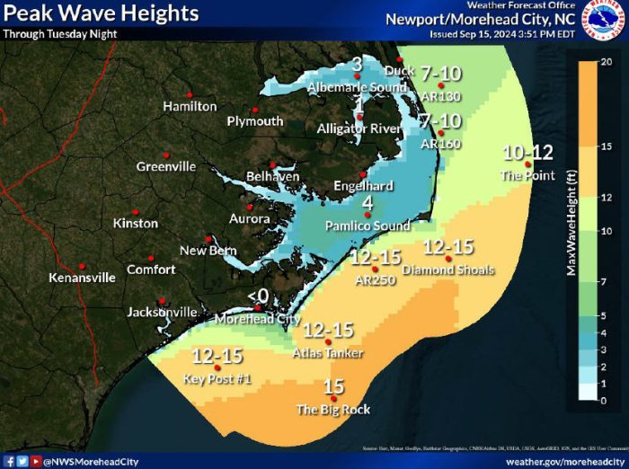
Rain over the past week will make some low-lying areas more susceptible to flooding, while large breaking waves of up to 12 feet in the surf zone will also make beach erosion and ocean overwash more likely.
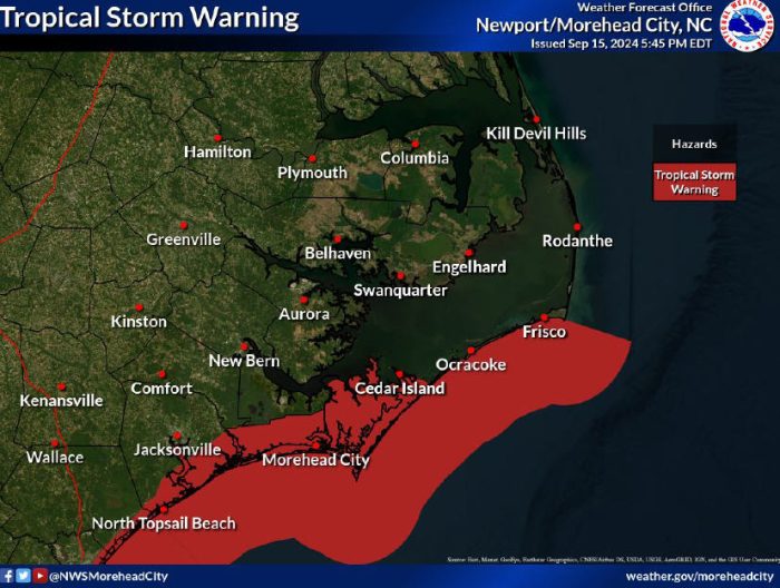
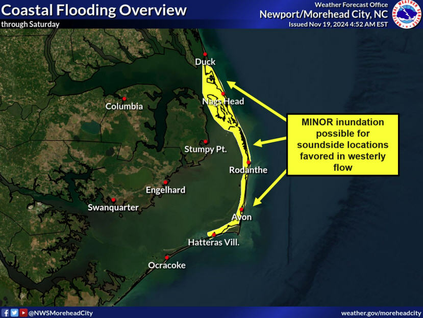
A Tropical Storm Warning is in effect for coastal waters south of Cape Hatteras through Surf City, (which includes Frisco, Hatteras Village, and Ocracoke Island). A Coastal Flood Advisory and a High Surf Advisory also remain in effect through Tuesday for Hatteras and Ocracoke Islands.
Cape Hatteras Elementary and Cape Hatteras Secondary will follow a two-hour delay schedule on Tuesday, September 17, due to potential coastal flooding.
A list of local Outer Banks resources for information is below.
- For alerts and notifications from Dare County, visit https://www.darenc.gov/departments/emergency-management/emergency-alerts.
- For information on the local forecast, visit weather.gov/mhx for general weather information, or the National Weather Service office in Newport/Morehead City’s Facebook page at https://www.facebook.com/NWSMoreheadCity/.
- For up-to-date information on tropical conditions, follow the NWS at gov/mhx/tropical or visit the National Hurricane Center’s website.
- For updates regarding road conditions, visit DriveNC.gov and follow the North Carolina Department of Transportation and NCDOT NC 12 on Facebook. The Dare County Sheriff’s Office also shares local road condition updates on its Facebook page.
- To get notified of ferry delays or cancellations, sign up for text and/or email alerts via the N.C. Ferry System’s FINS system: www.ncdot.gov/fins.
- For rip current information and other beach hazards, sign up for text alerts from Dare County, ocean rescue agencies, and the National Weather Service by texting “OBXBeachConditions” to 77295.
- For real-time flood maps that show water level rises throughout Hatteras and Ocracoke Islands, (as well as optional alerts), visit the NC Flood Inundation Mapping and Alert Network.
- For up-to-the-minute local information on hurricanes, as they happen, listen to Radio Hatteras at 101.5 (Avon through Hatteras) and 99.9 (Tri-villages), or visit them online at https://www.radiohatteras.org/.
- For online news coverage on active storms, continue to check the Island Free Press.
