Threat of minor soundside flooding along the Outer Banks this week

The possibility of minor soundside flooding along the Outer Banks has shifted to the end of the week.
After a strong cold front passes through the region early Thursday morning, winds will shift to the west.
A more powerful, yet dry, cold front will roll across the region on Friday followed by strong high pressure that will keep the winds up through the weekend.
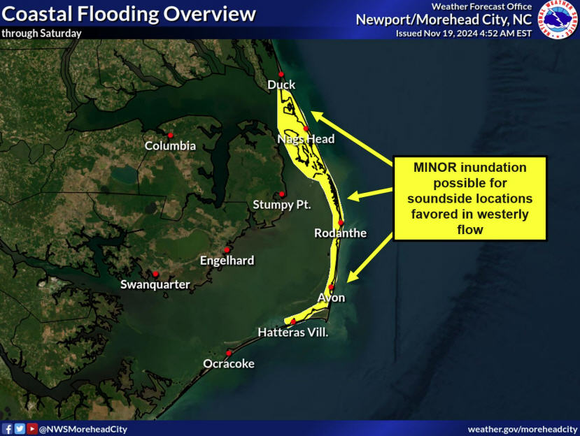
That will support a risk of elevated water levels for soundside areas that see flooding on a strong west blow, according to forecasters at the National Weather Service Newport/Morehead City office.
That includes areas from Duck to Hatteras village and on Roanoke Island, where shallow flooding of roads, lawns, parks, parking lots, and other low-lying areas near the waterfront are possible.
The forecast for the Pamlico and Albemarle sounds is calling for sustained west winds ranging between 15 and 25 knots, with gusts as high as 30 knots especially on Friday and Saturday.
“There remains some uncertainty regarding the strength of the winds behind each cold front,” NWS Newport forecasters said. If stronger winds materialize, water levels would be higher.”
Rainfall amounts from the initial front are not expected to make much of a dent in the moderate drought that continues to expand across North Carolina.


