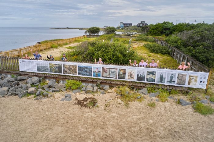
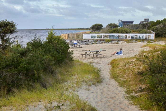
A new outdoor photo exhibit was recently unveiled at the Salvo Community Cemetery, (also known as the Salvo Day Use Cemetery), which outlines the history of the area, the years-long efforts to bring attention to the historic site, and the continued threat of coastal erosion to soundside Salvo, and the Outer Banks in general.
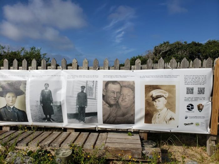
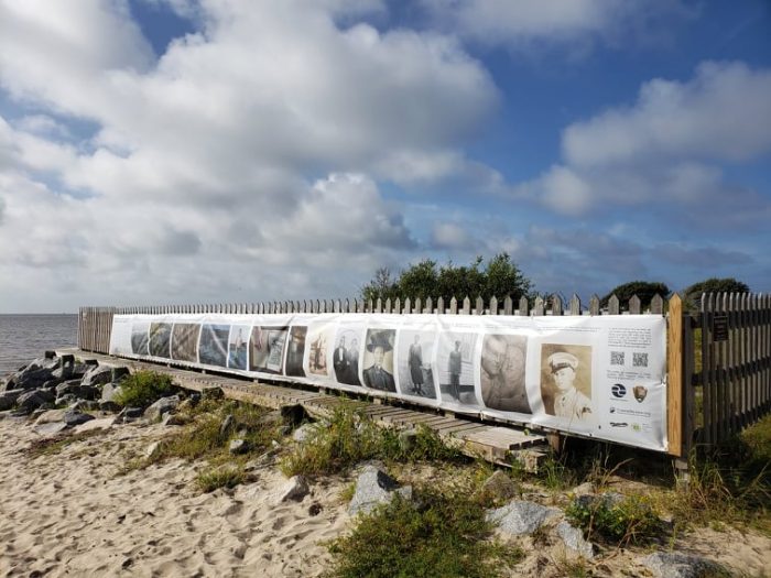
The new exhibit, which consists of a 41.5-foot-long and weather-proof mesh banner, includes photos of Hatteras Island residents interred at the cemetery, as well as a synopsis of the cemetery’s role in the history of the island, and the challenges the site continues to encounter in the age of climate change.
The nearly 150-year-old cemetery, which is bordered on all sides by National Park Service land within the popular Salvo Day Use Area, has been continually battered by storms and erosion, particularly over the last 10-20 years.
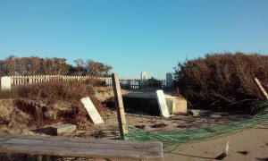
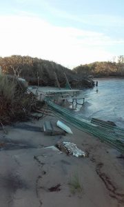
By 2016, headstones had broken, washed away, or had been removed by concerned family members who worried they could disappear altogether, and tombs were becoming exposed as the soundfront area steadily receded from a regular onslaught of high water and waves. Two local groups, Hatteras Island Genealogical and Historic Preservation Society and the Rodanthe-Waves-Salvo Civic Association, responded by launching fundraising campaigns to raise the estimated $120,000 to protect the site, and in the years that followed, the group was able to add a protective bulkhead and armor rock barrier, as well as install fencing and signage signifying the site’s importance.
The new public art exhibit is the latest in a long line of improvements to the Salvo Community Cemetery, and is the brainchild of Durham-based journalist and photographer, Justin Cook, who worked with local residents and historians to create the panel of photographs, and the ensuing story.
Cook has his own ties to the Outer Banks, with family roots in Stumpy Point and distant relatives who lived on Hatteras Island. His interest in his own family, as well as a passion for examining the effects of climate change, led to a 2020 Pulitzer Center on Crisis Reporting Connected Coastlines Initiative Grant, for his Coastal Review-published project, Tide and Time.
“This is actually a combination of some of the reporting I did for the larger [Tide and Times] project, and [conversations with] local residents like Robin Daniels Holt, who did a bunch of research about the actual plot of land, such as who’s buried here and when it was founded,” said Cook. “And that was kind of the goal with this project – to make it as collaborative as possible with the folks who live here.”
Working with the company Photoville, Cook weeded through countless photographs shared with him by local residents to create the banner, which was roughly a month-long process. Island volunteers pitched in along the way, providing more information or measuring the fence itself so that the banner could easily be attached to its new home.
The ensuing collection of photos in the exhibit includes shots of the Salvo Community Cemetery at its lowest point, when tombstones were sinking into the water and visitors walked over the gravesites on a regular basis, but it also includes both historic and present-day photos of islanders with connections to the cemetery itself.
“I’ve seen a lot of really good work done about sea level rise on the Outer Banks, specifically, and the approach taken is often very broad,” said Cook. “This was a chance to focus on this really small area, and tell a story that’s not just about the effects of erosion caused to the landscape, but also the effects on the people connected to the ecosystem around them.”
“It’s really easy to say, ‘Well, why don’t you just move?’ But that’s not the solution,” he added. “People have a deep connection to the Outer Banks, and to this land, and I wanted to tell that story… People see the photo of Miss Jean standing in the water, and she could be anybody’s grandma.”
Cook wanted local residents to see their own stories in the exhibit, but he also wanted to reach a wider audience of visitors as well, who might not know much about the history of the Outer Banks, the local effects of erosion and climate change, or how the two are connected.
“The Salvo Day Use Area is one of the busiest beaches on the island,” he said. “People might not go to museums or visitors center to see exhibits, especially with the ongoing pandemic, but they won’t miss this exhibit – it’s right there in front of them.”
“I wanted to locals to see themselves, but I also wanted the tourists to understand what’s happening here, and how we all contribute,” said Cook. “There are people that sort of believe in climate change and understand what’s happening, but aren’t quite activated yet to really think about it. I hope that this type of project makes the connection, and shows more of the day-to-day effects on people who are just like them.”
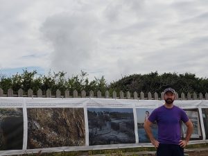
The exhibit is the brainchild of Cook, but the project also received financial assistant or support from a number of organizations, including Photoville, the North Carolina Arts Council, The Pulitzer Center, The Coastal Review, and the Cape Hatteras National Seashore.
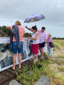
Cook also credits the local residents and the folks involved in supporting the Salvo Community Cemetery for making the new exhibit come to fruition, and who showed up on the morning the exhibit was unveiled, (September 16), to help with the installation.
“The spirit of them trying to preserve the cemetery is what [started this project] in the first place,” said Cook. “It was very collaborative, and there were so many different organizations they worked with, and that’s kind of how I wanted to approach it, as well – as a collaboration.”
“It was really fun to work on, it was a lot of hard work, and I met a lot of really incredible people along the way,” he added. “At the end of the day, it’s their story, not mine, and they trusted me with it. And I just hope I did it justice.”
The new exhibit can be viewed at the Cape Hatteras National Seashore’s Salvo Day Use Area public beach access, which is located on the soundside of N.C. Highway 12 on the northern border of Salvo village.


Had to drag climate change into it. The island is eroding in some cases on both sides. Prior to the dunes being built sea water would come in and if powerful enough make its way to the sound which made the island retreat. Any number of historical maps and satellite images clearly show the island maintaining more or less the same dimensions, but slowly moving west. After the dunes were built sand went out to sea versus being carried to the sound. As the beaches became smaller the waves carved out the dunes faster, but no sand was going to the sound as it could not.
For those who do not know it…they are man made and were put in place to eliminate/reduce nuisance flooding since high winds, such as a nor’easter would push water into the villages making it inconvenient to live there at times. Man did a number of this and other barrier islands long before the concept of climate change existed, but the go to for any issue now is climate change.
I agree with G Surf’s comments…..by building the dunes to protect fixed structures like roads and villages, we have reduced the delta effect that is natural for a barrier island. However, I appreciate the article and the effort, and the photos are wonderful.