Cape Point re-opens to off-road vehicles
By IRENE NOLAN
By IRENE NOLAN
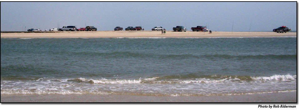
The National Park Service re-opened Cape Point to vehicles today, a full week earlier than last year.
The east side of Cape Point is open to vehicles from 6 a.m. until 10 p.m. daily. Night driving is prohibited from 10 p.m. until 6 a.m.
A pre-nesting closure west of Cape Point on the South Beach is still closed to pedestrians and ORVs, as is Ramp 45 behind the Cape Point Campground.
Island Free Press correspondent Rob Alderman said folks were expecting today’s opening and were lined up and ready about 7:30 a.m. when the signs and fencing blocking vehicles from Cape Point came down.
Cape Point was closed to ORVs on May 13 when piping plover nests in the area began hatching. For a while, limited access was allowed to pedestrians who waded below the low tide line to the Point. However, the limited access was also closed on May 24.
The last of 15 piping plover chicks at Cape Point had fledged by July 1. The piping plovers are the only federally listed birds that are protected under a consent decree that settled a lawsuit by environmental groups against the Park Service.
However, the area remained closed until July 7 when the final brood of American oystercatcher chicks in the area fledged. These birds are not federally protected but are a state species of special concern.
A pedestrian corridor from Ramp 44 to Cape Point was opened on July 7, but ORVs were prohibited until two weeks after the last oystercatcher chicks in the area fledged.
Alderman said the Point was longer than it’s been for some time. He added that two islands that had formed on the shoals off the Point had merged into one large island, which he estimated to be 100 feet or so from the beach.
He said that at low tide, the water was rushing through the narrow channel between the shore and the island and was probably 6 or 7 feet deep in places. He said he wouldn’t recommend that folks try crossing it.
Doug McGee, the Park Service’s lead biologist for Hatteras, has said that he thinks the earlier pre-nesting closures benefited this year’s breeding pairs, who settled down and started nesting slightly earlier than last year. Also, he said the wet spring kept the areas in which the birds like to forage around the salt pond moist later in the spring than usual.
For up-to-date information on currently open or closed areas, check the Cape Hatteras National Seashore’s Google Earth maps at: http://www.nps.gov/caha/planyourvisit/googleearthmap.htm
Subject
Name
(required, will not be published)
(required, will not be published)
City :
State :
Your Comments:
May be posted on the Letters to the Editor page at the discretion of the editor.
May be posted on the Letters to the Editor page at the discretion of the editor.
May be posted on the Letters to the Editor page at the discretion of the editor.
May be posted on the Letters to the Editor page at the discretion of the editor.


