Path Narrows as Tropical Storm Watch Continues for Hatteras and Ocracoke Islands
A Tropical Storm Watch continues to be in effect from South Santee River, South Carolina, to Duck, North Carolina, per the 8 a.m. Monday public advisory from the National Hurricane Center (NHC.)
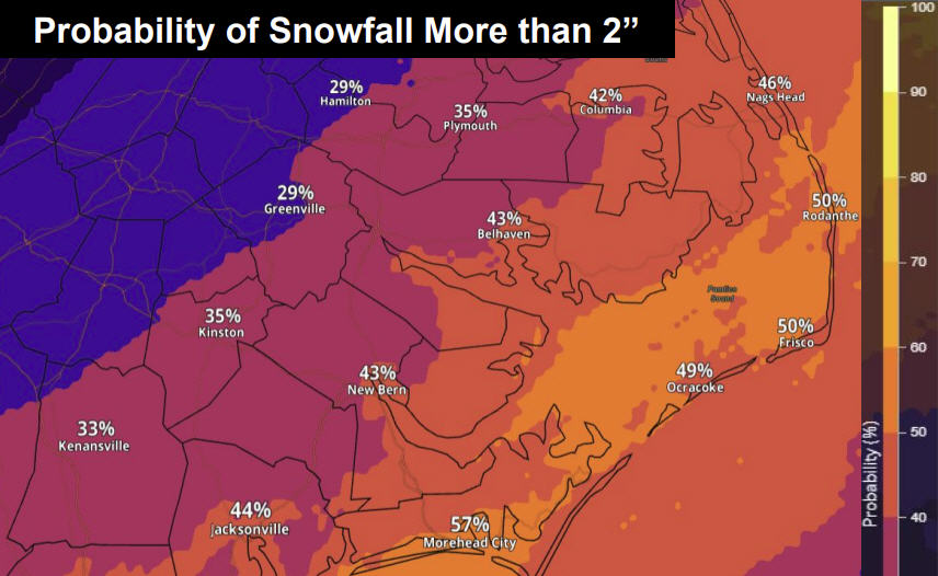
Island residents are warned to expect heavy rain and potential coastal flooding through Tuesday night with possible 1-2’ ft. inundation in soundside areas along the Outer Banks.
A Tropical Storm Watch means that tropical storm conditions are possible within the watch area, in this case within the next 24 to 36 hours.
At 8 a.m., the poorly defined circulation associated with the disturbance remained off the coast of Georgia. The system has been moving little, and a slow and erratic motion is forecast through this afternoon, followed by a faster northeastward motion tonight and Tuesday.
Per the NHC forecast track, the system will move near the Georgia and South Carolina coasts later today and move along the North Carolina coast on Tuesday.
Maximum sustained winds remain near 35 mph (55 km/h) with higher gusts. Some strengthening is possible during the next 48 hours, and the system is expected to become a tropical storm by Tuesday morning and then become post-tropical by Tuesday night.
Although satellite and radar data indicate that the associated showers and thunderstorms show some signs of organization, the center of circulation is not yet well defined. Only a slight increase in the definition of the circulation would lead to the formation of a tropical cyclone, however, and the formation chance through the next 48 hours is 90%
Island residents and visitors should prepare for potential high tropical storm winds (defined as wind speeds between 39 mph and 73 mph), heavy rain in the 4-7” range per the NHC, coastal flooding, rough surf, and high waves.
Coastal flooding risk will be greatest for soundside locations on Hatteras and Ocracoke Islands Tuesday into Tuesday night, and 1-2’ inundation of water above ground is possible in areas adjacent to the Albemarle and Pamlico Sounds.
Rough surf could result in minor erosion and overwash along the oceanside as well, with seas up to 8’-12’ across Atlantic coastal waters.
Visit www.weather.gov/mhx for weather forecast information covering Eastern NC, and visit the National Hurricane Center at www.nhc.noaa.gov for information on the tropics.
The Island Free Press will continue to monitor this system and will post updates as soon as they are available.


