

A Storm Surge Warning and Tropical Storm Warning are still in effect for Hatteras and Ocracoke islands, as Isaias continues to move north through N.C., per a Tuesday morning update from the National Weather Service (NWS).
Isaias made landfall as a Category 1 hurricane with maximum sustained winds of 85 mph winds near Ocean Isle Beach, N.C., late Monday night. Expect tropical-storm-force winds to continue this morning for the Outer Banks area, and as winds turn to the W/SW, there will be the potential for storm surge inundation of 2-4 ft along the Outer Banks, and especially north of Oregon Inlet.
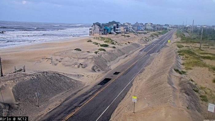
As of 9:00 a.m, roughly 4″ of soundside flooding was affecting N.C. Highway 12 in the Rodanthe / Waves / Salvo area, and this will likely be the case until the winds subside. However, no ocean overwash was reported, and the highway remains passable throughout Hatteras Island.
As of 5:00 a.m. on Tuesday, the center of Tropical Storm Isaias was located over northeastern North Carolina, about 25 miles southeast of Roanoke Rapids. Isaias is moving toward the north-northeast near 28 mph (44 km/h), and this general motion accompanied by some additional increase in forward speed is expected through today. On the forecast track, the center of Isaias will move into southeastern Virginia early this morning, near or along the coast of the mid-Atlantic states today, and across the northeastern United States into southern Canada tonight.
Maximum sustained winds are near 70 mph (110 km/h) with higher gusts. Only gradual weakening is anticipated while Isaias moves north-northeastward near the mid-Atlantic coast today. A faster rate of weakening is expected to begin tonight, and the system is forecast to become post-tropical tonight or early Wednesday.
Tropical-storm-force winds extend outward up to 140 miles (220 km) from the center. Sustained winds of 48 mph (78 km/h) and a gust to 63 mph (102 km/h) was recently reported at Duck, North Carolina.
The Island Free Press will continue to post updates as soon as they become available. For more information on the local forecast, visit www.weather.gov/mhx for weather information, or the National Weather Service office in Newport / Morehead City’s Facebook page at https://www.facebook.com/NWSMoreheadCity/.


