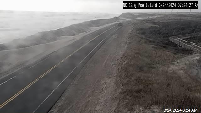
N.C. Highway 12 remains closed on northern Ocracoke on Sunday morning; Highway is open and passable on Hatteras Island
11:30 A.M. UPDATE: N.C. Highway 12 will not reopen on Sunday, per an update from the North Carolina Department of Transportation (NCDOT). “Unfortunately, due to continued strong winds and overwash, we will NOT be reopening NC12 on Ocracoke Island today,” stated NCDOT. “We will continue working to reopen the highway at some point Monday.”
N.C. Highway 12 remained closed on Sunday morning on northern Ocracoke Island from the Hatteras-Ocracoke ferry terminal to the NPS Pony Pens due to ocean overwash. Per an update from the North Carolina Department of Transportation (NCDOT), crews hope to reopen the highway, (and resume ferry service), later in the day.
The Hatteras-Ocracoke, Ocracoke-Swan Quarter, and Ocracoke-Cedar ferry operations have all been suspended as of Sunday morning due to weather conditions.
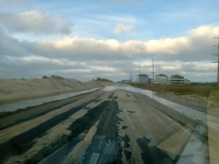
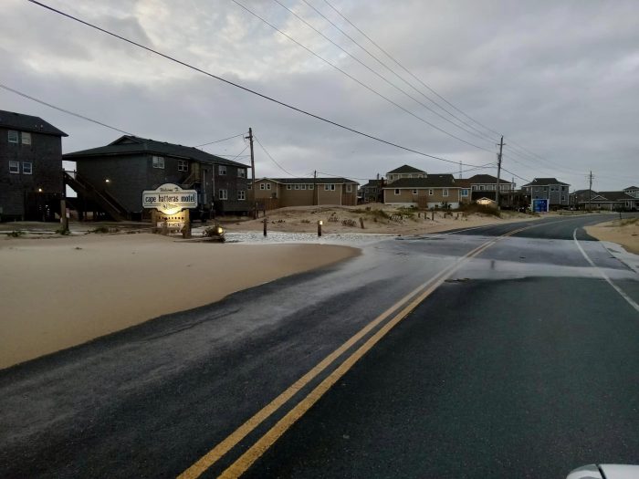
On Hatteras Island, there is some sand and standing water on the highway, particularly on Pea Island, north of Hatteras Village, and in northern Buxton, which had minor ocean overwash with Sunday’s approximately 7:45 a.m. high tide.
The highway is open and passable throughout Hatteras Island, however, and NCDOT crews will be working to clear the road as needed.
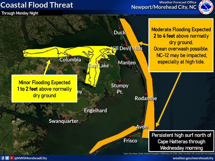
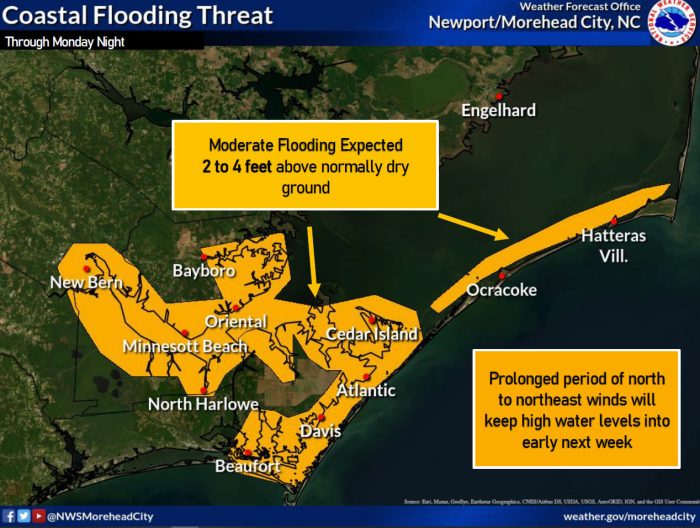
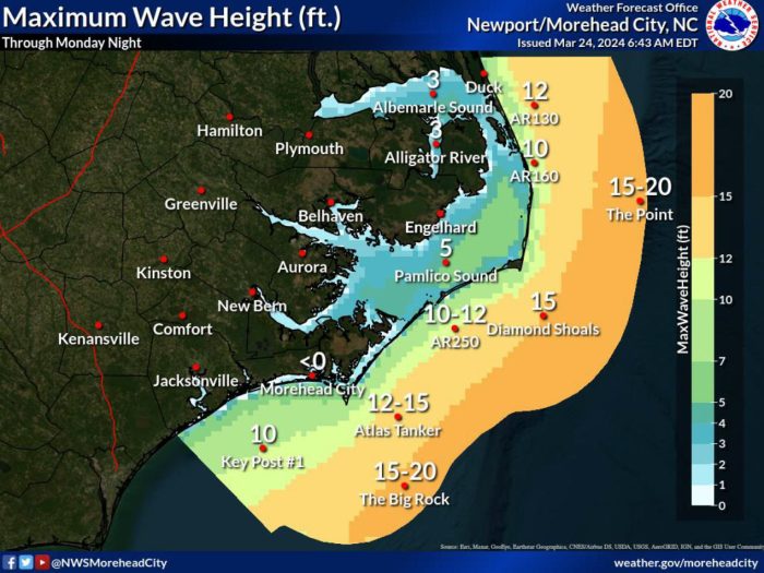
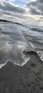
Impacts from the weekend’s low pressure system are expected to continue on Sunday, with large long-period swell lasting into the middle of the week. This will result in persistent high surf conditions, especially for the beaches north of Cape Hatteras in Buxton.
Large breaking waves of 10-15 feet are expected in the surf zone for all Outer Banks beaches, and oceanside flooding of 2-4 feet above ground level is possible through early Tuesday. Ocean overwash that affects N.C. Highway 12 is most likely during high tide, and the next high tide is at 8:00 p.m. on Sunday.
Minor to moderate soundside flooding is also possible on southern Hatteras Island and Ocracoke Island, with flooding of 2-4 feet above ground level possible through Monday night.
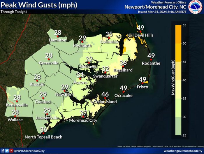
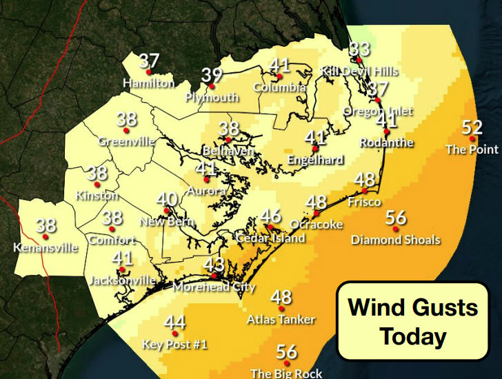
Strong northerly winds will also continue on Sunday, with peak wind gusts of 50 mph currently forecast.
A Coastal Flood Warning, Gale Warning, Wind Advisory, and High Surf Advisory are all in effect for the Outer Banks.
- For more information on the local weather forecast, visit www.weather.gov/mhx for weather information, or the National Weather Service office in Newport/Morehead City’s Facebook page at https://www.facebook.com/NWSMoreheadCity/.
- To get notified of ferry delays or cancellations, sign up for text and/or email alerts via the N.C. Ferry System’s FINS system: www.ncdot.gov/fins. Users will get notified of any schedule changes directly from the terminal, and can unsubscribe at any time.
- For updates regarding road conditions, visit DriveNC.gov and follow the North Carolina Department of Transportation and NCDOT NC 12 on Facebook. The Dare County Sheriff’s Office also shares local road condition updates on its Facebook page.