NWS Wednesday afternoon update calls for 3-6 feet of storm surge; wind gusts up to 120 mph
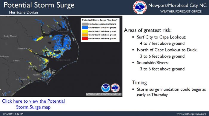
The Wednesday afternoon briefing from the National Weather Service (NWS) Newport / Morehead City office includes a slight increase in expected storm surge, with 3-6 feet above ground storm surge now forecast.
Storm surge inundation could begin as early as Thursday, and the public can keep track of estimates for specific villages and neighborhoods via the National Hurricane Center’s Storm Surge Inundation Map.
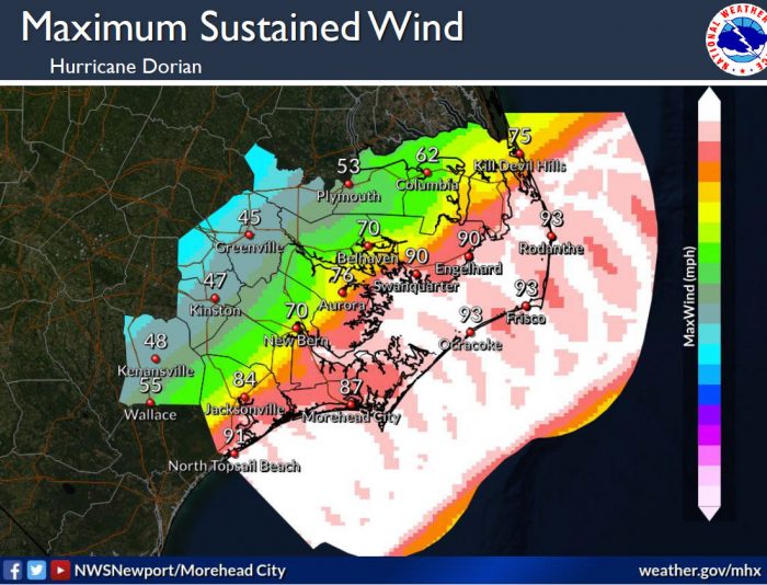
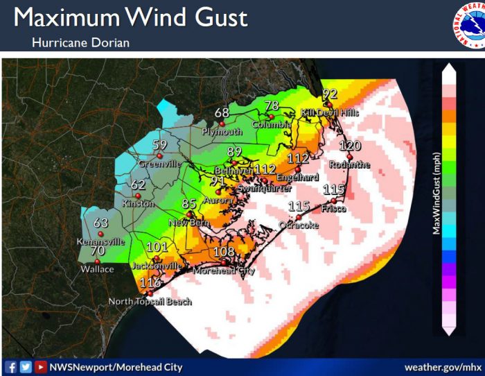
In addition, maximum sustained winds of 93 mph and wind gusts up to 120 mph are also forecast with the latest update, with tropical-storm-force winds expected to arrive sometime Thursday evening or night.
Tropical-storm-force winds are expected for a period of at least 12 to 18 hours for most of the Eastern N.C. area, and as much as 24 hours along the Outer Banks.
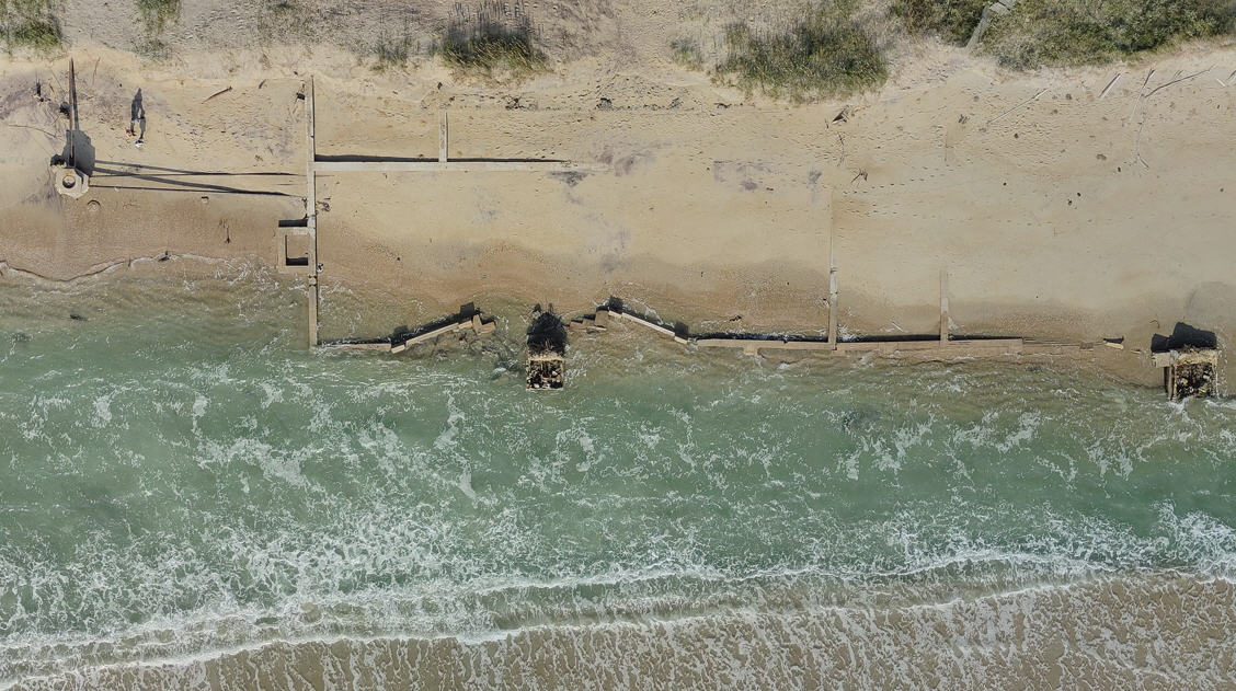
Very high surf and large breaking waves will likely result in moderate to significant beach erosion and ocean overwash along the North Carolina coast Thursday and Friday. Overwash and sound side flooding will likely cause issues on N.C. Highway 12 on the Outer Banks Thursday night through Friday night. Vulnerable areas could experience erosion or overwash for multiple high tide cycles.
Hurricane Dorian will also produce very heavy rainfall across Eastern North Carolina, with widespread flash flooding possible. 6 to 8 inches of rainfall is forecast for both Hatteras and Ocracoke islands. These heavy rainfall amounts in a relatively short period of time will likely produce flash flooding across eastern North Carolina Thursday through Friday evening.
Isolated tornadoes are possible late Wednesday through Friday morning.
Very dangerous marine conditions are expected with seas 15 to 25 feet and higher. A high threat of rip currents will continue for all area beaches and it is advised to stay out of the water.
Dare County is now under a Hurricane Warning and a Storm Surge Warning. The mandatory evacuation order remains in effect for all visitors and residents. Emergency Management strongly urges everyone to heed the warning and evacuate today. Those who do not evacuate should be prepared to sustain themselves for at least 72 hours. Emergency personnel will not be able to respond to calls for help during the flooding and high winds that are expected during this storm.
North Carolina Emergency Management has opened shelters in other areas of the state, including locations that are pet-friendly. For updated shelter information, visit https://www.ncdps.gov/storm-shelters. There are no emergency shelters in Dare County.
For updated information from Dare County Emergency Management, the towns and the National Park Service, visit www.darenc.com/hurricanedorian.
Subscribe to receive emergency alerts via text, email or phone directly from Dare County Emergency Management at www.DareNC.com/alerts and follow @DareCountyEM on Twitter.
Monitor updated local weather forecasts from the National Weather Service at www.weather.gov/mhx.
